ISS054-E-54109
| NASA Photo ID | ISS054-E-54109 |
| Focal Length | 290mm |
| Date taken | 2018.02.25 |
| Time taken | 09:27:47 GMT |
5568 x 3712 pixels 720 x 480 pixels 5568 x 3712 pixels 640 x 427 pixels
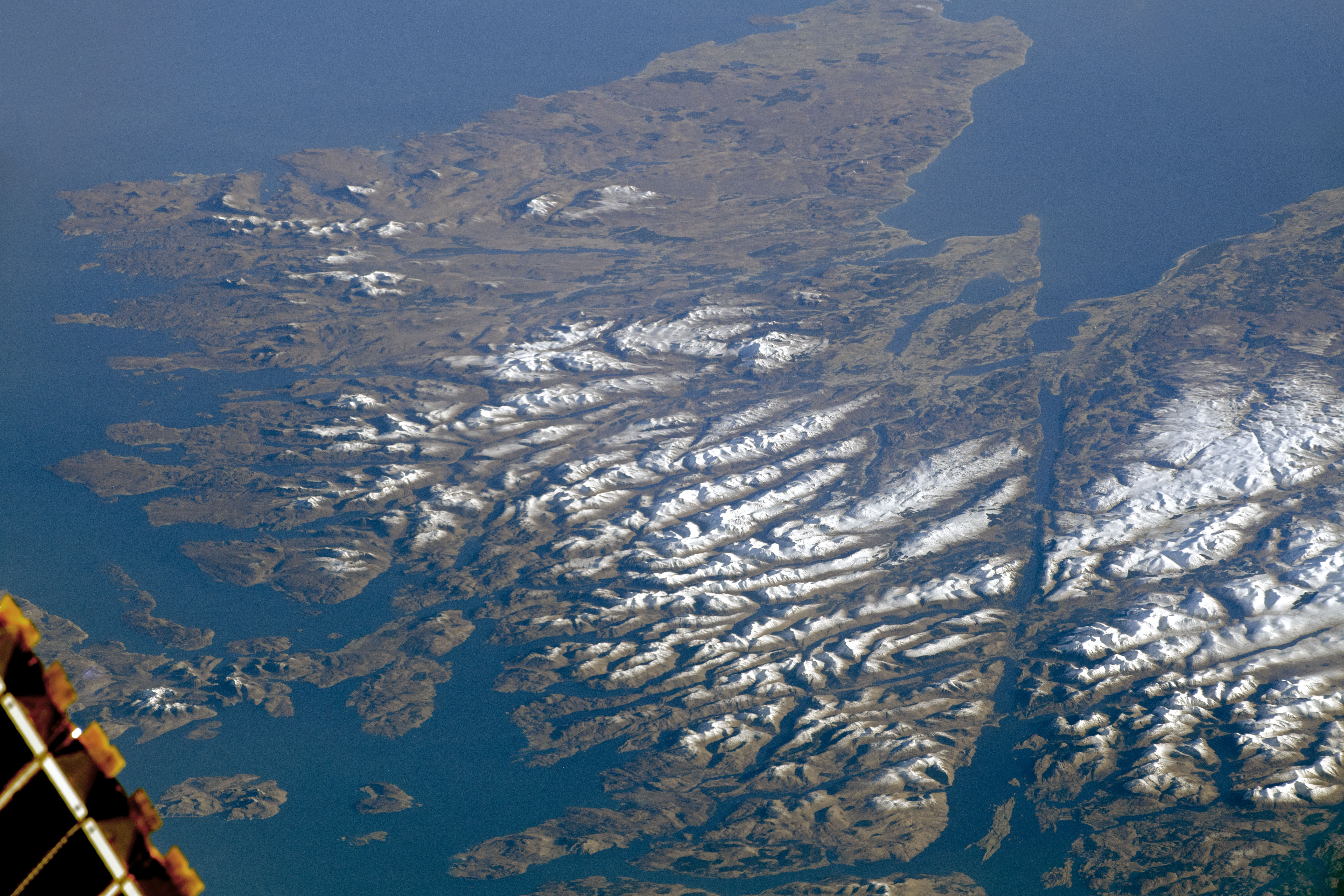


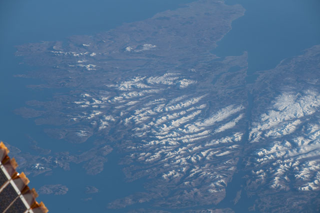
Photo center point: 57.1° N, 4.5° W
Photo center point by machine learning:
Country or Geographic Name: | UK-SCOTLAND |
Features: | LOCH LINNHE, GLASGOW, HIGH BOUNDARY FAULT, BEN NEVIS |
| Features Found Using Machine Learning: | |
Cloud Cover Percentage: | 10 (1-10)% |
Sun Elevation Angle: | 14° |
Sun Azimuth: | 123° |
Camera: | Nikon D5 Electronic Still Camera |
Focal Length: | 290mm |
Camera Tilt: | High Oblique |
Format: | 5568E: 5568 x 3712 pixel CMOS sensor, 35.9 x 23.9 mm, total pixels: 21.33 million, Nikon FX format |
Film Exposure: | |
| Additional Information | |
| Width | Height | Annotated | Cropped | Purpose | Links |
|---|---|---|---|---|---|
| 5568 pixels | 3712 pixels | No | No | NASA's Earth Observatory web site | Download Image |
| 720 pixels | 480 pixels | Yes | Yes | NASA's Earth Observatory web site | Download Image |
| 5568 pixels | 3712 pixels | No | No | Download Image | |
| 640 pixels | 427 pixels | No | No | Download Image |
Looking out from a window on the International Space Station, an astronaut captured this rare photograph of the Scottish Highlands. Cloud-covered skies are common for the region and typically prevent landscape photography from space, especially during the winter months (when this image was taken).
The topography of the Scottish Highlands is the result of geological processes spanning billions of years. The snow-capped mountains north of Glen Mor include some of the oldest rocks in Europe, and they were subsequently rearranged by tectonic forces hundreds of millions of years ago. The rocky landscape also shows signs of reshaping by flowing glaciers during the most recent Ice Ages.
Also known as the "Great Valley" or "Great Glen", Glen Mor is a fault zone marked by numerous elongated lakes (or lochs), one of which is the famous Loch Ness. In the early 2000s, locals built a pathway through the area - the Great Glen Way - for walkers and cyclists.
