ISS052-E-8757
| NASA Photo ID | ISS052-E-8757 |
| Focal Length | 1150mm |
| Date taken | 2017.06.26 |
| Time taken | 21:31:53 GMT |
4928 x 3280 pixels 720 x 480 pixels 4928 x 3280 pixels 640 x 426 pixels
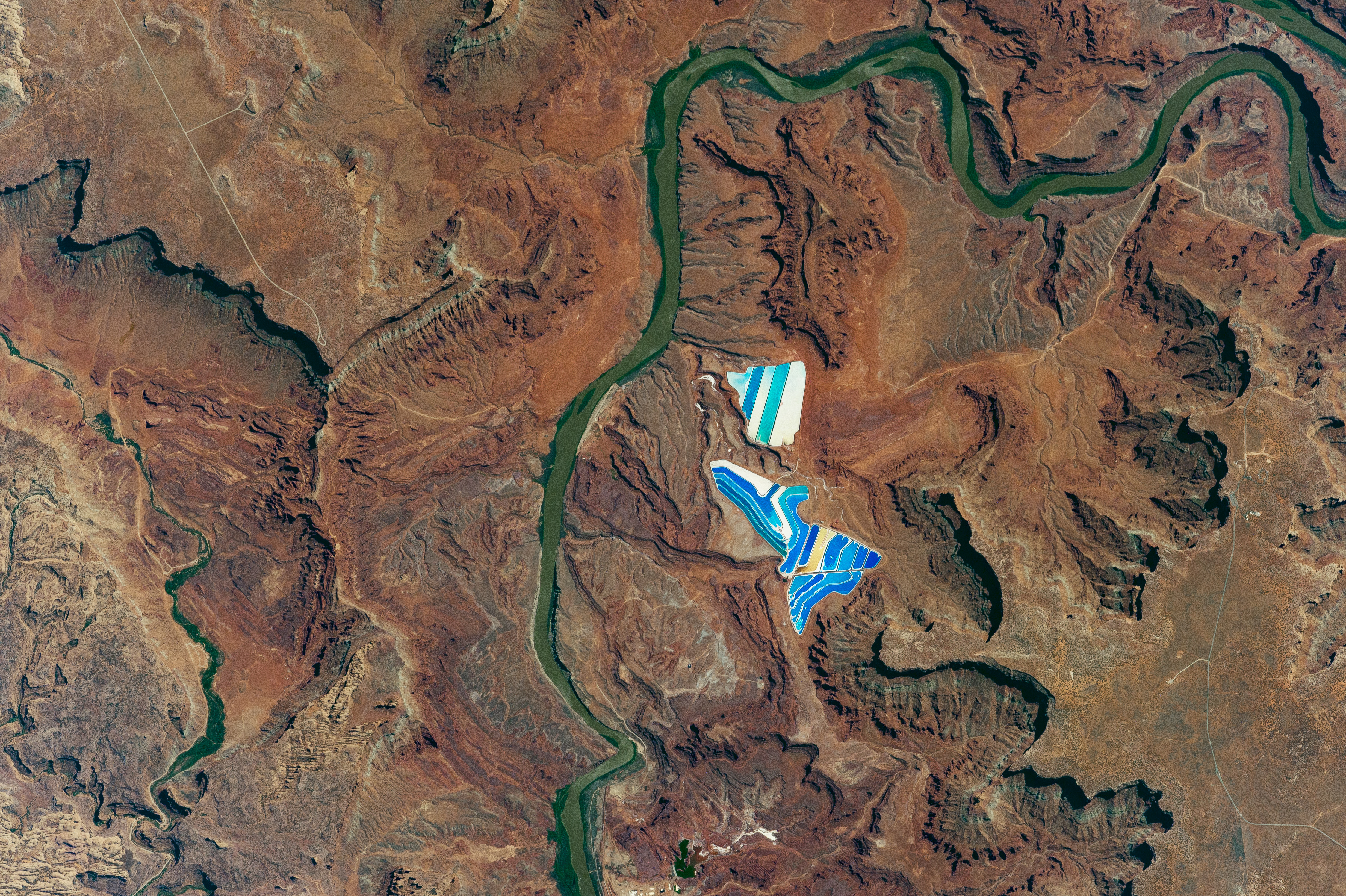
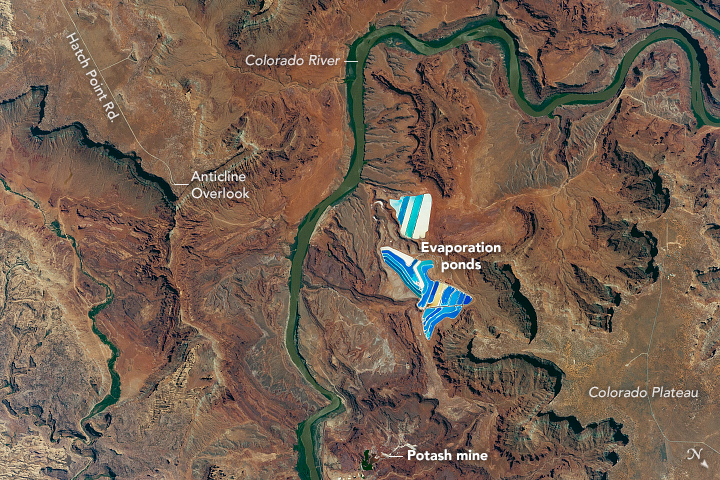
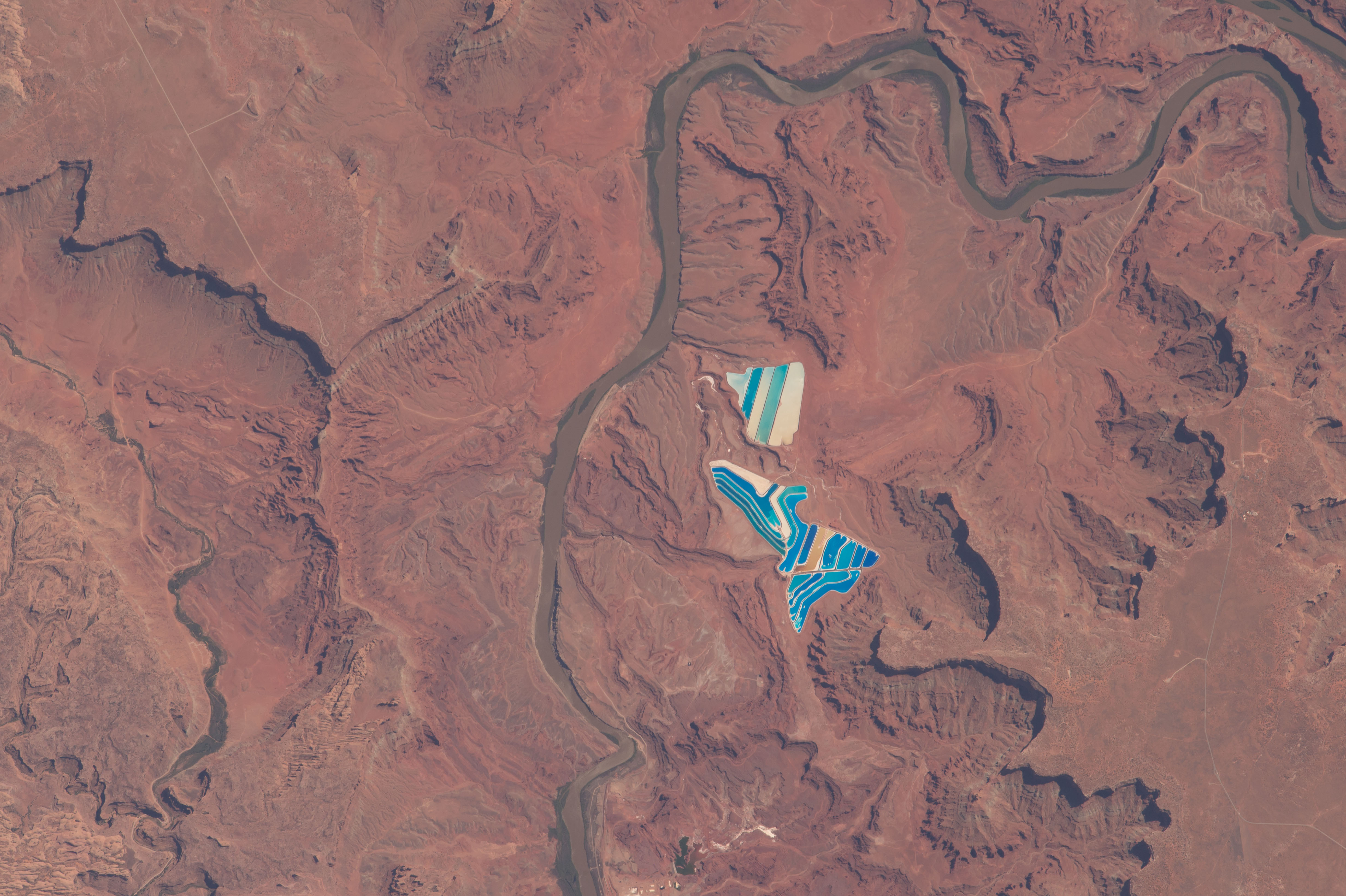


Photo center point: 38.5° N, 109.7° W
Photo center point by machine learning:
Country or Geographic Name: | USA-UTAH |
Features: | POTASH MINE, COLORADO R., MOAB, POTASH POND, PARADOX BASIN |
| Features Found Using Machine Learning: | |
Cloud Cover Percentage: | 0 (no clouds present) |
Sun Elevation Angle: | 57° |
Sun Azimuth: | 253° |
Camera: | Nikon D4 Electronic Still Camera |
Focal Length: | 1150mm |
Camera Tilt: | 32 degrees |
Format: | 4928E: 4928 x 3280 pixel CMOS sensor, 36.0mm x 23.9mm, total pixels: 16.6 million, Nikon FX format |
Film Exposure: | |
| Additional Information | |
| Width | Height | Annotated | Cropped | Purpose | Links |
|---|---|---|---|---|---|
| 4928 pixels | 3280 pixels | No | No | NASA's Earth Observatory web site | Download Image |
| 720 pixels | 480 pixels | No | No | NASA's Earth Observatory web site | Download Image |
| 4928 pixels | 3280 pixels | No | No | Download Image | |
| 640 pixels | 426 pixels | No | No | Download Image |
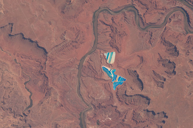
An astronaut aboard the International Space Station took this photograph of solar evaporation ponds outside the city of Moab, Utah. There are 23 colorful ponds spread across 400 acres. They are part of a large operation to mine potassium chloride - more commonly referred to as muriate of potash (MOP) - from ore buried underground. MOP is in high demand as fertilizer because there are no easy substitutes for potassium, an essential nutrient for plant growth.
Each pond color indicates a different state of evaporation. The deep, royal blue color is due to a dye that is added to a full pond of potash brine and water in order to speed up the rate of heat absorption. The seafoam green colors indicate shallower waters (with less dye) that are well into the evaporation process. The tan colored ponds are nearly dry; salt crystals (the final product) are left over in the pond and ready for collection.
Shadows cast on the landscape show the depth and dimension of the surrounding Utah desert. The Colorado Plateau stands at an average elevation of 1600 meters (5200 feet) above mean sea level, in contrast with the Colorado River Valley, with an average elevation of 1200 meters (3900 feet). The darker areas along the river bank are rich in green desert vegetation. Hatch Point Road leads to a scenic overlook for viewing the Cane Creek Anticline.
