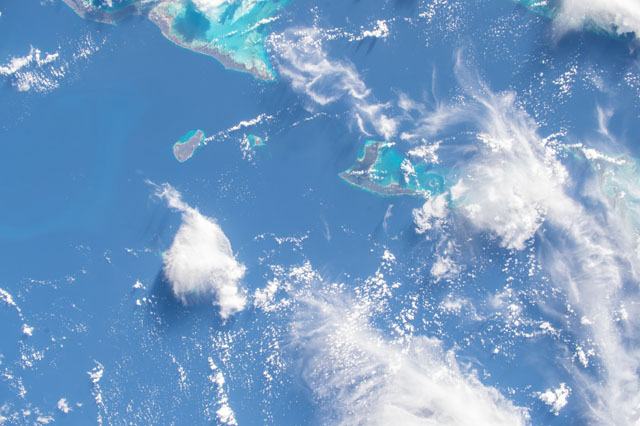
ISS045-E-52736
| NASA Photo ID | ISS045-E-52736 |
| Focal Length | 50mm |
| Date taken | 2015.10.09 |
| Time taken | 20:38:19 GMT |


Spacecraft nadir point: 25.0° N, 74.5° W
Photo center point: 24.0° N, 75.0° W
Photo center point by machine learning:
Photo center point: 24.0° N, 75.0° W
Photo center point by machine learning:
Nadir to Photo Center: South
Spacecraft Altitude: 214 nautical miles (396km)
Country or Geographic Name: | BAHAMAS |
Features: | CAT I., CONCEPTION I., RUM CAY, LONG I., SAN SALVADOR I., REEFS SHOALS, CAYS |
| Features Found Using Machine Learning: | |
Cloud Cover Percentage: | 50 (26-50)% |
Sun Elevation Angle: | 25° |
Sun Azimuth: | 249° |
Camera: | Nikon D4 Electronic Still Camera |
Focal Length: | 50mm |
Camera Tilt: | 17 degrees |
Format: | 4928E: 4928 x 3280 pixel CMOS sensor, 36.0mm x 23.9mm, total pixels: 16.6 million, Nikon FX format |
Film Exposure: | |
| Additional Information | |
| Width | Height | Annotated | Cropped | Purpose | Links |
|---|---|---|---|---|---|
| 4928 pixels | 3280 pixels | No | No | Download Image | |
| 640 pixels | 426 pixels | No | No | Download Image |
Download Packaged File
Download a Google Earth KML for this Image
View photo footprint information
Download a GeoTIFF for this photo
Georeferenced by human interaction - exported 2016-08-17-020623-UTCGeoreferenced by human interaction - exported 2016-08-24-031204-UTC
Georeferenced by human interaction - exported 2018-01-16-182643-UTC
An explanation of the georeference file(s) above
Image Caption: none
