ISS015-E-5624

| NASA Photo ID | ISS015-E-5624 |
| Focal Length | 180mm |
| Date taken | 2007.04.29 |
| Time taken | 17:41:12 GMT |
Resolutions offered for this image:
1000 x 1487 pixels 540 x 790 pixels 540 x 915 pixels 268 x 558 pixels 3032 x 2064 pixels 639 x 435 pixels
1000 x 1487 pixels 540 x 790 pixels 540 x 915 pixels 268 x 558 pixels 3032 x 2064 pixels 639 x 435 pixels


Spacecraft nadir point: 46.8° N, 71.5° W
Photo center point: 43.1° N, 79.0° W
Photo center point by machine learning:
Photo center point: 43.1° N, 79.0° W
Photo center point by machine learning:
Nadir to Photo Center: West
Spacecraft Altitude: 173 nautical miles (320km)
Country or Geographic Name: | USA-NEW YORK |
Features: | BUFFALO, NIAGARA FALLS |
| Features Found Using Machine Learning: | |
Cloud Cover Percentage: | 10 (1-10)% |
Sun Elevation Angle: | 56° |
Sun Azimuth: | 205° |
Camera: | Kodak DCS760c Electronic Still Camera |
Focal Length: | 180mm |
Camera Tilt: | High Oblique |
Format: | 3060E: 3060 x 2036 pixel CCD, RGBG array |
Film Exposure: | |
| Additional Information | |
| Width | Height | Annotated | Cropped | Purpose | Links |
|---|---|---|---|---|---|
| 1000 pixels | 1487 pixels | No | Yes | Earth From Space collection | Download Image |
| 540 pixels | 790 pixels | Yes | Yes | Earth From Space collection | Download Image |
| 540 pixels | 915 pixels | Yes | Yes | NASA's Earth Observatory web site | Download Image |
| 268 pixels | 558 pixels | Yes | Yes | NASA's Earth Observatory web site | Download Image |
| 3032 pixels | 2064 pixels | No | No | Download Image | |
| 639 pixels | 435 pixels | No | No | Download Image |
Download Packaged File
Download a Google Earth KML for this Image
View photo footprint information
Download a GeoTIFF for this photo
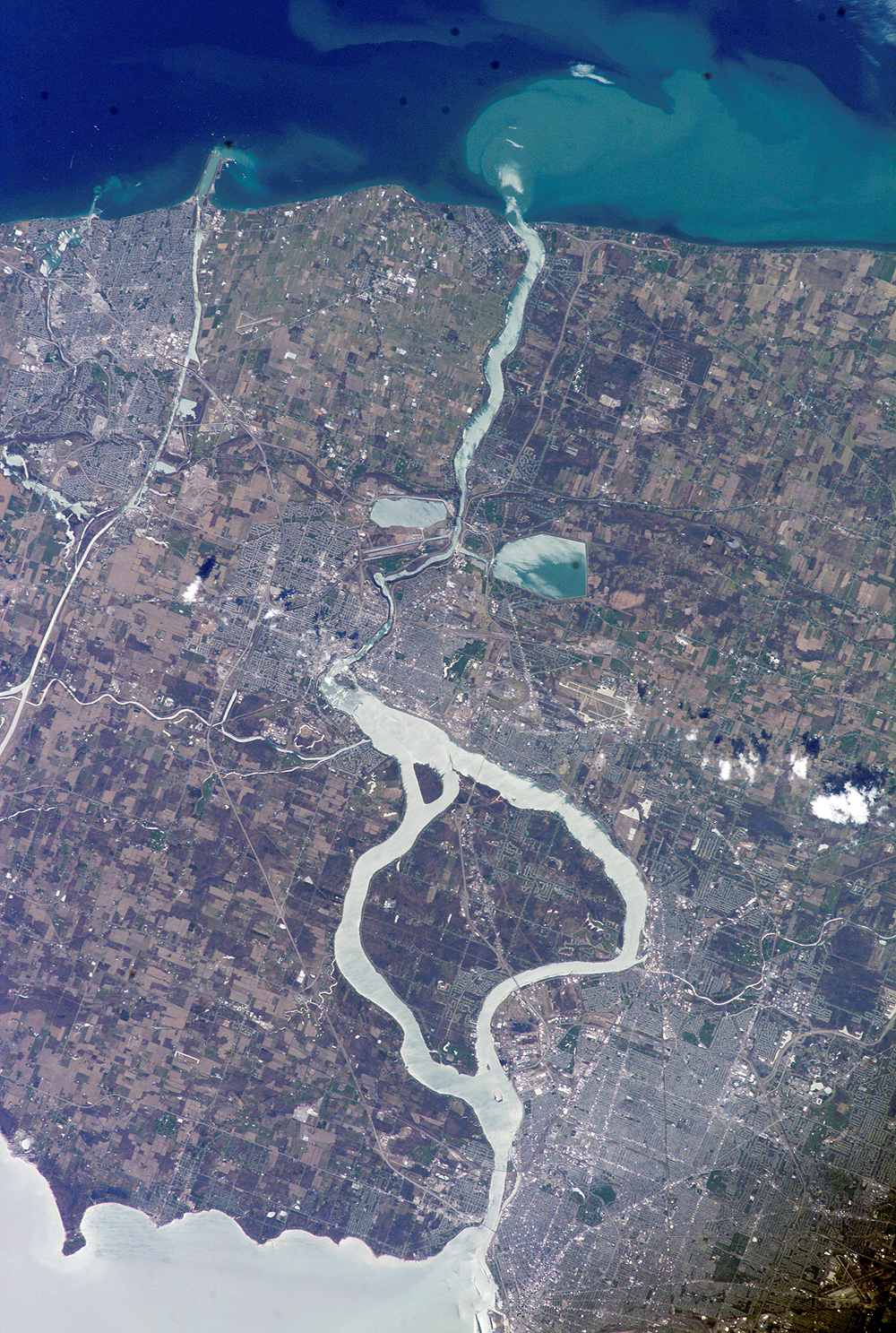
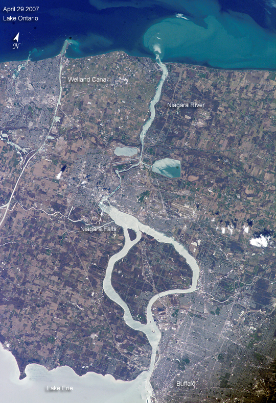
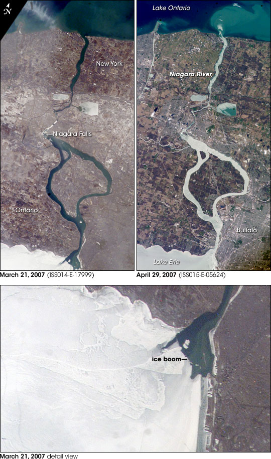
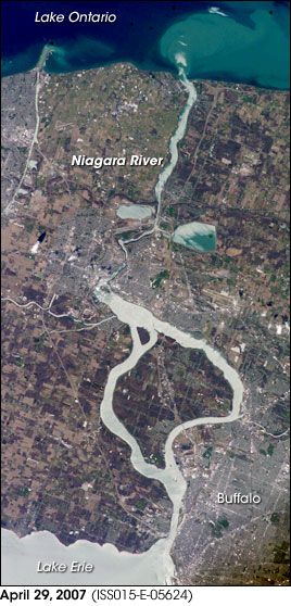
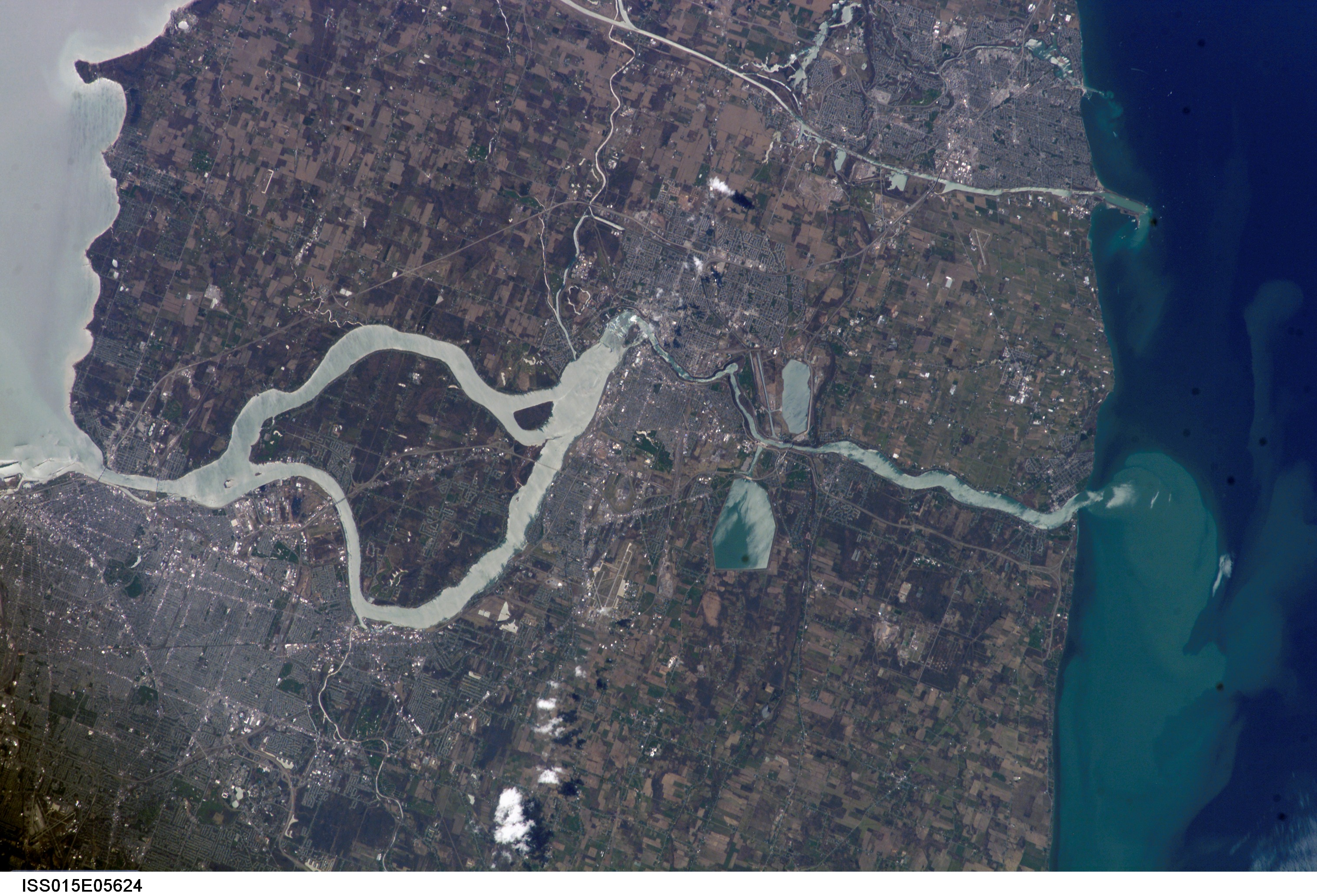
Image Caption: Springtime Comes to the Niagara River:
(image is paired with/compared to image ISS014-E-17999)
What a difference a month makes! These two images of the Niagara River draining Lake Erie (bottom) into Lake Ontario (top) were acquired about a month apart (March 21 and April 29, 2007, respectively) from the International Space Station. The pair documents the breakup of the Lake Erie ice pack, the unofficial signature of spring for residents of Buffalo and Niagara Falls. In March, the eastern end of Lake Erie is clogged with ice that is pushed against the shoreline by the prevailing westerly wind. The ice collects in Lake Erie, and the Lake Erie-Niagara River Ice Boom prevents it from flowing down the Niagara River, which is the international boundary between the Canadian Province of Ontario, and New York State.
The 2,680-meter (8,800-foot) boom is deployed each December. Operational since 1964, the boom serves several functions: it protects the water intakes for the Niagara River power plants, and it minimizes ice runs (large blocks of ice flowing downstream as ice breaks up in the spring) and blockages that can create damage and flooding along the river. At the height of winter, the thickness of the ice at the Buffalo harbor can reach 3.5 meters (12 feet). The removal of the ice boom, usually in early April, is now marked by local celebrations. This year the boom was removed in mid-April, a bit later than usual. A webcam allows remote viewers to monitor ice pack at the boom.
During their missions, astronauts track the changing seasons using such indicators as the springtime melting of ice packs in high-latitude oceans and lakes. Over the next two years, the space station astronauts will make these types of observations to support International Polar Year (IPY) investigations.
