ISS011-E-12863

| NASA Photo ID | ISS011-E-12863 |
| Focal Length | 400mm |
| Date taken | 2005.09.11 |
| Time taken | 22:39:17 GMT |
1000 x 662 pixels 540 x 357 pixels 540 x 540 pixels 3032 x 2008 pixels 639 x 435 pixels
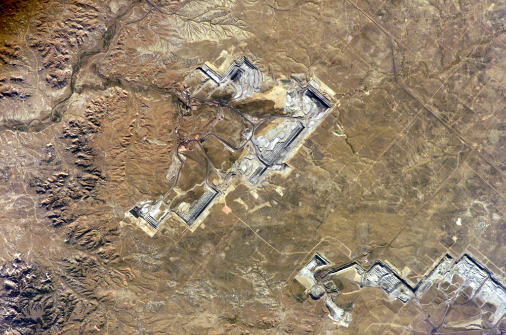
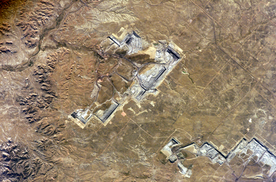
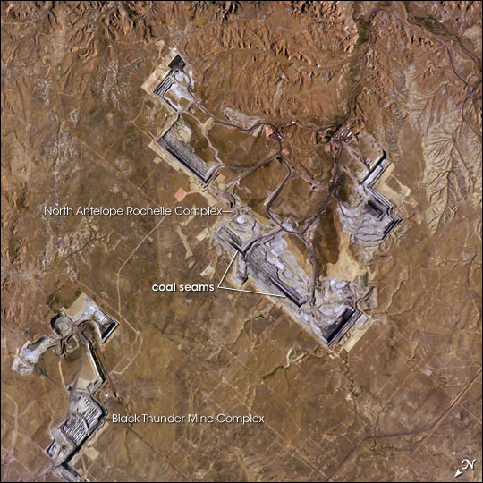
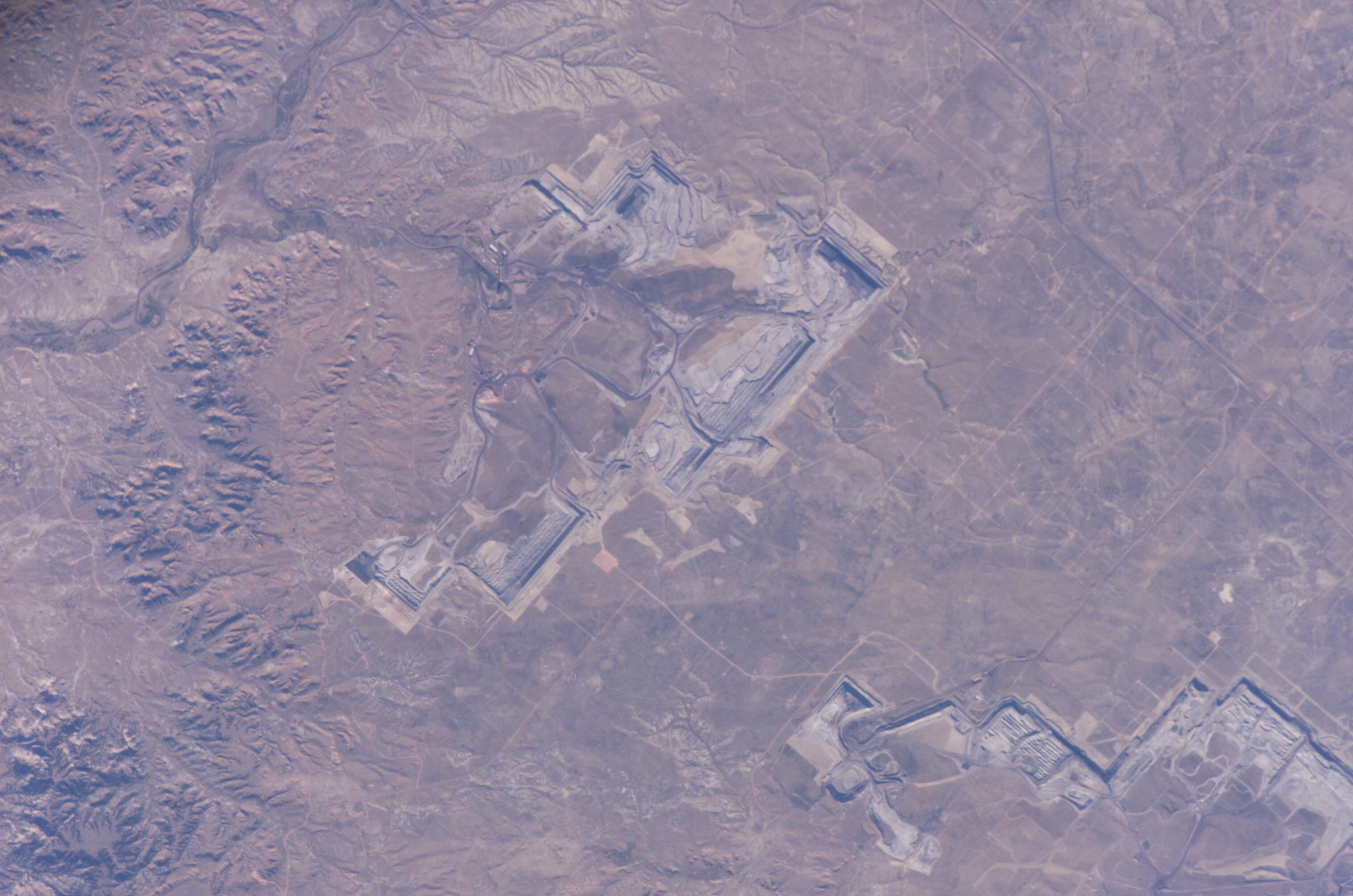
Photo center point: 43.8° N, 105.2° W
Photo center point by machine learning:
Country or Geographic Name: | USA-WYOMING |
Features: | LITTLE THUNDER CR., STRIP MINE |
| Features Found Using Machine Learning: | |
Cloud Cover Percentage: | 10 (1-10)% |
Sun Elevation Angle: | 27° |
Sun Azimuth: | 248° |
Camera: | Kodak DCS760c Electronic Still Camera |
Focal Length: | 400mm |
Camera Tilt: | 4 degrees |
Format: | 3060E: 3060 x 2036 pixel CCD, RGBG array |
Film Exposure: | |
| Additional Information | |
| Width | Height | Annotated | Cropped | Purpose | Links |
|---|---|---|---|---|---|
| 1000 pixels | 662 pixels | No | Yes | Earth From Space collection | Download Image |
| 540 pixels | 357 pixels | No | Yes | Earth From Space collection | Download Image |
| 540 pixels | 540 pixels | Yes | Yes | NASA's Earth Observatory web site | Download Image |
| 3032 pixels | 2008 pixels | No | No | Not enhanced | Download Image |
| 639 pixels | 435 pixels | No | No | Download Image |
The United States' highest rate of coal production is in Wyoming, with almost 400 million short tons extracted in 2004. The majority of this coal is burned to generate electrical power within the United States, but a small percentage is also goes to Spain and Canada. The Powder River Basin in the northeastern portion of the state is the most productive of Wyoming's coal fields. The extensive coal deposits - ranging in thickness from 21 to 53 meters (70 to 175 feet) - formed over 38-66 million years ago. The source of organic material for the coal originated in swamps, estuaries, and deltas associated with the regression (retreat) of a large inland seaway that occupied central North America during the Cretaceous Period, which spanned the years between about 144 to 65 million years ago.
Open-pit strip mining is the technique that coal operators prefer for removing the sparsely vegetated surface (overburden in mining terminology) of northeastern Wyoming that covers the coal seams. One of the largest of these mines, Peabody Energy's North Antelope Rochelle Complex, is located at the center of this astronaut photograph. A portion of Arch Coal's Black Thunder Mine Complex is visible to north. Active coal seam faces are visible as black lines, and the stepped benches along the sides of the pit allow access for trucks carrying coal and overburden from the mine. Large draglines and shovels remove the overburden and expose the coal seam; blasting reduces the coal to loadable fragments. The coal is then transported from Wyoming by up to 2000 rail cars per day. Following removal of the coal, mining companies are required by federal law to reclaim and revegetate the former mine workings.
