ISS008-E-5983
| NASA Photo ID | ISS008-E-5983 |
| Focal Length | 80mm |
| Date taken | 2003.11.14 |
| Time taken | 13:__:__ GMT |
Resolutions offered for this image:
3032 x 2064 pixels 540 x 357 pixels 1000 x 662 pixels 3032 x 2064 pixels 639 x 435 pixels
3032 x 2064 pixels 540 x 357 pixels 1000 x 662 pixels 3032 x 2064 pixels 639 x 435 pixels


Cloud masks available for this image:
Spacecraft nadir point:
Photo center point: 35.0° S, 57.5° W
Photo center point by machine learning:
Photo center point: 35.0° S, 57.5° W
Photo center point by machine learning:
Nadir to Photo Center:
Spacecraft Altitude: nautical miles (0km)
Country or Geographic Name: | URUGUAY |
Features: | RIO DE LA PLATA ESTUARY, SED. PLUMES |
| Features Found Using Machine Learning: | |
Cloud Cover Percentage: | 10 (1-10)% |
Sun Elevation Angle: | ° |
Sun Azimuth: | ° |
Camera: | Kodak DCS760c Electronic Still Camera |
Focal Length: | 80mm |
Camera Tilt: | Low Oblique |
Format: | 3060E: 3060 x 2036 pixel CCD, RGBG array |
Film Exposure: | |
| Additional Information | |
| Width | Height | Annotated | Cropped | Purpose | Links |
|---|---|---|---|---|---|
| 3032 pixels | 2064 pixels | No | Yes | Earth From Space collection | Download Image |
| 540 pixels | 357 pixels | Yes | Yes | Earth From Space collection | Download Image |
| 1000 pixels | 662 pixels | Yes | Yes | NASA's Earth Observatory web site | Download Image |
| 3032 pixels | 2064 pixels | No | No | Download Image | |
| 639 pixels | 435 pixels | No | No | Download Image |
Download Packaged File
Download a Google Earth KML for this Image
View photo footprint information
Download a GeoTIFF for this photo
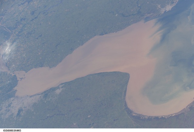
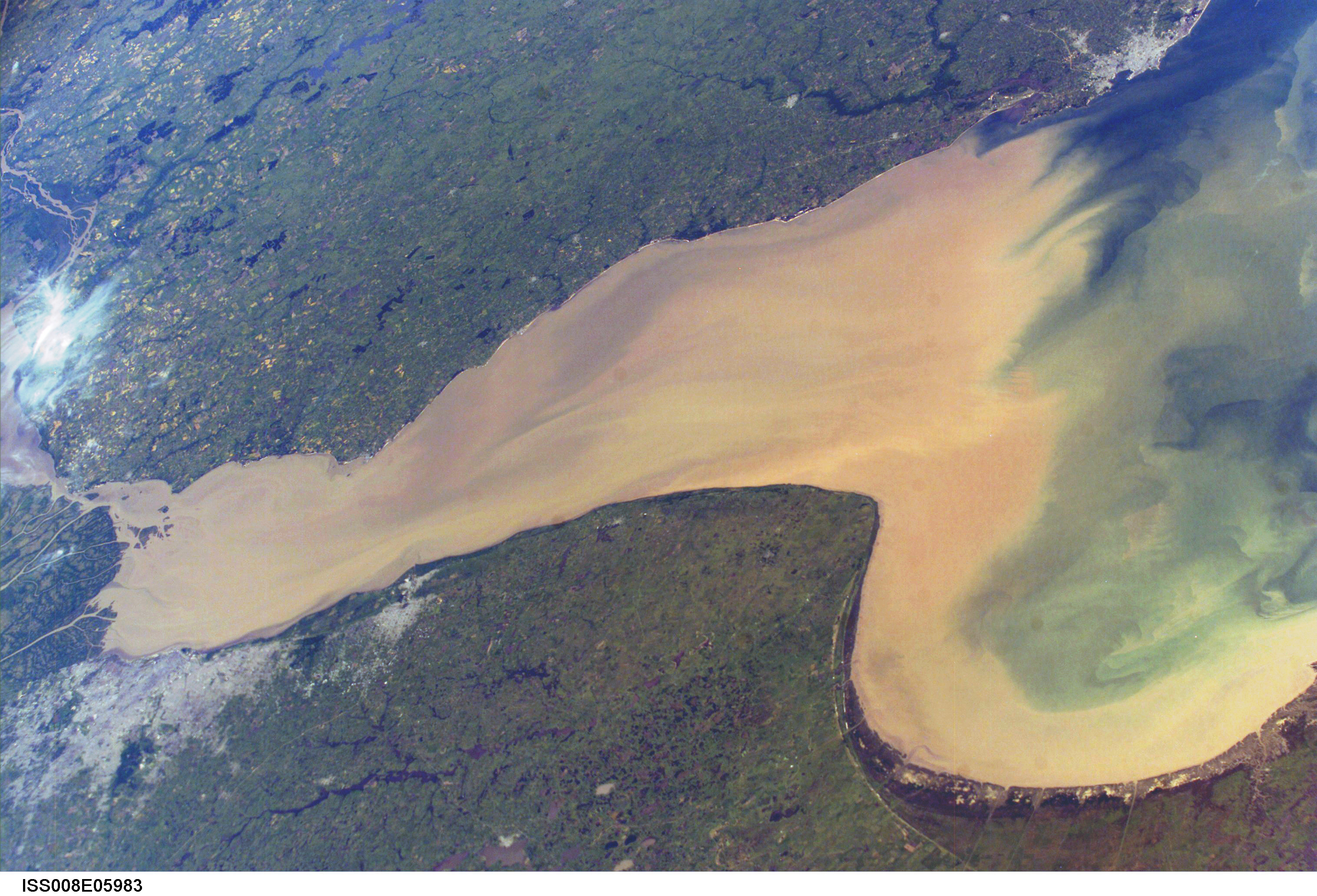
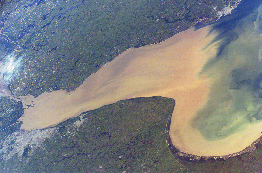
Image Caption: Rio de la Plata is the muddy estuary of the Parana and Uruguay Rivers, and forms part of the border between Argentina and Uruguay. The rich estuary supports both capital cities of Buenos Aires and Montevideo.
The Parana is South America's second longest river, and drains much of the southeastern part of the continent. The extensive delta of the Parana nearly reaches across the mouth of the Uruguay River. The rivers' fertile soils support extensive agriculture, including livestock, in the region surrounding the cities.
This image provides a snapshot of the complicated mixing in the Rio de la Plata between the fresh river waters and the water of the South Atlantic. The thick sediment plume of the Parana and Uruguay Rivers serves as a marker for the fresher water masses. It can be traced far out into the South Atlantic Ocean. The nutrients in the fresh water plume often feed large plankton blooms offshore.
