< ISS022-E-90683 >
| NASA Photo ID | ISS022-E-90683 |
| Focal Length | 85mm |
| Date taken | 2010.03.11 |
| Time taken | 11:13:36 GMT |

Cloud masks available for this image:
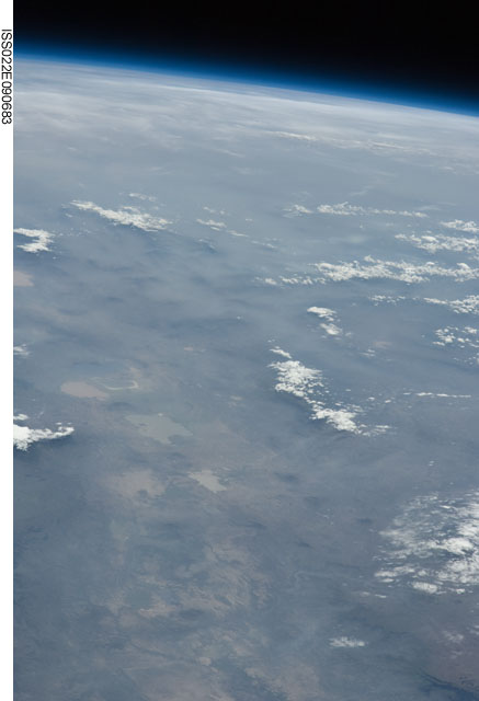
Spacecraft nadir point: 12.1° N, 44.6° E
Photo center point: 8.3° N, 38.6° E
Photo center point by machine learning:
Photo center point: 8.3° N, 38.6° E
Photo center point by machine learning:
Nadir to Photo Center: Southwest
Spacecraft Altitude: 185 nautical miles (343km)Body: Earth
Country or Geographic Name: | ETHIOPIA |
Features: | PAN-EARTH LIMB, RIFT VALLEY LAKES |
| Features Found Using Machine Learning: | PAN- |
Cloud Cover Percentage: | 25 (11-25)% |
Sun Elevation Angle: | 56° |
Sun Azimuth: | 245° |
Camera: | Nikon D2Xs Electronic Still Camera |
Focal Length: | 85mm |
Camera Tilt: | High Oblique |
Format: | 4288E: 4288 x 2848 pixel CMOS sensor, RGBG imager color filter |
Film Exposure: | |
| Additional Information | |
| Width | Height | Annotated | Cropped | Purpose | Links |
|---|---|---|---|---|---|
| 2929 pixels | 4288 pixels | No | No | Download Image | |
| 437 pixels | 640 pixels | No | No | Download Image |
Download Packaged File
Download a Google Earth KML for this Image
View photo footprint information
No GeoTIFF is available for this photo.Image Caption: none
