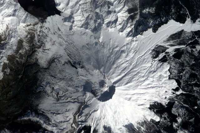
< ISS001-E-6701 >
| NASA Photo ID | ISS001-E-6701 |
| Focal Length | 800mm |
| Date taken | 2001.02.22 |
| Time taken | 21:39:39 GMT |


Spacecraft nadir point: 44.9° N, 120.7° W
Photo center point: 46.0° N, 122.0° W
Photo center point by machine learning:
Photo center point: 46.0° N, 122.0° W
Photo center point by machine learning:
Nadir to Photo Center: Northwest
Spacecraft Altitude: 201 nautical miles (372km)
Country or Geographic Name: | USA-WASHINGTON |
Features: | MOUNT ST. HELENS |
| Features Found Using Machine Learning: | |
Cloud Cover Percentage: | 10 (1-10)% |
Sun Elevation Angle: | 30° |
Sun Azimuth: | 212° |
Camera: | Kodak DCS460 Electronic Still Camera |
Focal Length: | 800mm |
Camera Tilt: | 27 degrees |
Format: | 3060E: 3060 x 2036 pixel CCD, RGBG array |
Film Exposure: | |
| Additional Information | |
| Width | Height | Annotated | Cropped | Purpose | Links |
|---|---|---|---|---|---|
| 3060 pixels | 2036 pixels | No | No | Download Image | |
| 640 pixels | 425 pixels | No | No | Download Image |
Download Packaged File
Download a Google Earth KML for this Image
View photo footprint information
No GeoTIFF is available for this photo.Image Caption: none
