ISS017-E-16161

| NASA Photo ID | ISS017-E-16161 |
| Focal Length | 800mm |
| Date taken | 2008.09.13 |
| Time taken | 11:47:21 GMT |
Resolutions offered for this image:
1000 x 602 pixels 540 x 325 pixels 540 x 334 pixels 3072 x 2098 pixels 640 x 437 pixels
1000 x 602 pixels 540 x 325 pixels 540 x 334 pixels 3072 x 2098 pixels 640 x 437 pixels


Spacecraft nadir point: 51.0° S, 10.3° E
Photo center point: 54.4° S, 3.4° E
Photo center point by machine learning:
Photo center point: 54.4° S, 3.4° E
Photo center point by machine learning:
Nadir to Photo Center: West
Spacecraft Altitude: 195 nautical miles (361km)
Country or Geographic Name: | BOUVET ISLAND |
Features: | CAPE VALDIVIA, SEA ICE, GLACIERS |
| Features Found Using Machine Learning: | |
Cloud Cover Percentage: | 10 (1-10)% |
Sun Elevation Angle: | 35° |
Sun Azimuth: | 350° |
Camera: | Nikon D2Xs Electronic Still Camera |
Focal Length: | 800mm |
Camera Tilt: | High Oblique |
Format: | 4288E: 4288 x 2848 pixel CMOS sensor, RGBG imager color filter |
Film Exposure: | |
| Additional Information | |
| Width | Height | Annotated | Cropped | Purpose | Links |
|---|---|---|---|---|---|
| 1000 pixels | 602 pixels | No | Yes | Earth From Space collection | Download Image |
| 540 pixels | 325 pixels | Yes | Yes | Earth From Space collection | Download Image |
| 540 pixels | 334 pixels | Yes | Yes | NASA's Earth Observatory web site | Download Image |
| 3072 pixels | 2098 pixels | No | No | Download Image | |
| 640 pixels | 437 pixels | No | No | Download Image |
Download Packaged File
Download a Google Earth KML for this Image
View photo footprint information
Download a GeoTIFF for this photo
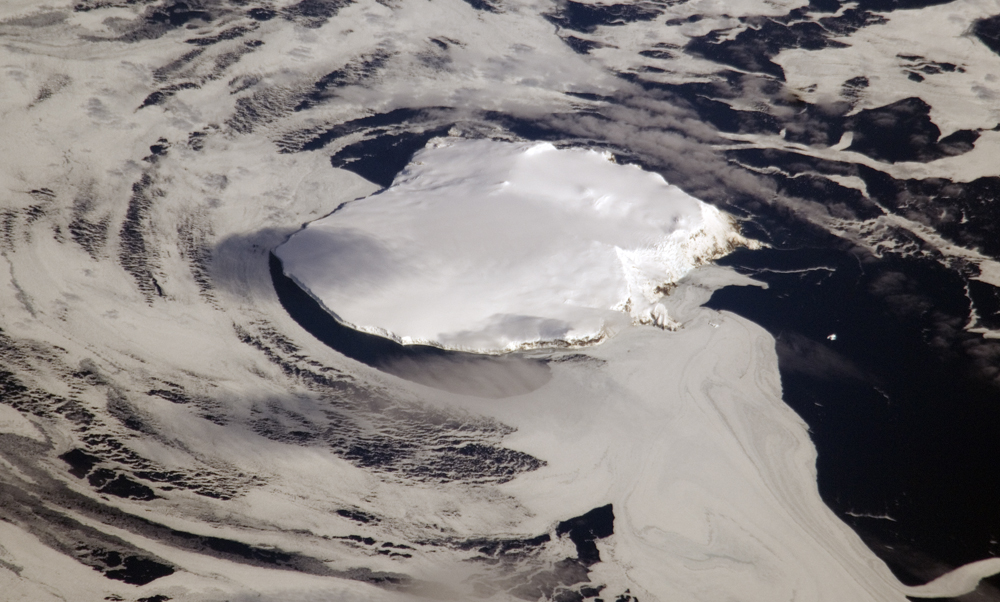
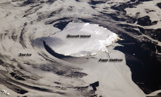
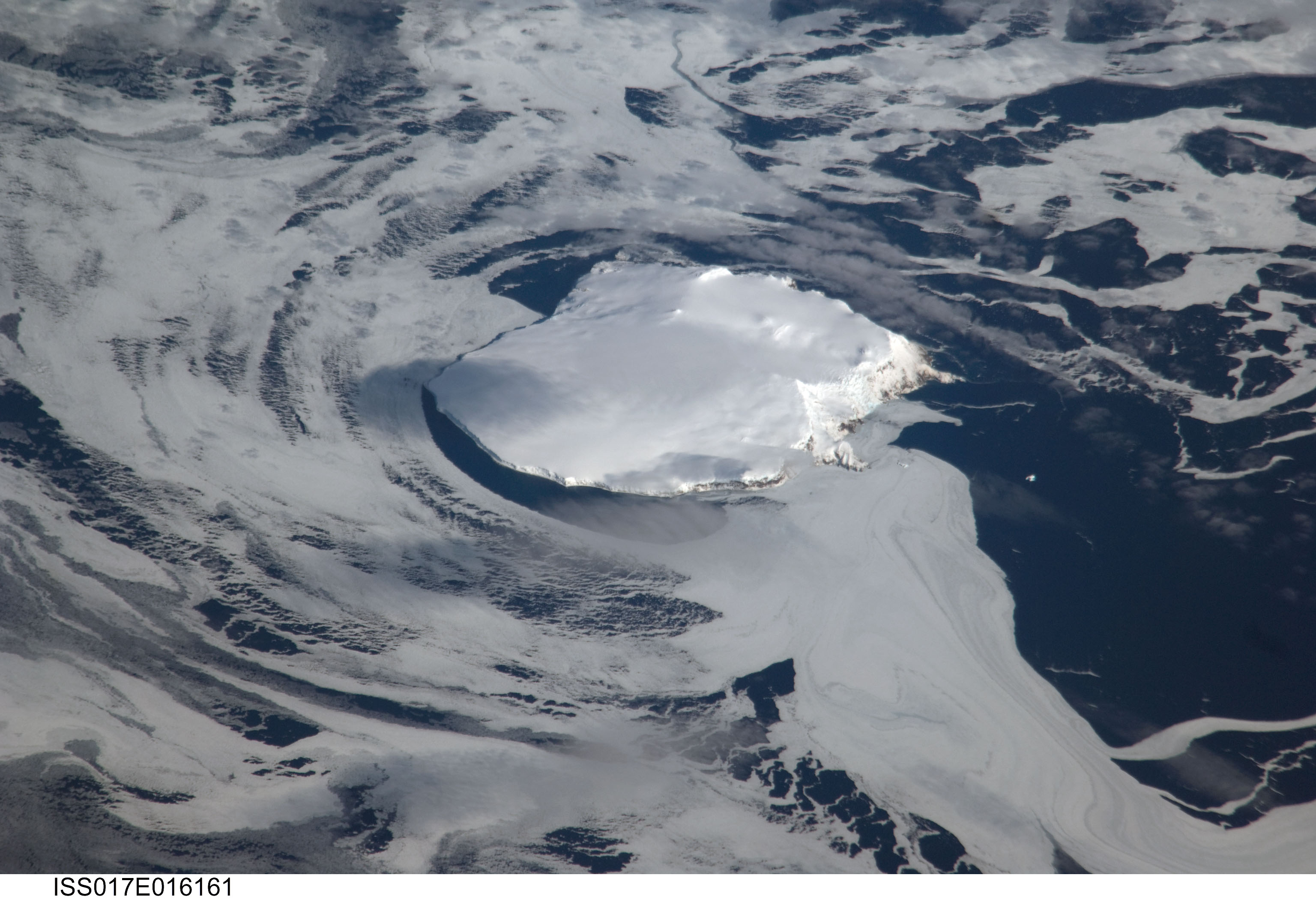
Image Caption: Bouvet Island, South Atlantic Ocean
Bouvet Island (in Norwegian, Bouvetoya) is known as the most remote island in the world; Antarctica, over 1600 kilometers (994 miles) to the south, is the nearest land mass. Located near the junction between the South American, African, and Antarctic tectonic plates, the island is mostly formed from a shield volcano--a broad, gently sloping cone formed by thin, fluid lavas--that is almost entirely covered by glaciers. The prominent Kapp (Cape) Valdivia on the northern coastline is a peninsula formed by a lava dome, a volcanic feature built by viscous lavas with a high silica content. It is only along the steep cliffs of the coastline that the underlaying dark volcanic rock is visible against the white snow and ice blanketing the island.
Bouvet Island was discovered by the French Captain Lozier-Bouvet in 1739, and was subsequently visited by representatives of different nations several times during the nineteenth century. The island was annexed by the Kingdom of Norway in 1927 following a Norwegian expedition's stay on the island. Bouvet is uninhabited, and its extremely harsh environment precludes anything but short-duration stays. Nevertheless, the island supports some flora (such as lichens) and fauna (seabirds and seals). Abundant sea ice surrounds the island in this astronaut photograph.
