Sierra Vista
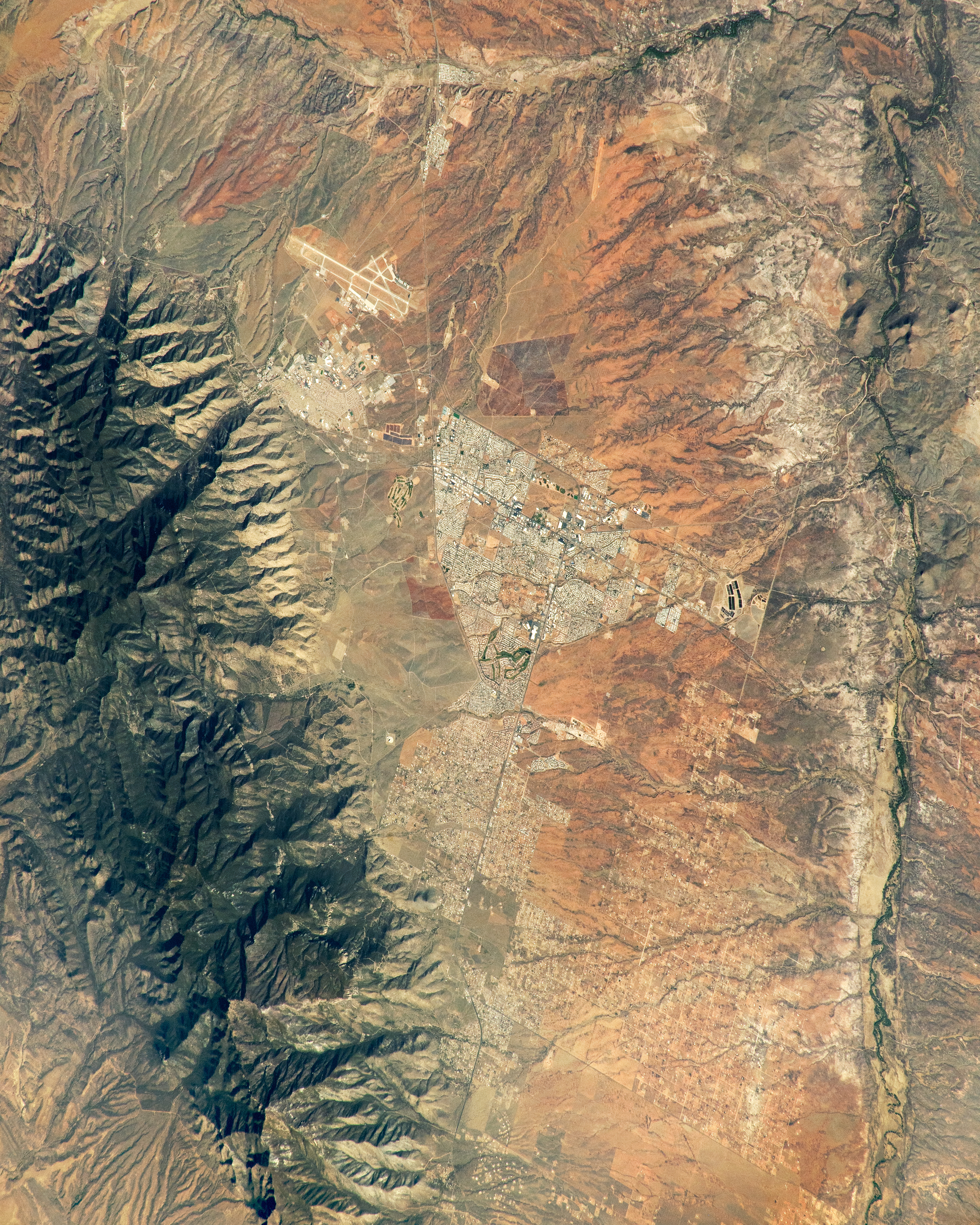
An astronaut aboard the International Space Station took this photograph of Sierra Vista in southern Arizona, just north of the United States-Mexico border. Bounded on all sides by military land (Fort Huachuca), national forest, and conservation areas, Sierra Vista’s city area is structured in a triangular shape. Creeks and washes sprawl across the desert flats from the Huachuca Mountains to the San Pedro River.
The Huachuca Mountains lie to the west of Sierra Vista and neighboring urban areas. These mountains are part of the Sky Islands, an isolated group of mountain ranges scattered throughout southeastern Arizona and northern Mexico. Cool peaks and uplands contrast with the hotter desert lowlands. Miller Peak rises to 9,466 feet (2,885 meters) above sea level, almost 5,000 feet (1,524 meters) above Sierra Vista. Portions of the Huachuca Mountains and the surrounding area fall within the Miller Peak Wilderness and the Coronado National Forest.
Toward the east, Sierra Vista stretches to the San Pedro Riparian National Conservation Area (NCA), which protects a rare riverbank ecosystem within the Chihuahuan and Sonoran Deserts. The conservation area is home to endangered species, such as the yellow-billed cuckoo, the willow flycatcher, and the semi-aquatic plant known as the Huachuca water-umbel.
The protected regions around Sierra Vista also preserve cultural and historical landmarks. The caves and canyons of the Huachuca Mountains contain petroglyphs dating back 13,000 years. Additionally, prehistoric mammoth remains and ancient tools have been found at the Murray Springs Clovis Archeological Site within the San Pedro NCA.
Astronaut photograph ISS067-E-13009 was acquired on April 13, 2022, with a Nikon D5 digital camera using a focal length of 500 millimeters. The image was provided by the ISS Crew Earth Observations Facility and the Earth Science and Remote Sensing Unit at Johnson Space Center. The image was taken by a member of the Expedition 67 crew. It has been cropped and enhanced to improve contrast, and lens artifacts have been removed. The International Space Station Program supports the laboratory as part of the ISS National Lab to help astronauts take pictures of Earth that will be of the greatest value to scientists and the public and to make those images freely available on the Internet. Additional images taken by astronauts and cosmonauts can be viewed at the NASA/JSC Gateway to Astronaut Photography of Earth. Caption by Sara Schmidt, GeoControl Systems, JETS II Contract at NASA-JSC.
