Northern California Coastline
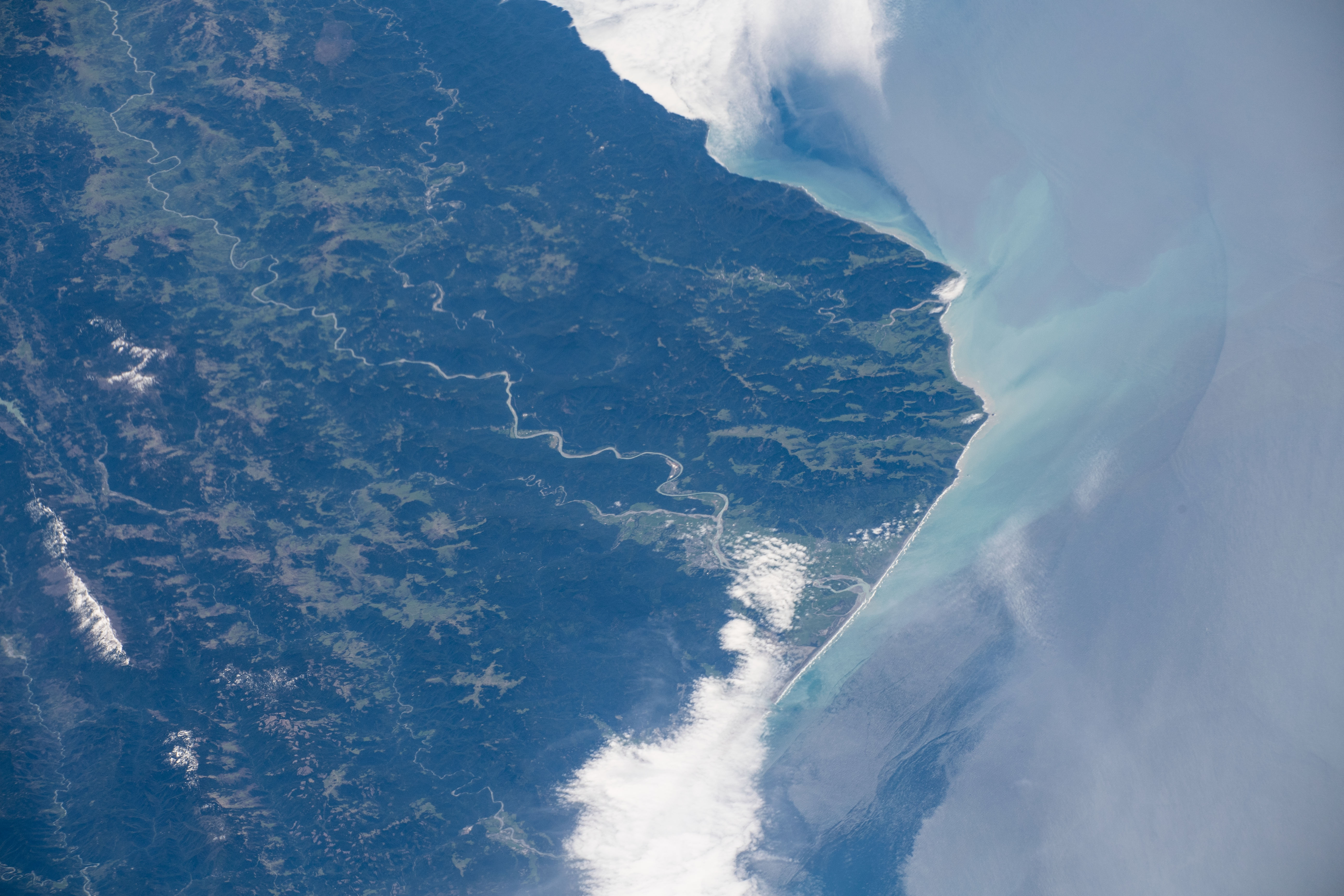
While orbiting over the U.S. West Coast, an astronaut on the International Space Station looked south to take this photo of Humboldt County in northern California. Forests make up much of the dark green landscapes. Lighter green areas along the coastal river estuaries are wetlands. The Eel River flows through mountainous topography and meets the Pacific Ocean near Eureka, CA.
Eureka, located just north of the Eel River outlet (bottom of image), is obscured by its notorious fog. The climate of Humboldt County is persistently wet with temperatures rarely exceeding 80°F (~27°C) year round. The area’s rainy season is during the winter, receiving about 75% of its annual rainfall from November through March. Thick summer fog brings essential moisture to the famous redwood forests during relatively drier summer months.
The regional airport here was originally built as a Naval Air Station during World War II to test military defogging equipment. Later the runways were used for military experiments for low visibility landings and the airport is still used today for commercial flights.
Large faults run through Cape Mendocino and off the coastline. Humboldt County is subject to high seismic risk due to its close proximity to a triple junction where the Pacific, North American and Gorda Plates meet just offshore. Earthquakes here put the coastline at risk for tsunamis and landslide hazards.
References
- U.S. Department of Commerce, National Oceanic and Atmospheric Administration, National Weather Service. NOAA Technical Memorandum, NWS WR-252 Climate of Eureka, California (1998). Accessed May 23, 2019.
- National Aeronautics and Space Administration. NASA Contractor Report 3255, Fog Dispersion (1980). Accessed May 23, 2019.
Astronaut photograph ISS059-E-35737 was acquired on April 25, 2019, with a Nikon D5 digital camera using a 210 millimeter lens and is provided by the ISS Crew Earth Observations Facility and the Earth Science and Remote Sensing Unit, Johnson Space Center. The image was taken by a member of the Expedition 59 crew. The image has been cropped and enhanced to improve contrast, and lens artifacts have been removed. The International Space Station Program supports the laboratory as part of the ISS National Lab to help astronauts take pictures of Earth that will be of the greatest value to scientists and the public, and to make those images freely available on the Internet. Additional images taken by astronauts and cosmonauts can be viewed at the NASA/JSC Gateway to Astronaut Photography of Earth. Caption by Andrea Meado, Jacobs Technology, JETS Contract at NASA-JSC.
