Browse all wallpapers
ISS Mission 56
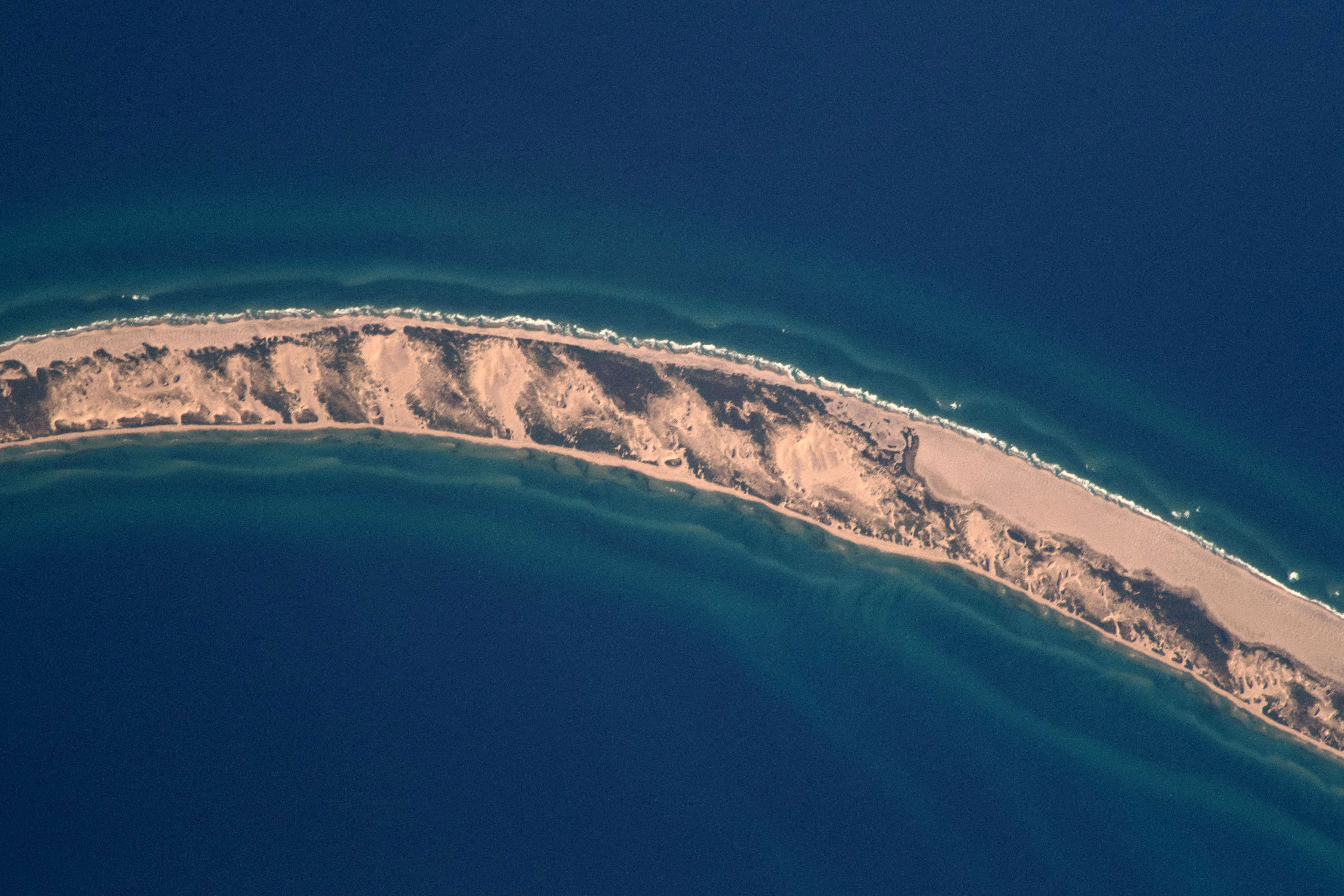
Sable Island is a small, remote sliver of land located ~186 mi (300 km) from Halifax, Nova Scotia in the Atlantic Ocean. The island is just over 26 mi (44km) long and is about 1 mi (1.6 km) across at its widest point. Sable Island National Park Reserve was founded on June 20, 2013 through Parks Canada. The island however, has been used as a permanent weather station since 1891. Sable Island is populated by very few humans (staff working at the Station) and is home to wild horses and grey seals. Over 350 recorded shipwrecks have occurred at Sable Island since 1583. Sable Island has naturally been a center point for shipwrecks over many centuries due to surrounding rich fishing waters, stormy weather patterns, and major ocean currents
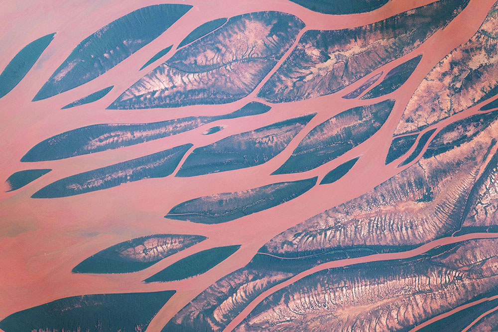
The Betsiboka River Delta empties into the Mozambique Channel at Bombetoka Bay in northwest Madagascar. The red and orange colored waters of the river are the result of sediment eroding from surrounding floodplains. High erosion rates of silt here are attributed to a century of deforestation of rainforests and coastal mangroves. Surrounding this river delta are coffee plantations, one of Madagascar’s many export crops. The Betsiboka River is susceptible to flooding when cyclones and tropical storms hit the island.
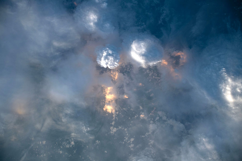
A variety of clouds are seen off the coast of Guatemala. Various shades of grey, white, and steel blue dominate the photo with warm orange tones peeking through the clouds. This picture was taken around 6:00 in the morning locally. The orange and yellow colors are likely due to the sun rise.
ISS Mission 55
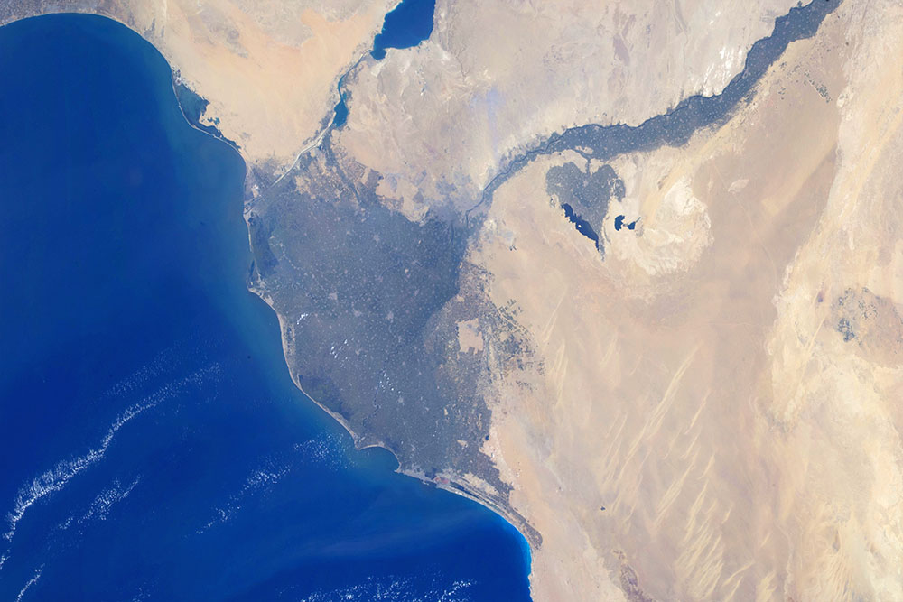
The Nile River flows north across the Libyan Desert until its delta meets the Mediterranean Sea. Cairo, the capitol of Egypt, is located at the apex of the Nile River Delta where vegetation fans out in contrast to the tan desert landscape. The Nile River is essential for life in Egypt, with 95% of the population living within 20 km of the river and its delta. Countries along the surrounding coastline include Egypt, Israel, Lebanon, and the Gaza Strip. The Mediterranean island of Cyprus is seen in the dual screen panoramic view.
Click here to to watch a time-lapse video featuring this Nile River Delta imagery.
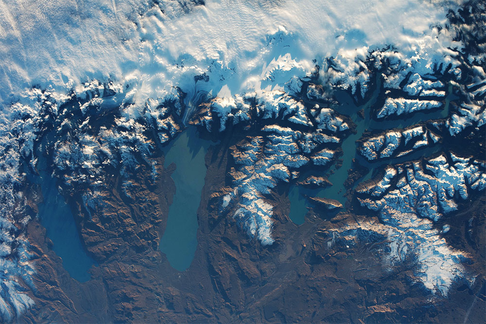
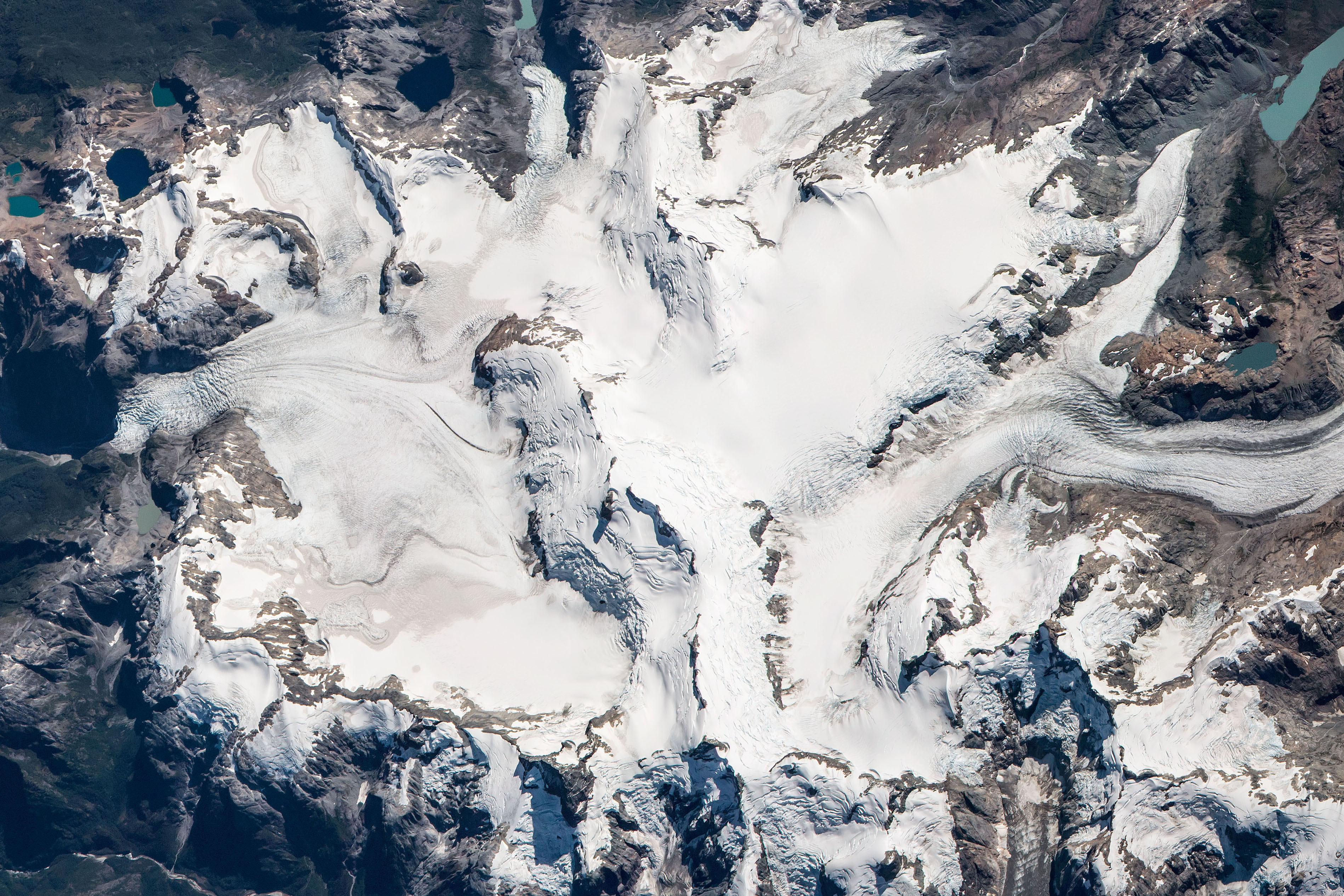
The Southern Patagonia Icefield, located in the Andes Mountains of Chile, has dramatic elevation changes from mountain peaks to the adjacent lake surfaces in Argentina. Some of the highest peaks pictures here are over 10,000 ft (>3000 m) high, while the lakes rest at about 550 ft (176 m) above sea level. From image left to right, the massive lakes seen are Argentino Lake, Viedma Lake, and O’Higgins/San Martin Lake. The Viedma glacier, feeding into Viedma Lake, is clearly visible in this shot while other glaciers are obscured by cloud cover. These lakes have noticeable color differences due lake depth, sediment content, and more.
To explore more images of glaciers taken by astronauts in space, visit our Glacier Collections page.
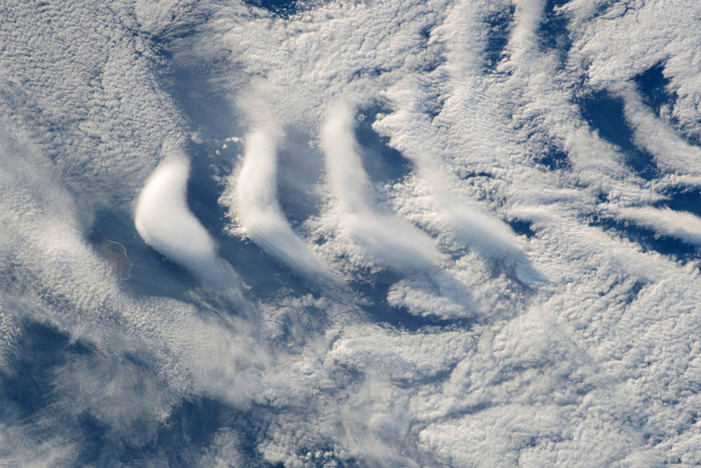
The Crozet Islands are a part of an archipelago in the Southern Indian Ocean near Antarctica. These islands have dramatic relief again the surrounding oceans, rising over 2500 ft above sea level. Wind traveling across the Indian Ocean acts as a smooth flowing fluid and moves around the tall islands. The result of this wind flow can be visualized by the V-shaped clouds on the leeward or downwind direction of the islands. A sliver of Île aux Cochons, or Pig Island in French, is seen in this photo causing the occurrence of the ship wave clouds.
The Namib Desert is on full display in this panoramic view from the International Space Station. The Namib Desert hugs the coastline of southwest Africa for more than 1000 miles. In the foreground, is a large sand sea made of some of the largest sand dunes on Earth. Several types of sand dunes occur here including star and linear dunes. Additional information and astronaut photos of the Namib Desert over time can be found here: 2018, 2016, 2014, 2009, 2005.
ISS Mission 54
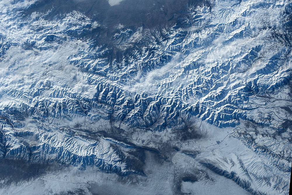
The Tien Shan Mountains stretch over 1000 mi (1600 km) across central Asia. This composite image shows a small slice of the range in eastern Kyrgystan near the Kazakhstan border. The tallest peaks in this image are over 13,000 ft (4000 m) high, with a relief of over 6000 ft (1800 m) from the surrounding flatter topography. The snow covered mountains and cloud filled valleys are make for cool-toned white, grey, and blue scene. Read more about the Tien Shan Mountains here.
ISS Mission 52
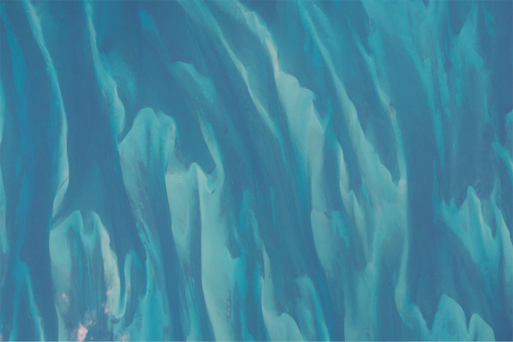
These blue tiger strips are actually made of sediment suspended the clear waters of the Bahamas. This composite image was taken south of Andros Island at the Great Bahama Bank. Carbonate sediment making the “stripes” in this image are moved around by turbid water. The waters are light blue in color due to shallow water depths. Read more here about the Bahamas here: Andros Island, Great Exuma Island, Long Island, Little Bahama Bank, Long Island, Cat Island
ISS Mission 49
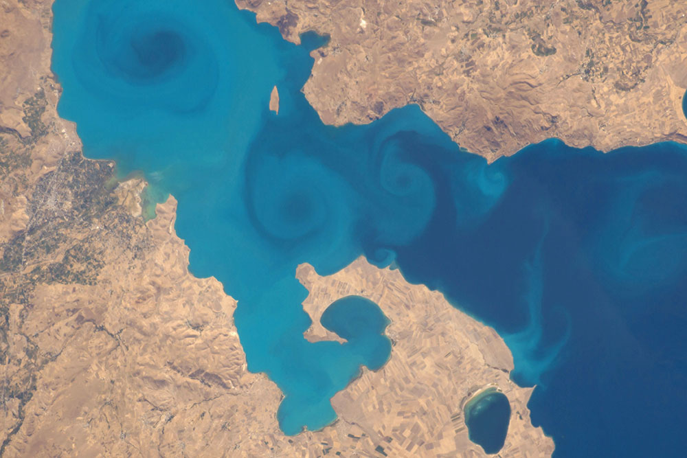
Lake Van is Turkey’s largest lake and is also the largest soda lake on Earth, meaning it has high concentrations of carbonate species. Lake Van is an endorheic lake and has a high pH of 10 with high salinity levels. This region of Turkey is prone to natural disasters such as severe earthquakes, landslides, and flooding. Major earthquakes can occur in this seismically active region due to the convergence of the Eurasian and Arabian tectonic plates.
ISS Mission 48
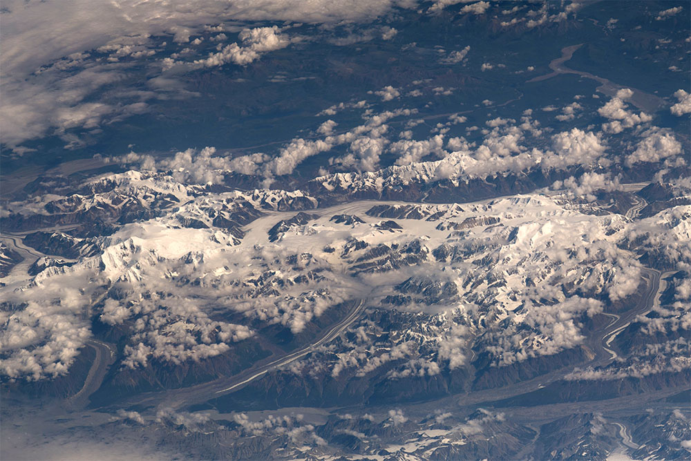
In this image is the rugged mountain terrain of the Yukon Territory, Canada along the Alaskan border. Some of the highest peaks here are over 15,000 ft high (4,500 m), rising above the clouds. Long valleys are carved out by existing glaciers which feed meltwater to braided rivers. The Yukon Territory has a subarctic climate and its rocky landscape is home to just over 35,000 people. Beyond these mountains, are greener landscapes susceptible to wildfires.
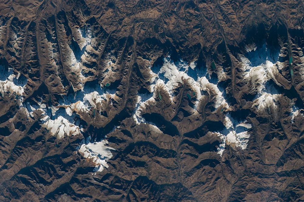
The Cordillera Blanca, or white range in Spanish, is a part of the Peruvian Andes Mountains. The Andes Range hug the west coast of South America. Nestled in these mountain peaks are numerous glaciers and teal-colored tarn lakes. Often these lakes are parallel with valleys that glaciers have previously eroded and carved out. This picture encompasses much of Huascarán National Park in Peru, where the highest peaks reach over 20,000 ft (~6000 m). Read more about the Andes here.
ISS Mission 47
This image is of Nevado Queulat of Queulat National Park in Chile. It is one of many peaks making up the Patagonian Andes along the West coast of South America. Glaciers and tarn lakes surround the Nevado, or snowy peak. Glaciers form at high altitudes as snow accumulates and compacts over many years, turning into ice. Some glaciers slowly move downhill under the weight of added snow. This heavy block of ice erodes rocky material beneath the glacier and can carve out cirques, which may later fill with water and become a tarn lake or pond. Glacial tarns can vary in color from milky turquoise to sapphire blue, or also be very clear. Read more about Chilean mountains and glaciers here.
The Belize Barrier Reef encompasses much of Belize’s coastline along the Caribbean Sea. The Belize Barrier Reef is a section of the Mesoamerican Barrier Reef System, the second largest coral reef system on Earth. From above the water appears to be various shades of blue. Light blue-green colors here indicate shallow water depth and coral reefs below the surface while darker blues indicate much deeper water. The Belize Barrier Reef is made of numerous cayes, or keys, and atolls. The reef ecosystem is susceptible to damage from natural events such as El Niño weather patterns and hurricanes.
Read about the Ambergris Cay in this barrier reef system here.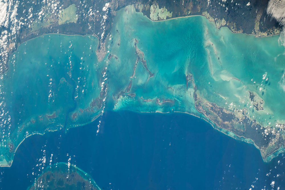
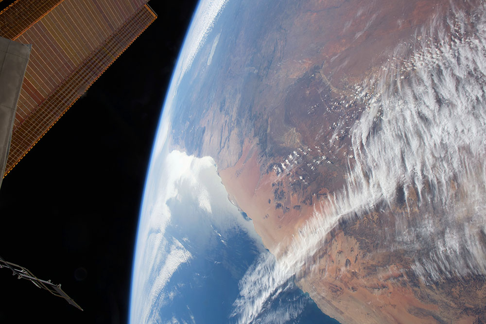
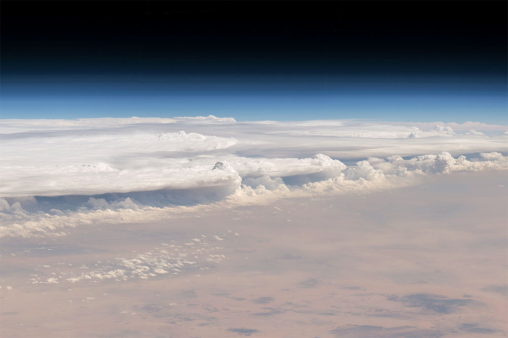
A wall of clouds encroaches the Al-Qassim region of Saudi Arabia in center of the Arabian Peninsula. This oblique angle shows an impressive cloud wall high into the atmosphere. The gradual fade above the clouds from light blue to black is known as Earth's limb.
Saudi Arabia is known to be the birthplace of Islam and nearby this photo is the city of Medina. Saudi Arabia is the largest country in the world without a major river. However, Saudi Arabia has plenty of coastline along the Red Sea, Gulf of Suez, and the Persian Gulf. To view satellite information when this picture was taken click here.
ISS Mission 44
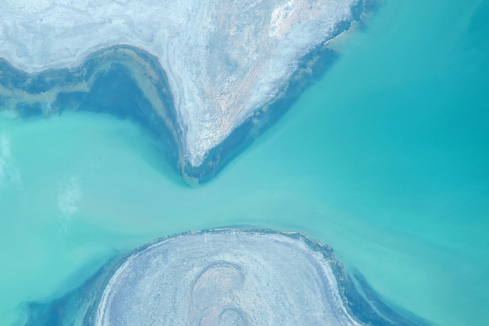
The water levels of the Aral Sea are constantly changing with time. Though called a sea, this body of water is actually a large endorheic lake with no outflow of water. The Aral Sea has shrunk significantly since the 1960s due to two major source rivers being diverted for agriculture. Receding shorelines can be seen in this abstract, art-like image of the North Aral Sea. Click the following links to view additional imagery and read more about the Aral Sea over recent years: 1964-2000, 2000-2008, 2010-2011, 2014, 2017, 2018.