[Skip to Content]
Earth From Space
Earth from Space logo  9 Matches Search ResultsEarth from Space logo

Image: gray corner Image: gray corner
View Image Information
Image: Geographic Location
Image: gray corner Image: gray corner

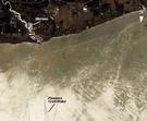
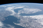
Photo #: ISS013-E-27872 Technical Info
All Available Images Lo-Resolution 295k
Features: CLEVELAND, VERMILION R., GLINT, LAKE, DETROIT, RIVER, ERIE, LAKE ERIE, SUNGLINT
Geographic Region: USA-OHIO


Image: gray corner Image: gray corner
View Image Information
Image: Geographic Location
Image: gray corner Image: gray corner

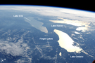
Photo #: ISS031-E-123071 Technical Info
All Available Images Lo-Resolution 197k
Features: ERIE, FINGER LAKES, LAKE ERIE, ONTARIO, PAN, SUNGLINT, LAKE HURON, LAKE ONTARIO, RANGE, LAKE
Geographic Region: USA-NEW YORK


Image: gray corner Image: gray corner
View Image Information
Image: Geographic Location
Image: gray corner Image: gray corner

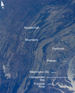
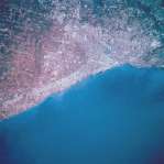
Photo #: ISS033-E-22378 Technical Info
All Available Images Lo-Resolution 521k
Features: VALLEY, WASHINGTON D.C., RANGE, MOUNTAIN, LAKE ERIE, APPALACHIAN MTS., GLINT, ISS, PLATEAU, CHESAPEAKE BAY, SUNGLINT, RIVER, BAY
Geographic Region: USA-PENNSYLVANIA


Image: gray corner Image: gray corner
View Image Information
Image: Geographic Location
Image: gray corner Image: gray corner

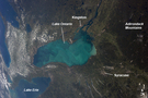
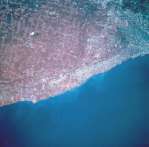
Photo #: ISS036-E-35635 Technical Info
All Available Images Lo-Resolution 236k
Features: LAKE ONTARIO, SYRACUSE, LAKE, ERIE, RIVER, WHITING EVENT, LAKE ERIE, ONTARIO, KINGSTON
Geographic Region: USA-NEW YORK


Image: gray corner Image: gray corner
View Image Information
Image: Geographic Location
Image: gray corner Image: gray corner

Photo #: ISS062-E-44966 Technical Info
All Available Images Lo-Resolution 428k
Features: KEWEENAW PENINSULA, LAKE ERIE, SUPERIOR, LAKE SUPERIOR, READING, STRAITS OF MACKINAC, GREEN BAY, CANADA, LAKE ONTARIO, LAKE HURON, ONTARIO, PENINSULA, BAY, ERIE, LAKE, SAULT STE. MARIE, ICE, GREAT LAKES
Geographic Region: USA-MICHIGAN


Image: gray corner Image: gray corner
View Image Information
Image: Geographic Location
Image: gray corner Image: gray corner

Photo #: ISS062-E-121292 Technical Info
All Available Images Lo-Resolution 546k
Features: LAKE ERIE, AIRPORT, CLEVELAND
Geographic Region: USA-OHIO


Image: gray corner Image: gray corner
View Image Information
Image: Geographic Location
Image: gray corner Image: gray corner

Photo #: STS068-209-69 Technical Info
All Available Images Lo-Resolution 324k
Features: URBAN AREA, RIVER, LAKE ERIE, AIRPORT, CLEVELAND, LAKE
Geographic Region: USA-OHIO


Image: gray corner Image: gray corner
View Image Information
Image: Geographic Location
Image: gray corner Image: gray corner

Photo #: STS068-209-70 Technical Info
All Available Images Lo-Resolution 323k
Features: URBAN AREA, PLAIN, LAKE ERIE, CLEVELAND, AGRICULTURE, LAKE
Geographic Region: USA-OHIO


Image: gray corner Image: gray corner
View Image Information
Image: Geographic Location
Image: gray corner Image: gray corner

Photo #: STS068-237-47 Technical Info
All Available Images Lo-Resolution 143k
Features: AGRICULTURE, LAKE ERIE, PLAIN, AIRPORT, RIVER, LAKE, CLEVELAND, URBAN AREA, COAST
Geographic Region: USA-OHIO


NASA
Home Page
JSC
Home Page
JSC Digital
Image Collection
Earth Science &
Remote Sensing
NASA meatball logo
This service is provided by the International Space Station program and the JSC Earth Science & Remote Sensing Unit, ARES Division, Exploration Integration Science Directorate.
ESRS logo