[Skip to Content]
Earth From Space
Earth from Space logo  11 Matches Search ResultsEarth from Space logo

Image: gray corner Image: gray corner
View Image Information
Image: Geographic Location
Image: gray corner Image: gray corner

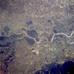
Photo #: ISS036-E-3918 Technical Info
All Available Images Lo-Resolution 302k
Features: RIVER, LITTLE ROCK, LAKE, OXBOW LAKES, ARKANSAS RIVER, AGRICULTURE, CHANNEL
Geographic Region: USA-ARKANSAS


Image: gray corner Image: gray corner
View Image Information
Image: Geographic Location
Image: gray corner Image: gray corner

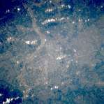
Photo #: ISS038-E-57827 Technical Info
All Available Images Lo-Resolution 204k
Features: MEANDER LAKES, RIVER, HIGHWAY, LITTLE ROCK, ARKANSAS R., BRIDGE
Geographic Region: USA-ARKANSAS


Image: gray corner Image: gray corner
View Image Information
Image: Geographic Location
Image: gray corner Image: gray corner

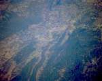
Photo #: NASA7-723-63 Technical Info
All Available Images Lo-Resolution 416k
Features: PLAIN, PIVOT IRRIGATION, AGRICULTURE, DODGE CITY, ARKANSAS R., RIVER
Geographic Region: USA-KANSAS


Image: gray corner Image: gray corner
View Image Information
Image: Geographic Location
Image: gray corner Image: gray corner

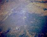
Photo #: NASA7-723-69 Technical Info
All Available Images Lo-Resolution 358k
Features: RIVER, URBAN AREA, LAKE, TULSA, ARKANSAS RIVER, PLAIN
Geographic Region: USA-OKLAHOMA


Image: gray corner Image: gray corner
View Image Information
Image: Geographic Location
Image: gray corner Image: gray corner

Photo #: STS062-86-106 Technical Info
All Available Images Lo-Resolution 371k
Features: ARKANSAS & MISSISSIPPI R, RIVER, FLOOD PLAIN, AGRICULTURE
Geographic Region: USA-MISSISSIPPI


Image: gray corner Image: gray corner
View Image Information
Image: Geographic Location
Image: gray corner Image: gray corner

Photo #: STS064-89-47 Technical Info
All Available Images Lo-Resolution 386k
Features: TULSA, SAPULPA, RIVER, URBAN AREA, ARKANSAS R
Geographic Region: USA-OKLAHOMA


Image: gray corner Image: gray corner
View Image Information
Image: Geographic Location
Image: gray corner Image: gray corner

Photo #: STS068-167-W Technical Info
All Available Images Lo-Resolution 316k
Features: LAKE OUACHITA, AGRICULTURE, ARKANSAS RIVER, MOUNTAIN, LAKE, FOREST, RIVER, VALLEY
Geographic Region: USA-ARKANSAS


Image: gray corner Image: gray corner
View Image Information
Image: Geographic Location
Image: gray corner Image: gray corner

Photo #: STS068-167-X Technical Info
All Available Images Lo-Resolution 304k
Features: LITTLE ROCK, LAKE, MOUNTAIN, AGRICULTURE, ARKANSAS RIVER, RIVER, HIGHWAY, FLOOD PLAIN
Geographic Region: USA-ARKANSAS


Image: gray corner Image: gray corner
View Image Information
Image: Geographic Location
Image: gray corner Image: gray corner

Photo #: STS068-167-Y Technical Info
All Available Images Lo-Resolution 319k
Features: PINE BLUFF, RIVER, FLOOD PLAIN, FOREST, ARKANSAS RIVER
Geographic Region: USA-ARKANSAS


Image: gray corner Image: gray corner
View Image Information
Image: Geographic Location
Image: gray corner Image: gray corner

Photo #: STS068-262-2 Technical Info
All Available Images Lo-Resolution 351k
Features: FOREST, SMOKE, URBAN AREA, ARKANSAS R., RESERVOIR, RIVER, HILL, FORT SMITH
Geographic Region: USA-ARKANSAS


Image: gray corner Image: gray corner
View Image Information
Image: Geographic Location
Image: gray corner Image: gray corner

Photo #: STS073-731-80 Technical Info
All Available Images Lo-Resolution 329k
Features: AGR., URBAN AREA, RIVER, PLAIN, TULSA, ARKANSAS R.
Geographic Region: USA-OKLAHOMA


NASA
Home Page
JSC
Home Page
JSC Digital
Image Collection
Earth Science &
Remote Sensing
NASA meatball logo
This service is provided by the International Space Station program and the JSC Earth Science & Remote Sensing Unit, ARES Division, Exploration Integration Science Directorate.
ESRS logo