
Geographic Region: USA-IOWA
Feature: WATERLOO
|
Geographic Region: USA-IOWA Feature: WATERLOO |
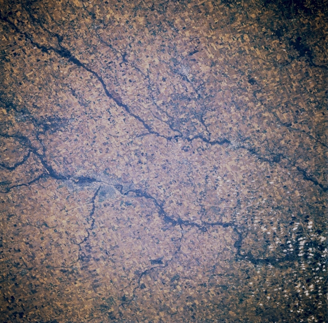 |
| STS61A-041-0088 Cedar River, Wapsipinicon River, Waterloo, and Cedar Falls, Iowa, U.S.A. November 1985 Two rivers traverse this rich farming and livestock region--the more northeasterly Wapsipinicon River and the larger Cedar River, on which are situated the twin cities of Cedar Falls and Waterloo (midway between left center and center). Waterloo, the larger and more easterly of the twin cities, is an industrial and trade center specializing in farm machinery and air conditioning equipment. Cedar Falls has a diversity of small manufacturing industries and is the home of Northern Iowa University. |
| Images: | All Available Images Low-Resolution 424k |
|
| Mission: | STS61A |
|
| Roll - Frame: | 41 - 88 |
|
| Geographical Name: | USA-IOWA |
|
| Features: | WATERLOO |
|
| Center Lat x Lon: | 42.5N x 92W |
|
| Film Exposure: | N | N=Normal exposure, U=Under exposed, O=Over exposed, F=out of Focus |
| Percentage of Cloud Cover-CLDP: | 10 |
|
| Camera:: | HB |
|
| Camera Tilt: | 34 | LO=Low Oblique, HO=High Oblique, NV=Near Vertical |
| Camera Focal Length: | 250 |
|
| Nadir to Photo Center Direction: | SW | The direction from the nadir to the center point, N=North, S=South, E=East, W=West |
| Stereo?: | N | Y=Yes there is an adjacent picture of the same area, N=No there isn't |
| Orbit Number: | 80 |
|
| Date: | 19851104 | YYYYMMDD |
| Time: | 170202 | GMT HHMMSS |
| Nadir Lat: | 43.4N |
Latitude of suborbital point of spacecraft |
| Nadir Lon: | 90.2W |
Longitude of suborbital point of spacecraft |
| Sun Azimuth: | 168 | Clockwise angle in degrees from north to the sun measured at the nadir point |
| Space Craft Altitude: | 179 | nautical miles |
| Sun Elevation: | 30 | Angle in degrees between the horizon and the sun, measured at the nadir point |
| Land Views: | PLAIN |
|
| Water Views: | RIVER |
|
| Atmosphere Views: | |
|
| Man Made Views: | AGRICULTURE, URBAN AREA |
|
| City Views: | |
|
Photo is not associated with any sequences | ||
| NASA Home Page |
JSC Home Page |
JSC Digital Image Collection |
Earth Science & Remote Sensing |
|
This service is provided by the International Space Station program and the JSC Earth Science & Remote Sensing Unit, ARES Division, Exploration Integration Science Directorate.

|