 Photo #: STS61A-35-77 Date: Nov. 1985
Geographic Region: USA-NORTH DAKOTA
Feature: MISSOURI RIVER

 Photo #: STS61A-35-77 Date: Nov. 1985 Photo #: STS61A-35-77 Date: Nov. 1985Geographic Region: USA-NORTH DAKOTA Feature: MISSOURI RIVER |
 |
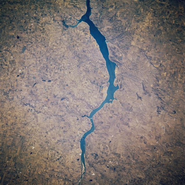
| STS61A-035-0077 Lake Oahe, North Dakota, U.S.A. October 1985 Lake Oahe, 250 miles (403 kilometers) long, was completed in the 1950s and is used for recreation, irrigation, flood control, and hydroelectric power. The northern portion of the lake is featured in this south-looking, low-oblique photograph. The Missouri River Valley in which the lake sits is approximately 300 to 500 feet (92 to 153 meters) deep and is surrounded by bluffs and hills on either side. Land east of the lake was covered with ice age glaciers nearly 10 000 years ago, but land west of the lake was not touched by glaciation. Visible are agricultural fields to the east of the lake and to the west the hilly terrain of the Standing Rock Indian Reservation in which is buried Chief Sitting Bull of the Sioux Indians. |
| Images: | All Available Images Low-Resolution 392k |
|
| Mission: | STS61A |
|
| Roll - Frame: | 35 - 77 |
|
| Geographical Name: | USA-NORTH DAKOTA |
|
| Features: | MISSOURI RIVER |
|
| Center Lat x Lon: | 46.0N x 100.5W |
|
| Film Exposure: | N | N=Normal exposure, U=Under exposed, O=Over exposed, F=out of Focus |
| Percentage of Cloud Cover-CLDP: | 0 |
|
| Camera:: | HB |
|
| Camera Tilt: | 24 | LO=Low Oblique, HO=High Oblique, NV=Near Vertical |
| Camera Focal Length: | 250 |
|
| Nadir to Photo Center Direction: | SE | The direction from the nadir to the center point, N=North, S=South, E=East, W=West |
| Stereo?: | N | Y=Yes there is an adjacent picture of the same area, N=No there isn't |
| Orbit Number: | 34 |
|
| Date: | 19851101 | YYYYMMDD |
| Time: | 191529 | GMT HHMMSS |
| Nadir Lat: | 47.0N |
Latitude of suborbital point of spacecraft |
| Nadir Lon: | 101.4W |
Longitude of suborbital point of spacecraft |
| Sun Azimuth: | 192 | Clockwise angle in degrees from north to the sun measured at the nadir point |
| Space Craft Altitude: | 181 | nautical miles |
| Sun Elevation: | 27 | Angle in degrees between the horizon and the sun, measured at the nadir point |
| Land Views: | PLAIN |
|
| Water Views: | LAKE |
|
| Atmosphere Views: | |
|
| Man Made Views: | AGRICULTURE |
|
| City Views: | |
|
Photo is not associated with any sequences | ||
| NASA Home Page |
JSC Home Page |
JSC Digital Image Collection |
Earth Science & Remote Sensing |
|
|