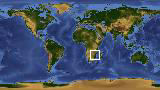
Geographic Region: BOTSWANA
Feature: OKVANGO SWAMP
|
Geographic Region: BOTSWANA Feature: OKVANGO SWAMP |
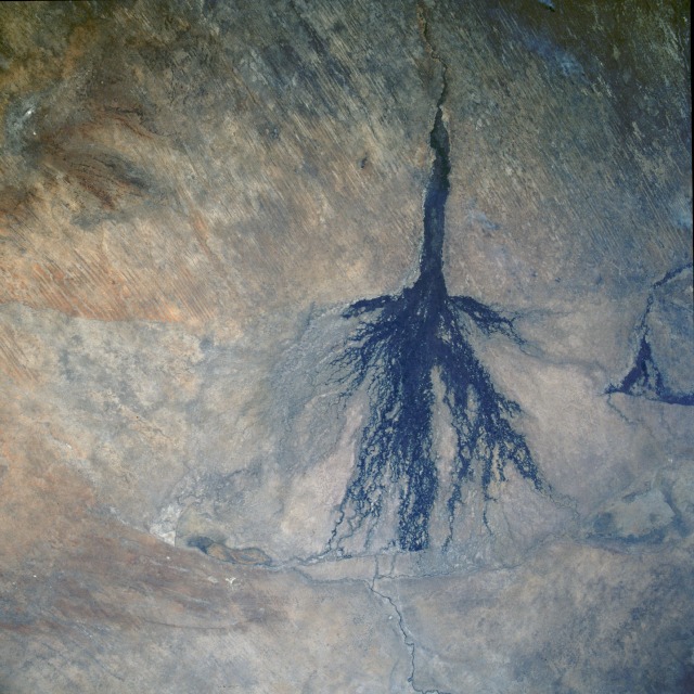 |
| STS51I-33-0053 Okavango Delta and Swamp, Botswana August 1985 The dark "broom-shaped" area of this photograph indicates where the denser vegetation is found in the Okavango Inland Delta of northwest Botswana. The delta is part of the Ngami Depression, which is located at the extreme southern end of the East African Rift System and is the result of block faulting. The Okavango River, which originates in the plateau of southeastern Angola, provides an intermittent flow of water as the river enters the delta area from the northwest. East-west trending wind streaks are observed on the slightly elevated terrain west and northwest of the Okavango Delta. Because this delta is situated in a desert climate, Earth scientists have deemed this site to be one of the most ecologically sensitive areas on the planet. This sensitivity is heightened by the constant competition for specific land use among would-be users of the land, including farmers, cattle ranchers, and those who would establish a natural game preserve. Hot, humid conditions make this area an ideal habitat for the tsetse fly, a known carrier of African sleeping sickness. Because of the geographic location and the critical nature of the Okavango Delta, the countries of Angola and Namibia also feel their governments should participate in deciding the ultimate use of the delta. |
| Images: | All Available Images Low-Resolution 136k |
|
| Mission: | STS51I |
|
| Roll - Frame: | 33 - 53 |
|
| Geographical Name: | BOTSWANA |
|
| Features: | OKVANGO SWAMP |
|
| Center Lat x Lon: | 19.5S x 22.5E |
|
| Film Exposure: | N | N=Normal exposure, U=Under exposed, O=Over exposed, F=out of Focus |
| Percentage of Cloud Cover-CLDP: | 5 |
|
| Camera:: | HB |
|
| Camera Tilt: | 11 | LO=Low Oblique, HO=High Oblique, NV=Near Vertical |
| Camera Focal Length: | 50 |
|
| Nadir to Photo Center Direction: | E | The direction from the nadir to the center point, N=North, S=South, E=East, W=West |
| Stereo?: | N | Y=Yes there is an adjacent picture of the same area, N=No there isn't |
| Orbit Number: | 33 |
|
| Date: | 19850829 | YYYYMMDD |
| Time: | 123132 | GMT HHMMSS |
| Nadir Lat: | 19.7S |
Latitude of suborbital point of spacecraft |
| Nadir Lon: | 21.9E |
Longitude of suborbital point of spacecraft |
| Sun Azimuth: | 312 | Clockwise angle in degrees from north to the sun measured at the nadir point |
| Space Craft Altitude: | 192 | nautical miles |
| Sun Elevation: | 48 | Angle in degrees between the horizon and the sun, measured at the nadir point |
| Land Views: | BASIN, DESERT, FAULT, DUNE |
|
| Water Views: | DELTA, RIVER, SWAMP |
|
| Atmosphere Views: | |
|
| Man Made Views: | |
|
| City Views: | |
|
Photo is not associated with any sequences | ||
| NASA Home Page |
JSC Home Page |
JSC Digital Image Collection |
Earth Science & Remote Sensing |
|
This service is provided by the International Space Station program and the JSC Earth Science & Remote Sensing Unit, ARES Division, Exploration Integration Science Directorate.

|