
Geographic Region: AUSTRALIA-WA
Feature: LAKE ARGYLE
|
Geographic Region: AUSTRALIA-WA Feature: LAKE ARGYLE |
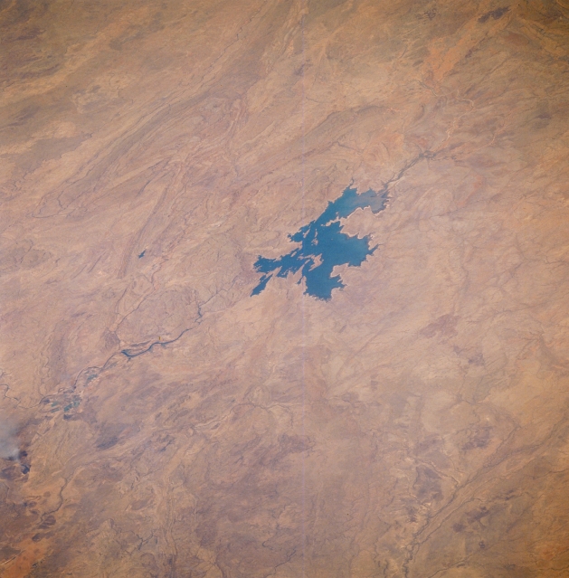 |
| STS51F-34-0013 Lake Argyle, Western Australia, Australia August 1985 Located on the Kimberley Plateau near the Western Australia, Northern Territory boundary, Lake Argyle is the largest man made lake in Australia. The main channel of the Ord River (dark, meandering feature) north of the lake is visible as it drains northward, eventually emptying into the Joseph Bonaparte Gulf (not in this image ). The Ord and Bow Rivers that flow into the southern end of the lake are difficult to discern. Low, folded mountains can be identified east and west of this river valley. |
| Images: | All Available Images Low-Resolution 298k |
|
| Mission: | STS51F |
|
| Roll - Frame: | 34 - 13 |
|
| Geographical Name: | AUSTRALIA-WA |
|
| Features: | LAKE ARGYLE |
|
| Center Lat x Lon: | 16S x 129.0E |
|
| Film Exposure: | N | N=Normal exposure, U=Under exposed, O=Over exposed, F=out of Focus |
| Percentage of Cloud Cover-CLDP: | 0 |
|
| Camera:: | HB |
|
| Camera Tilt: | LO | LO=Low Oblique, HO=High Oblique, NV=Near Vertical |
| Camera Focal Length: | 250 |
|
| Nadir to Photo Center Direction: | W | The direction from the nadir to the center point, N=North, S=South, E=East, W=West |
| Stereo?: | N | Y=Yes there is an adjacent picture of the same area, N=No there isn't |
| Orbit Number: | 36 |
|
| Date: | 19850801 | YYYYMMDD |
| Time: | 031137 | GMT HHMMSS |
| Nadir Lat: | 14.2S |
Latitude of suborbital point of spacecraft |
| Nadir Lon: | 133.1E |
Longitude of suborbital point of spacecraft |
| Sun Azimuth: | 0 | Clockwise angle in degrees from north to the sun measured at the nadir point |
| Space Craft Altitude: | 171 | nautical miles |
| Sun Elevation: | 57 | Angle in degrees between the horizon and the sun, measured at the nadir point |
| Land Views: | PLATEAU, MOUNTAIN |
|
| Water Views: | LAKE, RIVER |
|
| Atmosphere Views: | |
|
| Man Made Views: | |
|
| City Views: | |
|
Photo is not associated with any sequences | ||
| NASA Home Page |
JSC Home Page |
JSC Digital Image Collection |
Earth Science & Remote Sensing |
|
This service is provided by the International Space Station program and the JSC Earth Science & Remote Sensing Unit, ARES Division, Exploration Integration Science Directorate.

|