
Geographic Region: USA-ALABAMA
Feature: WEISS RESERVOIR, GADSDEN
|
Geographic Region: USA-ALABAMA Feature: WEISS RESERVOIR, GADSDEN |
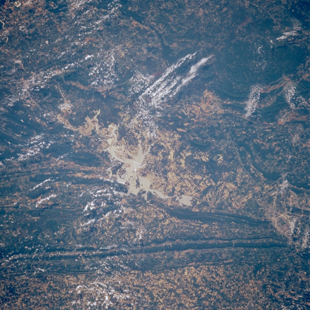 |
| STS51B-53-0017 Weiss Lake, Alabama, U.S.A. May 1985 A few widely scattered clouds obscure some of the mountainous terrain in this southeast-looking photograph of northeast Alabama. Featured are light, irregular-shaped Weiss Lake, the result of damning part of the Coosa River, and Lookout Mountain immediately northwest of the lake. Visible are Gadsden, Alabama, near the apex of two northeast-southwest-trending mountain ridges (bottom right); a small segment of the Cumberland Plateau (northwest); and part of the more extensive Appalachian Mountains (southeast). Apparent are dark forested areas and lighter valleys denoting agricultural activities. |
| Images: | All Available Images Low-Resolution 408k |
|
| Mission: | STS51B |
|
| Roll - Frame: | 53 - 17 |
|
| Geographical Name: | USA-ALABAMA |
|
| Features: | WEISS RESERVOIR, GADSDEN |
|
| Center Lat x Lon: | 34.0N x 85.5W |
|
| Film Exposure: | N | N=Normal exposure, U=Under exposed, O=Over exposed, F=out of Focus |
| Percentage of Cloud Cover-CLDP: | 30 |
|
| Camera:: | HB |
|
| Camera Tilt: | NV | LO=Low Oblique, HO=High Oblique, NV=Near Vertical |
| Camera Focal Length: | 250 |
|
| Nadir to Photo Center Direction: | The direction from the nadir to the center point, N=North, S=South, E=East, W=West |
|
| Stereo?: | Y | Y=Yes there is an adjacent picture of the same area, N=No there isn't |
| Orbit Number: | 79 |
|
| Date: | 1985____ | YYYYMMDD |
| Time: | GMT HHMMSS |
|
| Nadir Lat: | N |
Latitude of suborbital point of spacecraft |
| Nadir Lon: | E |
Longitude of suborbital point of spacecraft |
| Sun Azimuth: | Clockwise angle in degrees from north to the sun measured at the nadir point |
|
| Space Craft Altitude: | nautical miles |
|
| Sun Elevation: | Angle in degrees between the horizon and the sun, measured at the nadir point |
|
| Land Views: | MOUNTAIN, FOREST |
|
| Water Views: | LAKE, RIVER |
|
| Atmosphere Views: | |
|
| Man Made Views: | |
|
| City Views: | |
|
Photo is not associated with any sequences | ||
| NASA Home Page |
JSC Home Page |
JSC Digital Image Collection |
Earth Science & Remote Sensing |
|
This service is provided by the International Space Station program and the JSC Earth Science & Remote Sensing Unit, ARES Division, Exploration Integration Science Directorate.

|