
Geographic Region: USA-ARIZONA
Feature: THEODORE ROOSEVELT LAKE
|
Geographic Region: USA-ARIZONA Feature: THEODORE ROOSEVELT LAKE |
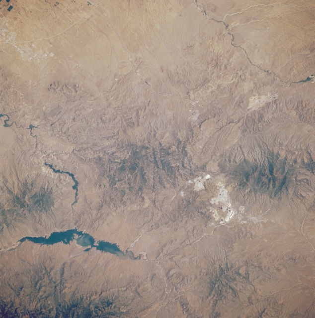 |
| STS51B-052-0037 Theodore Roosevelt Lake, Arizona, U.S.A. May 1985 Several small dams create a series of lakes in the Salt River as it twists westward toward Phoenix. Long, dark Theodore Roosevelt Lake is located roughly 60 miles (97 kilometers) east of Phoenix. Most of the forested Mazatzal and Mesca Mountains are part of the Tonto National Forest and Superstition Wilderness. The highly reflective areas in the Mesca Mountains near the city of Globe show extensive mining operations for silver, gold, asbestos, manganese, vanadium, and tungsten, but the mineral mined most often is copper. A small section of the Gila River is visible in the upper left corner of the photograph. |
| Images: | All Available Images Low-Resolution 314k |
|
| Mission: | STS51B |
|
| Roll - Frame: | 52 - 37 |
|
| Geographical Name: | USA-ARIZONA |
|
| Features: | THEODORE ROOSEVELT LAKE |
|
| Center Lat x Lon: | 33.5N x 111W |
|
| Film Exposure: | N | N=Normal exposure, U=Under exposed, O=Over exposed, F=out of Focus |
| Percentage of Cloud Cover-CLDP: | 0 |
|
| Camera:: | HB |
|
| Camera Tilt: | 21 | LO=Low Oblique, HO=High Oblique, NV=Near Vertical |
| Camera Focal Length: | 250 |
|
| Nadir to Photo Center Direction: | NE | The direction from the nadir to the center point, N=North, S=South, E=East, W=West |
| Stereo?: | Y | Y=Yes there is an adjacent picture of the same area, N=No there isn't |
| Orbit Number: | 49 |
|
| Date: | 19850502 | YYYYMMDD |
| Time: | 172234 | GMT HHMMSS |
| Nadir Lat: | 32.8N |
Latitude of suborbital point of spacecraft |
| Nadir Lon: | 112W |
Longitude of suborbital point of spacecraft |
| Sun Azimuth: | 114 | Clockwise angle in degrees from north to the sun measured at the nadir point |
| Space Craft Altitude: | 192 | nautical miles |
| Sun Elevation: | 57 | Angle in degrees between the horizon and the sun, measured at the nadir point |
| Land Views: | MOUNTAIN |
|
| Water Views: | LAKE, RIVER |
|
| Atmosphere Views: | |
|
| Man Made Views: | |
|
| City Views: | |
|
Photo is not associated with any sequences | ||
| NASA Home Page |
JSC Home Page |
JSC Digital Image Collection |
Earth Science & Remote Sensing |
|
This service is provided by the International Space Station program and the JSC Earth Science & Remote Sensing Unit, ARES Division, Exploration Integration Science Directorate.

|