
Geographic Region: USA-MISSOURI
Feature: MISSISSIPPI R,ILLINOIS R
|
Geographic Region: USA-MISSOURI Feature: MISSISSIPPI R,ILLINOIS R |
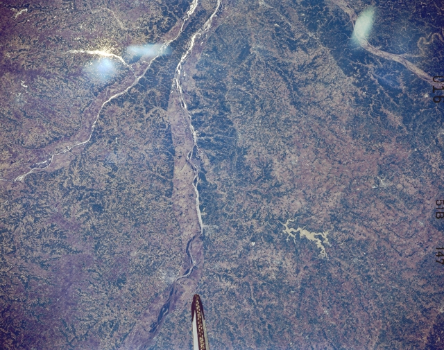 |
| STS51B-147-0016 Mississippi River, Illinois May 1985 This panoramic south-looking view shows the Mississippi River entering the scene to the left of the bottom center (north) near Canton, Missouri. The Mississippi River exits the scene just to the north of where the Illinois River enters the Mississippi River at the top center of the image. This part of the middle Mississippi River is a rich grain and livestock area, a part of the Great Corn Belt Region of the Midwestern United States. The Illinois River can be seen entering the scene at the left center of the image. The Missouri River and the extreme northeastern portion of the Ozark Plateau of east central Missouri are visible in the top right quadrant of the image. In the bottom right quarter of the image, the Clarence Cannon Reservoir, a recreational lake on the Salt River, is discernible. The streaks visible in the upper left and upper right portions of the image are caused by the glare of the sun on the Space Shuttle window. |
| Images: | All Available Images Low-Resolution 335k |
|
| Mission: | STS51B |
|
| Roll - Frame: | 147 - 16 |
|
| Geographical Name: | USA-MISSOURI |
|
| Features: | MISSISSIPPI R,ILLINOIS R |
|
| Center Lat x Lon: | 39.5N x 91.3W |
|
| Film Exposure: | N | N=Normal exposure, U=Under exposed, O=Over exposed, F=out of Focus |
| Percentage of Cloud Cover-CLDP: | 0 |
|
| Camera:: | LH |
|
| Camera Tilt: | NV | LO=Low Oblique, HO=High Oblique, NV=Near Vertical |
| Camera Focal Length: | 250 |
|
| Nadir to Photo Center Direction: | The direction from the nadir to the center point, N=North, S=South, E=East, W=West |
|
| Stereo?: | N | Y=Yes there is an adjacent picture of the same area, N=No there isn't |
| Orbit Number: | 64 |
|
| Date: | 1985____ | YYYYMMDD |
| Time: | GMT HHMMSS |
|
| Nadir Lat: | N |
Latitude of suborbital point of spacecraft |
| Nadir Lon: | E |
Longitude of suborbital point of spacecraft |
| Sun Azimuth: | Clockwise angle in degrees from north to the sun measured at the nadir point |
|
| Space Craft Altitude: | nautical miles |
|
| Sun Elevation: | Angle in degrees between the horizon and the sun, measured at the nadir point |
|
| Land Views: | VALLEY |
|
| Water Views: | RIVER |
|
| Atmosphere Views: | |
|
| Man Made Views: | AGRICULTURE |
|
| City Views: | |
|
Photo is not associated with any sequences | ||
| NASA Home Page |
JSC Home Page |
JSC Digital Image Collection |
Earth Science & Remote Sensing |
|
This service is provided by the International Space Station program and the JSC Earth Science & Remote Sensing Unit, ARES Division, Exploration Integration Science Directorate.

|