 Photo #: STS091-729-29 Date: Jun. 1998
Geographic Region: ARGENTINA
Feature: BAY BLANCA, POINT ALTA

 Photo #: STS091-729-29 Date: Jun. 1998 Photo #: STS091-729-29 Date: Jun. 1998Geographic Region: ARGENTINA Feature: BAY BLANCA, POINT ALTA |
 |
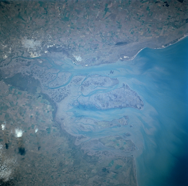
| STS091-729-029 Blanca Bay, Point Alta, Argentina June 1998 Blanca Bay, a city of over 250,000, has new bulk-handling facilities and grain terminals and provides the main shipping outlet for the southern pampas grain belt. The port facility suffers less from silting than the muddy Plate River Estuary at Buenos Aires. The city of Blanca Bay is now a major commercial, industrial, and financial center in the southern pampas region of Argentina. The oil industry, with new petrochemical and derivative industries has also escalated the growth of the city. To the southeast, the small port city of Point Alta is also benefiting from the industrial growth in the region. Point Alta is home to the Argentine Navy and the Puerto Rosales Naval Air Base. A large naval base is also located east of the city of Blanca Bay. The coastal area south of the city of Blanco Bay is a shallow, sandy, and muddy area. Though no major stream or river presently passes through the port city, there may have been such a river tens of thousands of years ago. Dredging keeps the shipping lanes open between the two port cities and the Atlantic Ocean. |
| Images: | All Available Images Low-Resolution 316k |
|
| Mission: | STS091 |
|
| Roll - Frame: | 729 - 29 |
|
| Geographical Name: | ARGENTINA |
|
| Features: | BAY BLANCA, POINT ALTA |
|
| Center Lat x Lon: | 39S x 62W |
|
| Film Exposure: | N | N=Normal exposure, U=Under exposed, O=Over exposed, F=out of Focus |
| Percentage of Cloud Cover-CLDP: | 5 |
|
| Camera:: | HB |
|
| Camera Tilt: | 22 | LO=Low Oblique, HO=High Oblique, NV=Near Vertical |
| Camera Focal Length: | 250 |
|
| Nadir to Photo Center Direction: | S | The direction from the nadir to the center point, N=North, S=South, E=East, W=West |
| Stereo?: | Y | Y=Yes there is an adjacent picture of the same area, N=No there isn't |
| Orbit Number: | 74 |
|
| Date: | 19980607 | YYYYMMDD |
| Time: | 145532 | GMT HHMMSS |
| Nadir Lat: | 37.6S |
Latitude of suborbital point of spacecraft |
| Nadir Lon: | 61.8W |
Longitude of suborbital point of spacecraft |
| Sun Azimuth: | 18 | Clockwise angle in degrees from north to the sun measured at the nadir point |
| Space Craft Altitude: | 206 | nautical miles |
| Sun Elevation: | 28 | Angle in degrees between the horizon and the sun, measured at the nadir point |
| Land Views: | PLAIN |
|
| Water Views: | BAY, SEDIMENT |
|
| Atmosphere Views: | |
|
| Man Made Views: | AGRICULTURE, URBAN AREA |
|
| City Views: | BLANCA BAY, POINT ALTA |
|
Photo is not associated with any sequences | ||
| NASA Home Page |
JSC Home Page |
JSC Digital Image Collection |
Earth Science & Remote Sensing |
|
|