
Geographic Region: USA-KANSAS
Feature: WICHITA
|
Geographic Region: USA-KANSAS Feature: WICHITA |
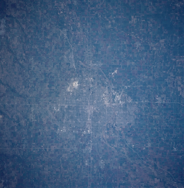 |
| STS090-731-066 Wichita, Kansas April, 1998 Located in south-central Kansas on the eastern Great Plains, the city of Wichita is situated at the confluence of the Arkansas and Little Arkansas Rivers. It is the home of McConnell Air Force Base whose runways are visible just to the bottom and left of the center of the view (southeast of the central city). The runways of the commercial Wichita Mid-Continent Airport are visible to the west (up) from the central city. Wichita is the chief agricultural, commercial, industrial, financial, and cultural center of southern Kansas. The city was founded in 1868 to serve travelers moving westward on the famous Chisholm Trail. |
| Images: | All Available Images Low-Resolution 323k |
|
| Mission: | STS090 |
|
| Roll - Frame: | 731 - 66 |
|
| Geographical Name: | USA-KANSAS |
|
| Features: | WICHITA |
|
| Center Lat x Lon: | 37.5N x 97.5W |
|
| Film Exposure: | N | N=Normal exposure, U=Under exposed, O=Over exposed, F=out of Focus |
| Percentage of Cloud Cover-CLDP: | 0 |
|
| Camera:: | HB |
|
| Camera Tilt: | 21 | LO=Low Oblique, HO=High Oblique, NV=Near Vertical |
| Camera Focal Length: | 250 |
|
| Nadir to Photo Center Direction: | SW | The direction from the nadir to the center point, N=North, S=South, E=East, W=West |
| Stereo?: | N | Y=Yes there is an adjacent picture of the same area, N=No there isn't |
| Orbit Number: | 223 |
|
| Date: | 19980501 | YYYYMMDD |
| Time: | 142813 | GMT HHMMSS |
| Nadir Lat: | 38.0N |
Latitude of suborbital point of spacecraft |
| Nadir Lon: | 96.8W |
Longitude of suborbital point of spacecraft |
| Sun Azimuth: | 97 | Clockwise angle in degrees from north to the sun measured at the nadir point |
| Space Craft Altitude: | 133 | nautical miles |
| Sun Elevation: | 34 | Angle in degrees between the horizon and the sun, measured at the nadir point |
| Land Views: | PLAIN |
|
| Water Views: | |
|
| Atmosphere Views: | |
|
| Man Made Views: | URBAN AREA, HIGHWAY, AIRPORT, AGRICULTURE |
|
| City Views: | WICHITA |
|
Photo is not associated with any sequences | ||
| NASA Home Page |
JSC Home Page |
JSC Digital Image Collection |
Earth Science & Remote Sensing |
|
This service is provided by the International Space Station program and the JSC Earth Science & Remote Sensing Unit, ARES Division, Exploration Integration Science Directorate.

|