
Geographic Region: AUSTRALIA-T
Feature: KING ISLAND
|
Geographic Region: AUSTRALIA-T Feature: KING ISLAND |
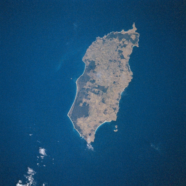 |
| STS081-749-007 King Island, Tasmania, Australia January 1997 King Island is located between Cape Otway (Victoria) and the northwest tip of Tasmania. The Bass Strait is east of the island and the Southern Ocean is west of King Island. The thin, highly reflective line along the north and east coast shows the location of extensive sandy beaches. King Island measures 40 miles (64 km) in length and 17 miles (27 km) in width. The island's major agricultural focus is in pastoral activities. Farm products are mainly related to the beef, dairy, and sheep industry. The darker landscape on the island maps the distribution and location of the more heavily forested areas, while the majority of the terrain (lighter-colored) is being used for the sustainability and further development of an active pastoral economy. The southern hemisphere's tallest lighthouse is located at Cape Wickam, at the northern (bottom center) end of the island. |
| Images: | All Available Images Low-Resolution 364k |
|
| Mission: | STS081 |
|
| Roll - Frame: | 749 - 7 |
|
| Geographical Name: | AUSTRALIA-T |
|
| Features: | KING ISLAND |
|
| Center Lat x Lon: | 40S x 144.0E |
|
| Film Exposure: | N | N=Normal exposure, U=Under exposed, O=Over exposed, F=out of Focus |
| Percentage of Cloud Cover-CLDP: | 5 |
|
| Camera:: | HB |
|
| Camera Tilt: | LO=Low Oblique, HO=High Oblique, NV=Near Vertical |
|
| Camera Focal Length: | 250 |
|
| Nadir to Photo Center Direction: | The direction from the nadir to the center point, N=North, S=South, E=East, W=West |
|
| Stereo?: | N | Y=Yes there is an adjacent picture of the same area, N=No there isn't |
| Orbit Number: | |
|
| Date: | 199701__ | YYYYMMDD |
| Time: | GMT HHMMSS |
|
| Nadir Lat: | N |
Latitude of suborbital point of spacecraft |
| Nadir Lon: | E |
Longitude of suborbital point of spacecraft |
| Sun Azimuth: | Clockwise angle in degrees from north to the sun measured at the nadir point |
|
| Space Craft Altitude: | nautical miles |
|
| Sun Elevation: | Angle in degrees between the horizon and the sun, measured at the nadir point |
|
| Land Views: | ISLAND, FOREST |
|
| Water Views: | |
|
| Atmosphere Views: | |
|
| Man Made Views: | AGRICULTURE |
|
| City Views: | |
|
Photo is not associated with any sequences | ||
| NASA Home Page |
JSC Home Page |
JSC Digital Image Collection |
Earth Science & Remote Sensing |
|
This service is provided by the International Space Station program and the JSC Earth Science & Remote Sensing Unit, ARES Division, Exploration Integration Science Directorate.

|