
Geographic Region: USA-CALIFORNIA
Feature: SANTA ROSA ISLAND, IS.
|
Geographic Region: USA-CALIFORNIA Feature: SANTA ROSA ISLAND, IS. |
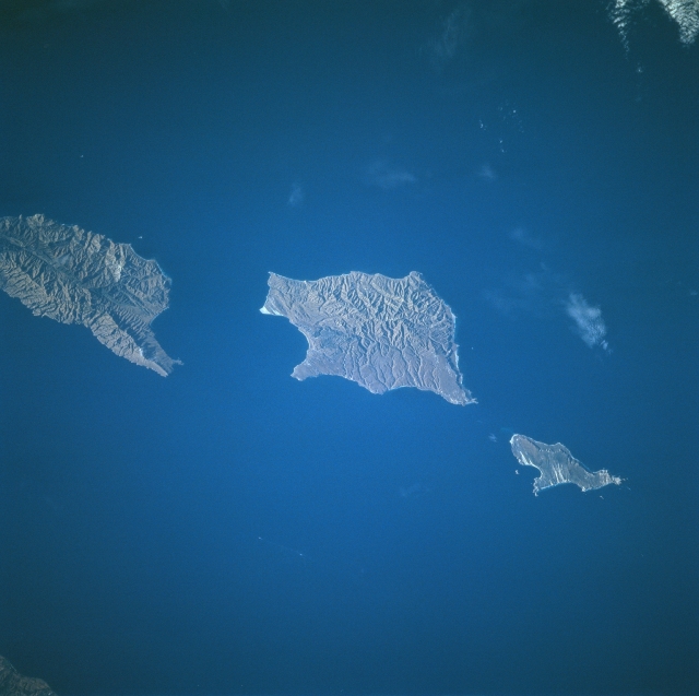 |
| STS078-754-089 Santa Barbara Islands, California June, 1996 The islands (top to bottom) of Santa Cruz, Santa Rose, and San Miguel can be seen in this near-vertical view. The islands, the exposed tops of low mountains, are the westward extension of the Santa Monica Mountains of southern California and are separated from the mainland by the Santa Barbara Channel. The islands, uninhabited by humans, are home to large populations of sea lions, nesting seabirds, and other unusual animal and plant life. |
| Images: | All Available Images Low-Resolution 234k |
|
| Mission: | STS078 |
|
| Roll - Frame: | 754 - 89 |
|
| Geographical Name: | USA-CALIFORNIA |
|
| Features: | SANTA ROSA ISLAND, IS. |
|
| Center Lat x Lon: | 34.0N x 120W |
|
| Film Exposure: | N | N=Normal exposure, U=Under exposed, O=Over exposed, F=out of Focus |
| Percentage of Cloud Cover-CLDP: | 5 |
|
| Camera:: | HB |
|
| Camera Tilt: | 34 | LO=Low Oblique, HO=High Oblique, NV=Near Vertical |
| Camera Focal Length: | 250 |
|
| Nadir to Photo Center Direction: | NW | The direction from the nadir to the center point, N=North, S=South, E=East, W=West |
| Stereo?: | Y | Y=Yes there is an adjacent picture of the same area, N=No there isn't |
| Orbit Number: | 113 |
|
| Date: | 19960627 | YYYYMMDD |
| Time: | 143320 | GMT HHMMSS |
| Nadir Lat: | 32.7N |
Latitude of suborbital point of spacecraft |
| Nadir Lon: | 119.1W |
Longitude of suborbital point of spacecraft |
| Sun Azimuth: | 74 | Clockwise angle in degrees from north to the sun measured at the nadir point |
| Space Craft Altitude: | 142 | nautical miles |
| Sun Elevation: | 19 | Angle in degrees between the horizon and the sun, measured at the nadir point |
| Land Views: | ISLAND, HILL |
|
| Water Views: | CHANNEL |
|
| Atmosphere Views: | |
|
| Man Made Views: | |
|
| City Views: | |
|
Photo is not associated with any sequences | ||
| NASA Home Page |
JSC Home Page |
JSC Digital Image Collection |
Earth Science & Remote Sensing |
|
This service is provided by the International Space Station program and the JSC Earth Science & Remote Sensing Unit, ARES Division, Exploration Integration Science Directorate.

|