
Geographic Region: USA-GEORGIA
Feature: ATLANTA, MARIETTA
|
Geographic Region: USA-GEORGIA Feature: ATLANTA, MARIETTA |
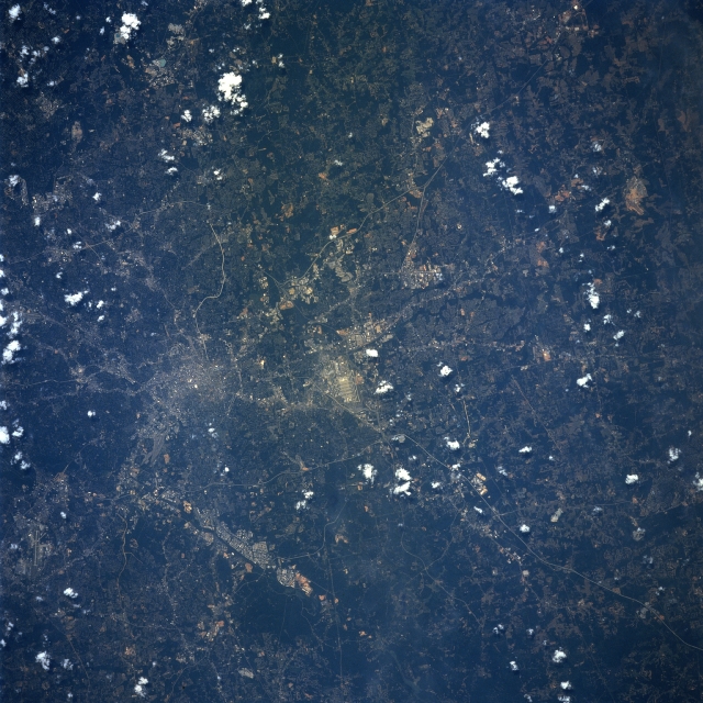 |
| STS078-751-076 Atlanta, Georgia June, 1996 One of the leading cities of the southern United States, the city of Atlanta can be seen in this near-vertical view. One of the fastest growing U.S. cities, Atlanta is the largest city in Georgia. The city is the cultural, industrial, transportation, financial, and commercial center, not only for the state of Georgia, but for the whole southern region of the United States. Atlanta was host to the 1996 Summer Olympic Games. The runways of Hartsfield Atlanta International Airport, one of the ten busiest airports in the world, are visible near the center of the image. Numerous interstate highways are visible traversing through and around the city of Atlanta. |
| Images: | All Available Images Low-Resolution 373k |
|
| Mission: | STS078 |
|
| Roll - Frame: | 751 - 76 |
|
| Geographical Name: | USA-GEORGIA |
|
| Features: | ATLANTA, MARIETTA |
|
| Center Lat x Lon: | 33.5N x 84.5W |
|
| Film Exposure: | N | N=Normal exposure, U=Under exposed, O=Over exposed, F=out of Focus |
| Percentage of Cloud Cover-CLDP: | 10 |
|
| Camera:: | HB |
|
| Camera Tilt: | 10 | LO=Low Oblique, HO=High Oblique, NV=Near Vertical |
| Camera Focal Length: | 100 |
|
| Nadir to Photo Center Direction: | N | The direction from the nadir to the center point, N=North, S=South, E=East, W=West |
| Stereo?: | N | Y=Yes there is an adjacent picture of the same area, N=No there isn't |
| Orbit Number: | 146 |
|
| Date: | 19960629 | YYYYMMDD |
| Time: | 160942 | GMT HHMMSS |
| Nadir Lat: | 33.1N |
Latitude of suborbital point of spacecraft |
| Nadir Lon: | 84.4W |
Longitude of suborbital point of spacecraft |
| Sun Azimuth: | 110 | Clockwise angle in degrees from north to the sun measured at the nadir point |
| Space Craft Altitude: | 143 | nautical miles |
| Sun Elevation: | 68 | Angle in degrees between the horizon and the sun, measured at the nadir point |
| Land Views: | FOREST, PLAIN |
|
| Water Views: | |
|
| Atmosphere Views: | |
|
| Man Made Views: | URBAN AREA, AIRPORT |
|
| City Views: | ATLANTA |
|
Photo is not associated with any sequences | ||
| NASA Home Page |
JSC Home Page |
JSC Digital Image Collection |
Earth Science & Remote Sensing |
|
This service is provided by the International Space Station program and the JSC Earth Science & Remote Sensing Unit, ARES Division, Exploration Integration Science Directorate.

|