
Geographic Region: TURKEY
Feature: GOKSU R.,KARST,TOROS RA.
|
Geographic Region: TURKEY Feature: GOKSU R.,KARST,TOROS RA. |
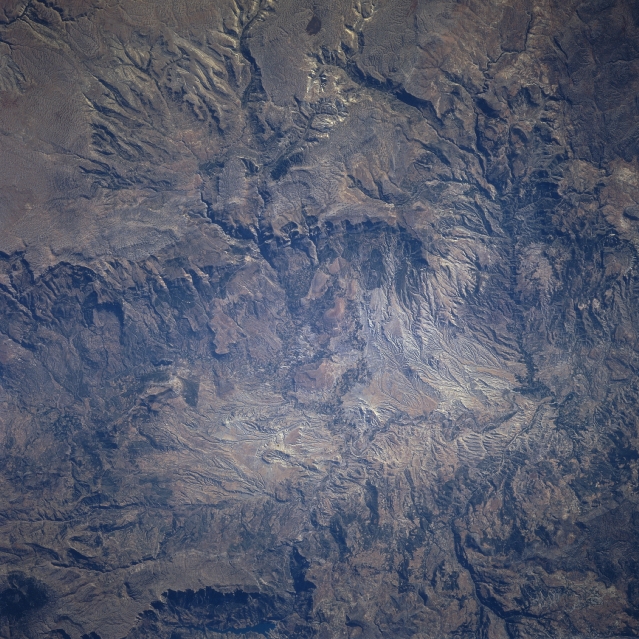 |
| STS078-740-076 Taurus Mountains, Turkey June 1996 Stretching 350 miles (565 km) roughly paralleling the Mediterranean Coast of Southern Turkey, this nadir-looking view shows a small portion of the rugged Taurus Mountains. The Taurus Mountains form the southern border of the Anatolian Plateau. Karst (limestone) topography and deeply eroded surfaces are abundant in this particular area, with numerous underground channels, caves, sinkholes, and springs. Population is sparse in the area. Elevations in this particular scene range to over 7500 feet (2288 meters). The Taurus Mountains have important chromium deposits and other minerals. |
| Images: | All Available Images Low-Resolution 383k |
|
| Mission: | STS078 |
|
| Roll - Frame: | 740 - 76 |
|
| Geographical Name: | TURKEY |
|
| Features: | GOKSU R.,KARST,TOROS RA. |
|
| Center Lat x Lon: | 36.5N x 33.5E |
|
| Film Exposure: | N | N=Normal exposure, U=Under exposed, O=Over exposed, F=out of Focus |
| Percentage of Cloud Cover-CLDP: | 0 |
|
| Camera:: | HB |
|
| Camera Tilt: | 8 | LO=Low Oblique, HO=High Oblique, NV=Near Vertical |
| Camera Focal Length: | 250 |
|
| Nadir to Photo Center Direction: | E | The direction from the nadir to the center point, N=North, S=South, E=East, W=West |
| Stereo?: | Y | Y=Yes there is an adjacent picture of the same area, N=No there isn't |
| Orbit Number: | 219 |
|
| Date: | 19960704 | YYYYMMDD |
| Time: | 051220 | GMT HHMMSS |
| Nadir Lat: | 36.4N |
Latitude of suborbital point of spacecraft |
| Nadir Lon: | 33.2E |
Longitude of suborbital point of spacecraft |
| Sun Azimuth: | 82 | Clockwise angle in degrees from north to the sun measured at the nadir point |
| Space Craft Altitude: | 139 | nautical miles |
| Sun Elevation: | 29 | Angle in degrees between the horizon and the sun, measured at the nadir point |
| Land Views: | MOUNTAIN, FAULT, ESCARPMENT, PLATEAU |
|
| Water Views: | |
|
| Atmosphere Views: | |
|
| Man Made Views: | |
|
| City Views: | |
|
Photo is not associated with any sequences | ||
| NASA Home Page |
JSC Home Page |
JSC Digital Image Collection |
Earth Science & Remote Sensing |
|
This service is provided by the International Space Station program and the JSC Earth Science & Remote Sensing Unit, ARES Division, Exploration Integration Science Directorate.

|