
Geographic Region: BALEARIC ISLANDS
Feature: IBIZA, ISLAND
|
Geographic Region: BALEARIC ISLANDS Feature: IBIZA, ISLAND |
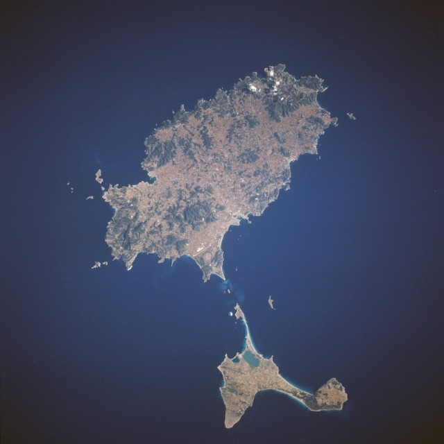 |
| STS077-708-027 Ibiza and Formentera Islands, Balearic Islands, Spain May 1996 The third and fourth largest islands of the Balearic Islands, Ibiza and Formentera, are visible in this north-northeast-looking, low-oblique photograph. Ibiza, the larger of the two islands, covers 221 square miles (572 square kilometers). Fisheries, agricultural products, salt refining, and tourism are the major industries of the island. Picturesque Ibiza, with its mild climate and Roman, Phoenician, and Carthaginian remains, attracts tourists and artists. Smaller Formentera, covering 40 square miles (104 square kilometers), has fisheries and salt refining as its two major industries. |
| Images: | All Available Images Low-Resolution 60k |
|
| Mission: | STS077 |
|
| Roll - Frame: | 708 - 27 |
|
| Geographical Name: | BALEARIC ISLANDS |
|
| Features: | IBIZA, ISLAND |
|
| Center Lat x Lon: | 39.0N x 1.5E |
|
| Film Exposure: | N | N=Normal exposure, U=Under exposed, O=Over exposed, F=out of Focus |
| Percentage of Cloud Cover-CLDP: | 0 |
|
| Camera:: | HB |
|
| Camera Tilt: | LO | LO=Low Oblique, HO=High Oblique, NV=Near Vertical |
| Camera Focal Length: | 100 |
|
| Nadir to Photo Center Direction: | The direction from the nadir to the center point, N=North, S=South, E=East, W=West |
|
| Stereo?: | Y | Y=Yes there is an adjacent picture of the same area, N=No there isn't |
| Orbit Number: | |
|
| Date: | 199605__ | YYYYMMDD |
| Time: | GMT HHMMSS |
|
| Nadir Lat: | N |
Latitude of suborbital point of spacecraft |
| Nadir Lon: | E |
Longitude of suborbital point of spacecraft |
| Sun Azimuth: | Clockwise angle in degrees from north to the sun measured at the nadir point |
|
| Space Craft Altitude: | nautical miles |
|
| Sun Elevation: | Angle in degrees between the horizon and the sun, measured at the nadir point |
|
| Land Views: | ISLAND, COAST, HILL |
|
| Water Views: | |
|
| Atmosphere Views: | |
|
| Man Made Views: | |
|
| City Views: | |
|
Photo is not associated with any sequences | ||
| NASA Home Page |
JSC Home Page |
JSC Digital Image Collection |
Earth Science & Remote Sensing |
|
This service is provided by the International Space Station program and the JSC Earth Science & Remote Sensing Unit, ARES Division, Exploration Integration Science Directorate.

|