
Geographic Region: USA-CALIFORNIA
Feature: SANTA ROSA MTS., CO DES.
|
Geographic Region: USA-CALIFORNIA Feature: SANTA ROSA MTS., CO DES. |
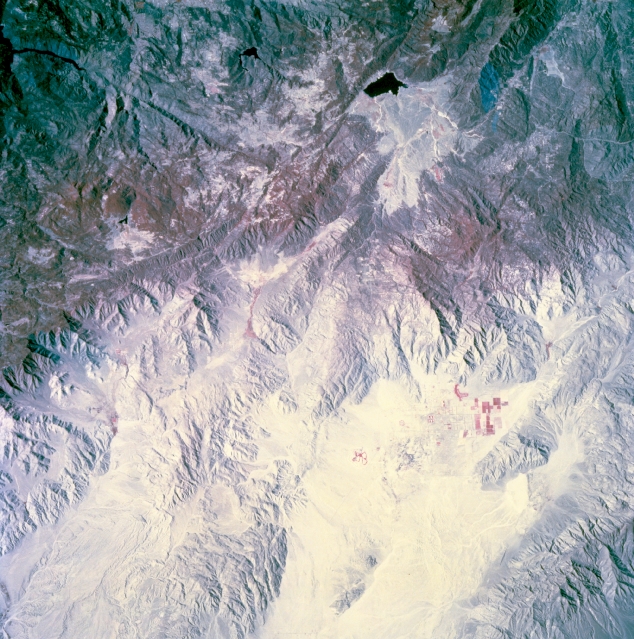 |
| STS073-744-058 Santa Rosa Mountains, Southern California, U.S.A. October 1995 A small section of the Santa Rosa Mountains between San Diego and the Salton Sea is featured in this color infrared, west-looking, low-oblique photograph. The color infrared film displays the sparsely vegetated eastern slopes, a small cluster of cultivated field patterns near the base of the eastern flank, and some forested areas in the higher elevations. Ridge lines vary between 4000 feet (1220 meters) and 6000 feet (1830 meters) above sea level. Discernible are a small lake to the west and several well defined linear fault valleys throughout the mountains. |
| Images: | All Available Images Low-Resolution 386k |
|
| Mission: | STS073 |
|
| Roll - Frame: | 744 - 58 |
|
| Geographical Name: | USA-CALIFORNIA |
|
| Features: | SANTA ROSA MTS., CO DES. |
|
| Center Lat x Lon: | 32.5N x 116.5W |
|
| Film Exposure: | N | N=Normal exposure, U=Under exposed, O=Over exposed, F=out of Focus |
| Percentage of Cloud Cover-CLDP: | 0 |
|
| Camera:: | HB |
|
| Camera Tilt: | 18 | LO=Low Oblique, HO=High Oblique, NV=Near Vertical |
| Camera Focal Length: | 250 |
|
| Nadir to Photo Center Direction: | W | The direction from the nadir to the center point, N=North, S=South, E=East, W=West |
| Stereo?: | Y | Y=Yes there is an adjacent picture of the same area, N=No there isn't |
| Orbit Number: | 117 |
|
| Date: | 19951027 | YYYYMMDD |
| Time: | 182019 | GMT HHMMSS |
| Nadir Lat: | 32.8N |
Latitude of suborbital point of spacecraft |
| Nadir Lon: | 115.8W |
Longitude of suborbital point of spacecraft |
| Sun Azimuth: | 158 | Clockwise angle in degrees from north to the sun measured at the nadir point |
| Space Craft Altitude: | 144 | nautical miles |
| Sun Elevation: | 42 | Angle in degrees between the horizon and the sun, measured at the nadir point |
| Land Views: | MOUNTAIN, FAULT, VALLEY |
|
| Water Views: | |
|
| Atmosphere Views: | |
|
| Man Made Views: | |
|
| City Views: | |
|
Photo is not associated with any sequences | ||
| NASA Home Page |
JSC Home Page |
JSC Digital Image Collection |
Earth Science & Remote Sensing |
|
This service is provided by the International Space Station program and the JSC Earth Science & Remote Sensing Unit, ARES Division, Exploration Integration Science Directorate.

|