
Geographic Region: GREECE
Feature: KEFALLINIA & ITHAKI ISLANDS
|
Geographic Region: GREECE Feature: KEFALLINIA & ITHAKI ISLANDS |
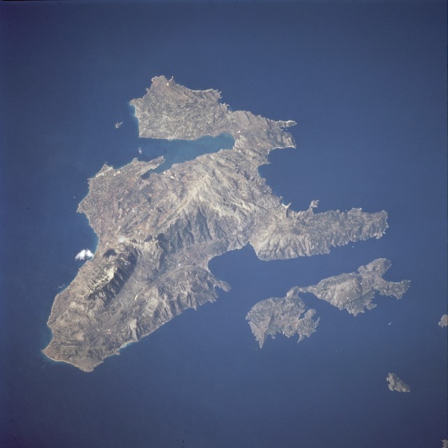 |
| STS073-739-033 Cephalonia (Kefallinia) Island, Ionian Islands October 1995 Devastated in 1953 by severe earthquakes, Cephalonia (Kefallinia), the largest [290 square miles (750 square kilometers)] and most mountainous of Greece's Ionian Islands, can be seen in this west-looking, low-oblique photograph. Located in the Ionian Sea off the western coast of Greece, the island has an irregular coastline and is largely mountainous, rising to 5340 feet (1630 meters) at Mount Ainos, which in ancient times was a temple of Zeus. In addition to the important occupations of sheep raising and fishing, Cephalonia, with its temperate climate and heavy rainfall, is also known for its wines, olives, and olive oil. The island, now almost depleted of its forests, was once famous for its pine forests. The island's most important city is Argostólion. The small Ionian island of Ithaca lies east of Cephalonia. |
| Images: | All Available Images Low-Resolution 71k |
|
| Mission: | STS073 |
|
| Roll - Frame: | 739 - 33 |
|
| Geographical Name: | GREECE |
|
| Features: | KEFALLINIA & ITHAKI ISLANDS |
|
| Center Lat x Lon: | 38.5N x 20.5E |
|
| Film Exposure: | N | N=Normal exposure, U=Under exposed, O=Over exposed, F=out of Focus |
| Percentage of Cloud Cover-CLDP: | 0 |
|
| Camera:: | HB |
|
| Camera Tilt: | 20 | LO=Low Oblique, HO=High Oblique, NV=Near Vertical |
| Camera Focal Length: | 250 |
|
| Nadir to Photo Center Direction: | W | The direction from the nadir to the center point, N=North, S=South, E=East, W=West |
| Stereo?: | Y | Y=Yes there is an adjacent picture of the same area, N=No there isn't |
| Orbit Number: | 62 |
|
| Date: | 19951024 | YYYYMMDD |
| Time: | 092924 | GMT HHMMSS |
| Nadir Lat: | 38.1N |
Latitude of suborbital point of spacecraft |
| Nadir Lon: | 21.3E |
Longitude of suborbital point of spacecraft |
| Sun Azimuth: | 164 | Clockwise angle in degrees from north to the sun measured at the nadir point |
| Space Craft Altitude: | 145 | nautical miles |
| Sun Elevation: | 39 | Angle in degrees between the horizon and the sun, measured at the nadir point |
| Land Views: | ISLAND, MOUNTAIN, VALLEY, COAST |
|
| Water Views: | SEA, BAY |
|
| Atmosphere Views: | |
|
| Man Made Views: | DEFORESTATION, AIRPORT |
|
| City Views: | |
|
Photo is not associated with any sequences | ||
| NASA Home Page |
JSC Home Page |
JSC Digital Image Collection |
Earth Science & Remote Sensing |
|
This service is provided by the International Space Station program and the JSC Earth Science & Remote Sensing Unit, ARES Division, Exploration Integration Science Directorate.

|