
Geographic Region: USA-ARKANSAS
Feature: ROGERS, RESERVOIR, AGR.
|
Geographic Region: USA-ARKANSAS Feature: ROGERS, RESERVOIR, AGR. |
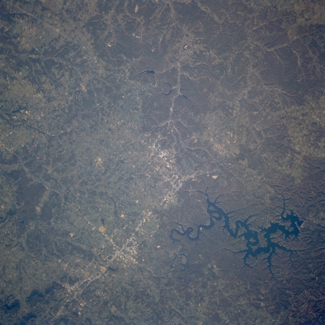 |
| STS073-731-081 Northwest Arkansas, U.S.A. October 1995 Featured in this near-vertical photograph are the mountainous topography of northwest Arkansas and U.S. Highway 71 that connects, from south to north, Fayetteville (near upper right corner), Springdale, Rogers, and Bentonville. Dark, serpentine Beaver Lake lies east of Rogers. Several dendritic stream drainage patterns are apparent in this forested, mountainous region of northwest Arkansas. |
| Images: | All Available Images Low-Resolution 330k |
|
| Mission: | STS073 |
|
| Roll - Frame: | 731 - 81 |
|
| Geographical Name: | USA-ARKANSAS |
|
| Features: | ROGERS, RESERVOIR, AGR. |
|
| Center Lat x Lon: | 36.5N x 94W |
|
| Film Exposure: | N | N=Normal exposure, U=Under exposed, O=Over exposed, F=out of Focus |
| Percentage of Cloud Cover-CLDP: | 0 |
|
| Camera:: | HB |
|
| Camera Tilt: | 19 | LO=Low Oblique, HO=High Oblique, NV=Near Vertical |
| Camera Focal Length: | 250 |
|
| Nadir to Photo Center Direction: | SW | The direction from the nadir to the center point, N=North, S=South, E=East, W=West |
| Stereo?: | N | Y=Yes there is an adjacent picture of the same area, N=No there isn't |
| Orbit Number: | 34 |
|
| Date: | 19951022 | YYYYMMDD |
| Time: | 152745 | GMT HHMMSS |
| Nadir Lat: | 37.0N |
Latitude of suborbital point of spacecraft |
| Nadir Lon: | 93.3W |
Longitude of suborbital point of spacecraft |
| Sun Azimuth: | 136 | Clockwise angle in degrees from north to the sun measured at the nadir point |
| Space Craft Altitude: | 146 | nautical miles |
| Sun Elevation: | 31 | Angle in degrees between the horizon and the sun, measured at the nadir point |
| Land Views: | MOUNTAIN, FOREST |
|
| Water Views: | LAKE |
|
| Atmosphere Views: | |
|
| Man Made Views: | HIGHWAY |
|
| City Views: | |
|
Photo is not associated with any sequences | ||
| NASA Home Page |
JSC Home Page |
JSC Digital Image Collection |
Earth Science & Remote Sensing |
|
This service is provided by the International Space Station program and the JSC Earth Science & Remote Sensing Unit, ARES Division, Exploration Integration Science Directorate.

|