
Geographic Region: USA-CALIFORNIA
Feature: MOJAVE DES., EDWARDS AFB
|
Geographic Region: USA-CALIFORNIA Feature: MOJAVE DES., EDWARDS AFB |
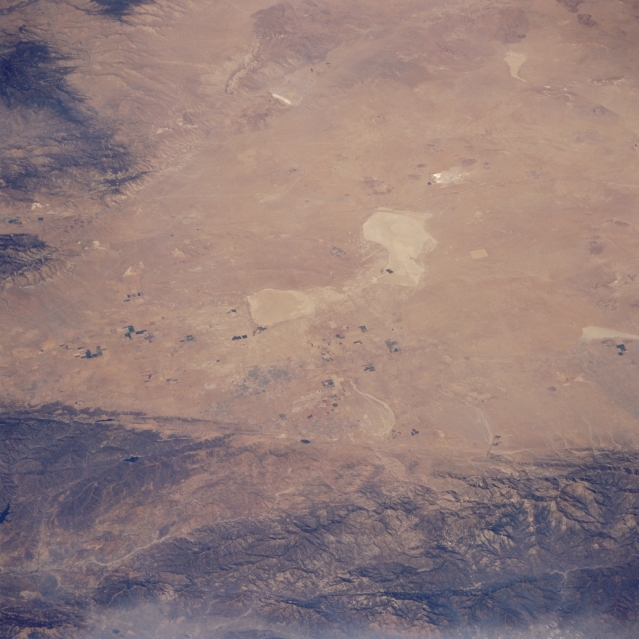 |
| STS073-726-073 Mojave Desert and Edwards Air Force Base, California, U.S.A. October 1995 The subdued colors of Rogers Dry Lake, Rosamond Dry Lake, and Edwards Air Force Base are discernible near the center of the photograph. Also visible are part of the western Mojave Desert--known locally as Antelope Valley--and several irrigated, rectangular field patterns. The San Andreas Fault traverses the northeastern flank of the San Gabriel Mountains. |
| Images: | All Available Images Low-Resolution 288k |
|
| Mission: | STS073 |
|
| Roll - Frame: | 726 - 73 |
|
| Geographical Name: | USA-CALIFORNIA |
|
| Features: | MOJAVE DES., EDWARDS AFB |
|
| Center Lat x Lon: | 35.0N x 118W |
|
| Film Exposure: | N | N=Normal exposure, U=Under exposed, O=Over exposed, F=out of Focus |
| Percentage of Cloud Cover-CLDP: | 5 |
|
| Camera:: | HB |
|
| Camera Tilt: | LO | LO=Low Oblique, HO=High Oblique, NV=Near Vertical |
| Camera Focal Length: | 100 |
|
| Nadir to Photo Center Direction: | The direction from the nadir to the center point, N=North, S=South, E=East, W=West |
|
| Stereo?: | N | Y=Yes there is an adjacent picture of the same area, N=No there isn't |
| Orbit Number: | |
|
| Date: | 1995____ | YYYYMMDD |
| Time: | GMT HHMMSS |
|
| Nadir Lat: | N |
Latitude of suborbital point of spacecraft |
| Nadir Lon: | E |
Longitude of suborbital point of spacecraft |
| Sun Azimuth: | Clockwise angle in degrees from north to the sun measured at the nadir point |
|
| Space Craft Altitude: | nautical miles |
|
| Sun Elevation: | Angle in degrees between the horizon and the sun, measured at the nadir point |
|
| Land Views: | DESERT, FAULT, MOUNTAIN |
|
| Water Views: | PLAYA |
|
| Atmosphere Views: | |
|
| Man Made Views: | |
|
| City Views: | |
|
Photo is not associated with any sequences | ||
| NASA Home Page |
JSC Home Page |
JSC Digital Image Collection |
Earth Science & Remote Sensing |
|
This service is provided by the International Space Station program and the JSC Earth Science & Remote Sensing Unit, ARES Division, Exploration Integration Science Directorate.

|