
Geographic Region: USA-TEXAS
Feature: RED RIVER, AGRICULTURE, RES.
|
Geographic Region: USA-TEXAS Feature: RED RIVER, AGRICULTURE, RES. |
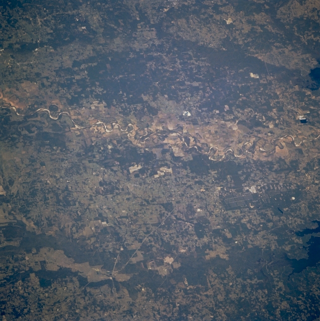 |
| STS073-726-028 Red River, Arkansas and Texas, U.S.A. October 1995 Featured in this north-looking, low-oblique photograph is the Red River Valley. North of the Red River is southwest Arkansas, and south of the river is Texas. The river's name is derived from its sediment, which is primarily eroded particles from sandstone in the red Permian Basin of northwest Texas. The portion of the Red River in this photograph lies between Idabel, Oklahoma, (not discernible) to the west and Texarkana, Texas, (not discernible) to the east. |
| Images: | All Available Images Low-Resolution 349k |
|
| Mission: | STS073 |
|
| Roll - Frame: | 726 - 28 |
|
| Geographical Name: | USA-TEXAS |
|
| Features: | RED RIVER, AGRICULTURE, RES. |
|
| Center Lat x Lon: | 33.5N x 94.5W |
|
| Film Exposure: | N | N=Normal exposure, U=Under exposed, O=Over exposed, F=out of Focus |
| Percentage of Cloud Cover-CLDP: | 0 |
|
| Camera:: | HB |
|
| Camera Tilt: | LO | LO=Low Oblique, HO=High Oblique, NV=Near Vertical |
| Camera Focal Length: | 250 |
|
| Nadir to Photo Center Direction: | The direction from the nadir to the center point, N=North, S=South, E=East, W=West |
|
| Stereo?: | Y | Y=Yes there is an adjacent picture of the same area, N=No there isn't |
| Orbit Number: | |
|
| Date: | 1995____ | YYYYMMDD |
| Time: | GMT HHMMSS |
|
| Nadir Lat: | N |
Latitude of suborbital point of spacecraft |
| Nadir Lon: | E |
Longitude of suborbital point of spacecraft |
| Sun Azimuth: | Clockwise angle in degrees from north to the sun measured at the nadir point |
|
| Space Craft Altitude: | nautical miles |
|
| Sun Elevation: | Angle in degrees between the horizon and the sun, measured at the nadir point |
|
| Land Views: | RANGE, VALLEY |
|
| Water Views: | RIVER |
|
| Atmosphere Views: | |
|
| Man Made Views: | |
|
| City Views: | |
|
Photo is not associated with any sequences | ||
| NASA Home Page |
JSC Home Page |
JSC Digital Image Collection |
Earth Science & Remote Sensing |
|
This service is provided by the International Space Station program and the JSC Earth Science & Remote Sensing Unit, ARES Division, Exploration Integration Science Directorate.

|