
Geographic Region: USA-WEST VIRGINIA
Feature: OHIO & NEW RIVERS, AGR.
|
Geographic Region: USA-WEST VIRGINIA Feature: OHIO & NEW RIVERS, AGR. |
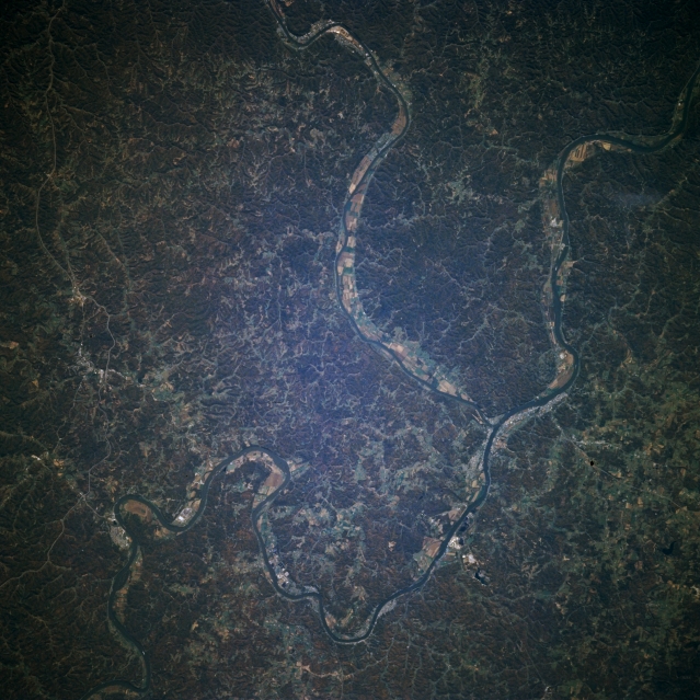 |
| STS073-704-060 Ohio River, Appalachian Plateau, West Virginia, U.S.A. October 1995 The Appalachian Plateau can be seen in this south-looking very low oblique photograph. The Ohio River crosses the image from the lower left to the upper right. The Appalachian Plateau (or sometime referred to as the Allegheny Plateau) is a series of low-rounded hills with numerous eroded valleys. The plateau is covered with a wide variety of deciduous trees in full fall color at the time this image was acquired. Coal and other minerals are mined throughout the region. The Ohio River separates the state of Ohio to the north (bottom) from the state of West Virginia (top). The Kanawa River enters the scene near the top center of the image and enters the Ohio River just to the right of center of the image. |
| Images: | All Available Images Low-Resolution 350k |
|
| Mission: | STS073 |
|
| Roll - Frame: | 704 - 60 |
|
| Geographical Name: | USA-WEST VIRGINIA |
|
| Features: | OHIO & NEW RIVERS, AGR. |
|
| Center Lat x Lon: | 38.5N x 82W |
|
| Film Exposure: | N | N=Normal exposure, U=Under exposed, O=Over exposed, F=out of Focus |
| Percentage of Cloud Cover-CLDP: | 0 |
|
| Camera:: | HB |
|
| Camera Tilt: | 19 | LO=Low Oblique, HO=High Oblique, NV=Near Vertical |
| Camera Focal Length: | 250 |
|
| Nadir to Photo Center Direction: | W | The direction from the nadir to the center point, N=North, S=South, E=East, W=West |
| Stereo?: | Y | Y=Yes there is an adjacent picture of the same area, N=No there isn't |
| Orbit Number: | 35 |
|
| Date: | 19951022 | YYYYMMDD |
| Time: | 170435 | GMT HHMMSS |
| Nadir Lat: | 38.3N |
Latitude of suborbital point of spacecraft |
| Nadir Lon: | 81.2W |
Longitude of suborbital point of spacecraft |
| Sun Azimuth: | 178 | Clockwise angle in degrees from north to the sun measured at the nadir point |
| Space Craft Altitude: | 146 | nautical miles |
| Sun Elevation: | 41 | Angle in degrees between the horizon and the sun, measured at the nadir point |
| Land Views: | PLATEAU, PLAIN, FOREST |
|
| Water Views: | RIVER |
|
| Atmosphere Views: | |
|
| Man Made Views: | |
|
| City Views: | |
|
Photo is not associated with any sequences | ||
| NASA Home Page |
JSC Home Page |
JSC Digital Image Collection |
Earth Science & Remote Sensing |
|
This service is provided by the International Space Station program and the JSC Earth Science & Remote Sensing Unit, ARES Division, Exploration Integration Science Directorate.

|