
Geographic Region: USA-OKLAHOMA
Feature: MANGUM,R.,L.,AGR,RUNWAYS
|
Geographic Region: USA-OKLAHOMA Feature: MANGUM,R.,L.,AGR,RUNWAYS |
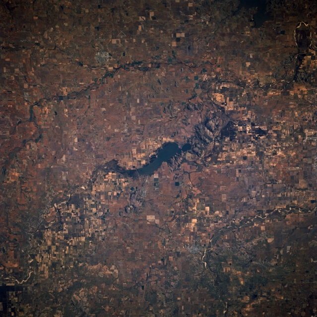 |
| STS073-702-023 Altus Lake and Quartz Mountain, Oklahoma, U.S.A. October 1995 Altus Lake and Quartz Mountain in southwest Oklahoma are featured in this west-looking, low-oblique photograph. Fed and drained by the north fork of the Red River, Altus Lake and its dam are used for recreation, flood control, and hydroelectric power. Some mining occurs in and around Quartz Mountain, south of Altus Lake. Viewing clockwise from the lake are condensed agriculture field patterns in the valley of the north fork of the Red River; Hobart, barely discernible as a gray smudge; the western portions of Tom Steed Lake; and the Salt Fork of Red River (upper left). |
| Images: | All Available Images Low-Resolution 371k |
|
| Mission: | STS073 |
|
| Roll - Frame: | 702 - 23 |
|
| Geographical Name: | USA-OKLAHOMA |
|
| Features: | MANGUM,R.,L.,AGR,RUNWAYS |
|
| Center Lat x Lon: | 35.0N x 99.5W |
|
| Film Exposure: | N | N=Normal exposure, U=Under exposed, O=Over exposed, F=out of Focus |
| Percentage of Cloud Cover-CLDP: | 0 |
|
| Camera:: | HB |
|
| Camera Tilt: | 10 | LO=Low Oblique, HO=High Oblique, NV=Near Vertical |
| Camera Focal Length: | 250 |
|
| Nadir to Photo Center Direction: | W | The direction from the nadir to the center point, N=North, S=South, E=East, W=West |
| Stereo?: | N | Y=Yes there is an adjacent picture of the same area, N=No there isn't |
| Orbit Number: | 116 |
|
| Date: | 19951027 | YYYYMMDD |
| Time: | 164912 | GMT HHMMSS |
| Nadir Lat: | 34.9N |
Latitude of suborbital point of spacecraft |
| Nadir Lon: | 99.1W |
Longitude of suborbital point of spacecraft |
| Sun Azimuth: | 151 | Clockwise angle in degrees from north to the sun measured at the nadir point |
| Space Craft Altitude: | 144 | nautical miles |
| Sun Elevation: | 38 | Angle in degrees between the horizon and the sun, measured at the nadir point |
| Land Views: | HILL |
|
| Water Views: | LAKE |
|
| Atmosphere Views: | |
|
| Man Made Views: | AGRICULTURE |
|
| City Views: | |
|
Photo is not associated with any sequences | ||
| NASA Home Page |
JSC Home Page |
JSC Digital Image Collection |
Earth Science & Remote Sensing |
|
This service is provided by the International Space Station program and the JSC Earth Science & Remote Sensing Unit, ARES Division, Exploration Integration Science Directorate.

|