
Geographic Region: USA-TEXAS
Feature: DALLAS-FT. WORTH,PART. FRM
|
Geographic Region: USA-TEXAS Feature: DALLAS-FT. WORTH,PART. FRM |
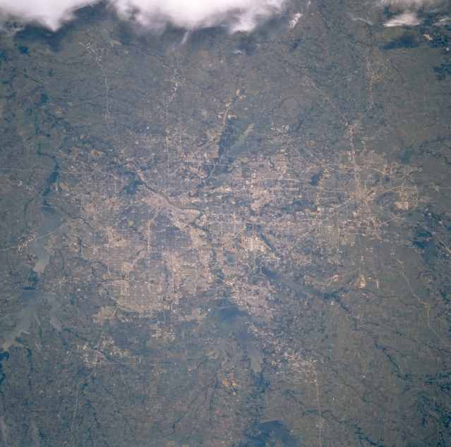 |
| STS071-745-065 Dallas-Fort Worth Metroplex, Texas, U.S.A. July 1995 The coalescing of Dallas and Fort Worth is captured in this photograph. Except for the Trinity River and its numerous tributaries, no physical landform has impeded the rapid urban buildup on the relatively flat prairie of the Dallas-Fort Worth region. Discernible are the central business districts for each city and several highly reflective runways of the Dallas-Fort Worth International Airport. Viewing clockwise from the left side of the photograph are several large reservoirs bordering the metroplex--Lake Lavon, Lake Ray Hubbard, Joe Pool Lake, Grapevine Lake, Lake Lewisville, and Lake Ray Roberts (bottom center). Clouds are observed to the south. |
| Images: | All Available Images Low-Resolution 348k |
|
| Mission: | STS071 |
|
| Roll - Frame: | 745 - 65 |
|
| Geographical Name: | USA-TEXAS |
|
| Features: | DALLAS-FT. WORTH,PART. FRM |
|
| Center Lat x Lon: | 32.5N x 97W |
|
| Film Exposure: | N | N=Normal exposure, U=Under exposed, O=Over exposed, F=out of Focus |
| Percentage of Cloud Cover-CLDP: | 5 |
|
| Camera:: | HB |
|
| Camera Tilt: | LO | LO=Low Oblique, HO=High Oblique, NV=Near Vertical |
| Camera Focal Length: | 100 |
|
| Nadir to Photo Center Direction: | The direction from the nadir to the center point, N=North, S=South, E=East, W=West |
|
| Stereo?: | Y | Y=Yes there is an adjacent picture of the same area, N=No there isn't |
| Orbit Number: | |
|
| Date: | 1995____ | YYYYMMDD |
| Time: | GMT HHMMSS |
|
| Nadir Lat: | N |
Latitude of suborbital point of spacecraft |
| Nadir Lon: | E |
Longitude of suborbital point of spacecraft |
| Sun Azimuth: | Clockwise angle in degrees from north to the sun measured at the nadir point |
|
| Space Craft Altitude: | nautical miles |
|
| Sun Elevation: | Angle in degrees between the horizon and the sun, measured at the nadir point |
|
| Land Views: | RANGE, PLAIN |
|
| Water Views: | RESERVOIR |
|
| Atmosphere Views: | |
|
| Man Made Views: | HIGHWAY, AIRPORT |
|
| City Views: | |
|
Photo is not associated with any sequences | ||
| NASA Home Page |
JSC Home Page |
JSC Digital Image Collection |
Earth Science & Remote Sensing |
|
This service is provided by the International Space Station program and the JSC Earth Science & Remote Sensing Unit, ARES Division, Exploration Integration Science Directorate.

|