 Photo #: STS069-729-19 Date: Sep. 1995
Geographic Region: USA-HAWAII
Feature: KAUAI, MOUNTAINS, COAST

 Photo #: STS069-729-19 Date: Sep. 1995 Photo #: STS069-729-19 Date: Sep. 1995Geographic Region: USA-HAWAII Feature: KAUAI, MOUNTAINS, COAST |
 |
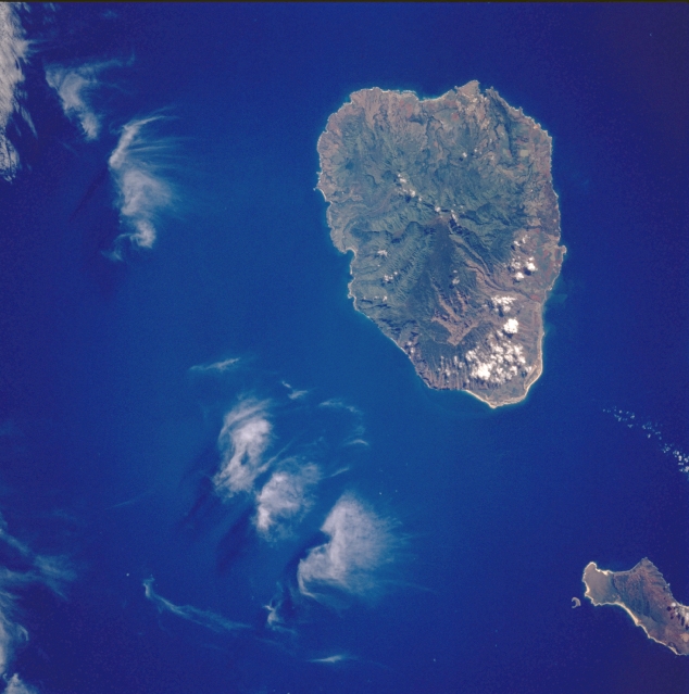
| STS069-729-019 Kauai, Hawaii, U.S.A. September 1995 Kauai, more than 5 million years old, is the oldest of the larger Hawaiian Islands. Waialeale Peak [5148 feet (1569 meters)], the wettest place on Earth, receives more than 500 inches (1270 centimeters) of precipitation each year. Because of excessive precipitation, much of the island (especially where humans and animals have modified the natural environment through agriculture and grazing) now faces the challenge of erosion. Gullied erosion has been documented along the Na Pali Coast of northwest Kauai where overgrazing has produced steep, barren slopes. The large quantity of rainfall has shaped beautiful vegetated canyons and valleys. Many conservationists are now studying the erosion problems to determine what balance can be maintained to protect and preserve the delicate flora and fauna species. The northeast half of Niihau is visible in the lower right corner of the photograph. |
| Images: | All Available Images Low-Resolution 271k |
|
| Mission: | STS069 |
|
| Roll - Frame: | 729 - 19 |
|
| Geographical Name: | USA-HAWAII |
|
| Features: | KAUAI, MOUNTAINS, COAST |
|
| Center Lat x Lon: | 22.0N x 159.5W |
|
| Film Exposure: | N | N=Normal exposure, U=Under exposed, O=Over exposed, F=out of Focus |
| Percentage of Cloud Cover-CLDP: | 5 |
|
| Camera:: | HB |
|
| Camera Tilt: | 30 | LO=Low Oblique, HO=High Oblique, NV=Near Vertical |
| Camera Focal Length: | 100 |
|
| Nadir to Photo Center Direction: | S | The direction from the nadir to the center point, N=North, S=South, E=East, W=West |
| Stereo?: | N | Y=Yes there is an adjacent picture of the same area, N=No there isn't |
| Orbit Number: | 67 |
|
| Date: | 19950911 | YYYYMMDD |
| Time: | 202955 | GMT HHMMSS |
| Nadir Lat: | 24.0N |
Latitude of suborbital point of spacecraft |
| Nadir Lon: | 159W |
Longitude of suborbital point of spacecraft |
| Sun Azimuth: | 118 | Clockwise angle in degrees from north to the sun measured at the nadir point |
| Space Craft Altitude: | 215 | nautical miles |
| Sun Elevation: | 55 | Angle in degrees between the horizon and the sun, measured at the nadir point |
| Land Views: | ISLAND, VOLCANO, MOUNTAIN |
|
| Water Views: | |
|
| Atmosphere Views: | |
|
| Man Made Views: | |
|
| City Views: | |
|
Photo is not associated with any sequences | ||
| NASA Home Page |
JSC Home Page |
JSC Digital Image Collection |
Earth Science & Remote Sensing |
|
|