
Geographic Region: AUSTRALIA-NT
Feature: ROPER RIVER, SED. PLUME
|
Geographic Region: AUSTRALIA-NT Feature: ROPER RIVER, SED. PLUME |
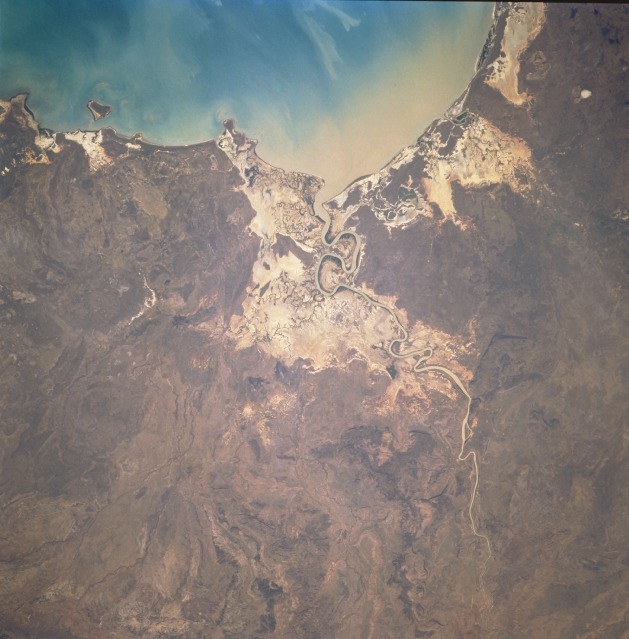 |
| STS069-728-79 Roper River, Northern Territory, Australia September 1995 The meandering channel of the Roper River (center of image) flows into Limmen Bight, located along the southwest shoreline of the Gulf of Carpentaria. The floodplain of the Roper River widens at the coast to include the large, tan-colored area surrounding the river mouth. The lower floodplain is well defined from the darker, more heavily vegetated uplands. River flow increases greatly during the summer rainy season. In this view, the muddy color of the river indicates that the river delivers a large supply of sediment to the coast. |
| Images: | All Available Images Low-Resolution 105k |
|
| Mission: | STS069 |
|
| Roll - Frame: | 728 - 79 |
|
| Geographical Name: | AUSTRALIA-NT |
|
| Features: | ROPER RIVER, SED. PLUME |
|
| Center Lat x Lon: | 14.5S x 135.5E |
|
| Film Exposure: | N | N=Normal exposure, U=Under exposed, O=Over exposed, F=out of Focus |
| Percentage of Cloud Cover-CLDP: | 0 |
|
| Camera:: | HB |
|
| Camera Tilt: | 19 | LO=Low Oblique, HO=High Oblique, NV=Near Vertical |
| Camera Focal Length: | 250 |
|
| Nadir to Photo Center Direction: | W | The direction from the nadir to the center point, N=North, S=South, E=East, W=West |
| Stereo?: | N | Y=Yes there is an adjacent picture of the same area, N=No there isn't |
| Orbit Number: | 73 |
|
| Date: | 19950912 | YYYYMMDD |
| Time: | 060715 | GMT HHMMSS |
| Nadir Lat: | 14.6S |
Latitude of suborbital point of spacecraft |
| Nadir Lon: | 136.7E |
Longitude of suborbital point of spacecraft |
| Sun Azimuth: | 287 | Clockwise angle in degrees from north to the sun measured at the nadir point |
| Space Craft Altitude: | 215 | nautical miles |
| Sun Elevation: | 38 | Angle in degrees between the horizon and the sun, measured at the nadir point |
| Land Views: | PLAIN, COAST |
|
| Water Views: | RIVER, GULF, SEDIMENT |
|
| Atmosphere Views: | |
|
| Man Made Views: | |
|
| City Views: | |
|
Photo is not associated with any sequences | ||
| NASA Home Page |
JSC Home Page |
JSC Digital Image Collection |
Earth Science & Remote Sensing |
|
This service is provided by the International Space Station program and the JSC Earth Science & Remote Sensing Unit, ARES Division, Exploration Integration Science Directorate.

|