
Geographic Region: USA-ARKANSAS
Feature: FORT SMITH, ARKANSAS R.
|
Geographic Region: USA-ARKANSAS Feature: FORT SMITH, ARKANSAS R. |
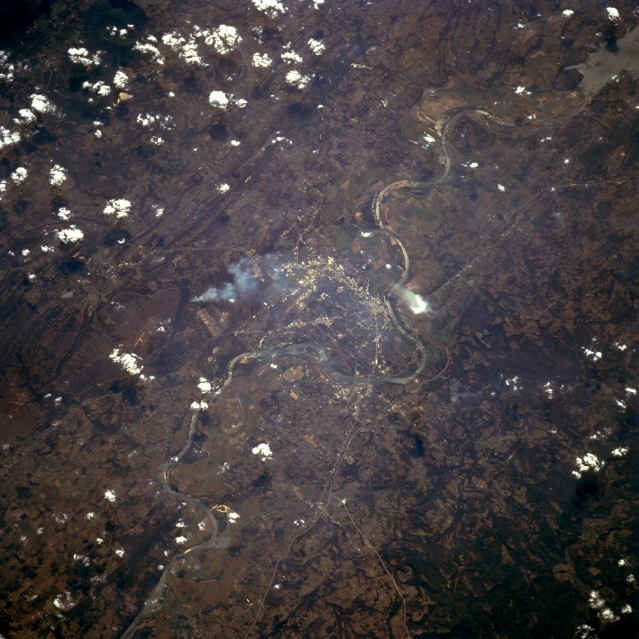 |
| STS068-262-002 Fort Smith, Arkansas, U.S.A. October 1994 Apparent in this photograph are some haze and a single white smoke plume (left of center) that obscure some detail of historic Van Buren and Fort Smith, which are separated by the main channel of the winding Arkansas River. The commercial areas within these cities can be determined by the concentration of highly reflective surfaces. Visible are a segment of Interstate Highway 40 that passes Fort Smith on the north side of the Arkansas River and the eastern extent of Robert S. Kerr Reservoir to the west in Oklahoma (upper right corner). Most of west-central Arkansas consists of gently rolling hills; however, more rugged, wooded terrain is found north of Fort Smith and Van Buren. |
| Images: | All Available Images Low-Resolution 351k |
|
| Mission: | STS068 |
|
| Roll - Frame: | 262 - 2 |
|
| Geographical Name: | USA-ARKANSAS |
|
| Features: | FORT SMITH, ARKANSAS R. |
|
| Center Lat x Lon: | 35.5N x 94.5W |
|
| Film Exposure: | N | N=Normal exposure, U=Under exposed, O=Over exposed, F=out of Focus |
| Percentage of Cloud Cover-CLDP: | 10 |
|
| Camera:: | HB |
|
| Camera Tilt: | 36 | LO=Low Oblique, HO=High Oblique, NV=Near Vertical |
| Camera Focal Length: | 250 |
|
| Nadir to Photo Center Direction: | W | The direction from the nadir to the center point, N=North, S=South, E=East, W=West |
| Stereo?: | N | Y=Yes there is an adjacent picture of the same area, N=No there isn't |
| Orbit Number: | 39 |
|
| Date: | 19941002 | YYYYMMDD |
| Time: | 200213 | GMT HHMMSS |
| Nadir Lat: | 36.1N |
Latitude of suborbital point of spacecraft |
| Nadir Lon: | 93.2W |
Longitude of suborbital point of spacecraft |
| Sun Azimuth: | 222 | Clockwise angle in degrees from north to the sun measured at the nadir point |
| Space Craft Altitude: | 118 | nautical miles |
| Sun Elevation: | 41 | Angle in degrees between the horizon and the sun, measured at the nadir point |
| Land Views: | HILL, FOREST |
|
| Water Views: | RIVER, RESERVOIR |
|
| Atmosphere Views: | SMOKE |
|
| Man Made Views: | URBAN AREA |
|
| City Views: | |
|
Photo is not associated with any sequences | ||
| NASA Home Page |
JSC Home Page |
JSC Digital Image Collection |
Earth Science & Remote Sensing |
|
This service is provided by the International Space Station program and the JSC Earth Science & Remote Sensing Unit, ARES Division, Exploration Integration Science Directorate.

|