
Geographic Region: FRANCE
Feature: LOIRE R., CITIES, AGRICULTURE
|
Geographic Region: FRANCE Feature: LOIRE R., CITIES, AGRICULTURE |
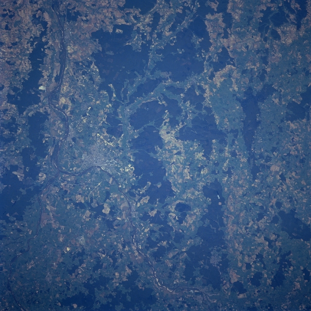 |
| STS068-246-098 Loire and Allier Rivers, France October, 1994 Near the left center of the image, the Allier and the Loire River join in this near-nadir-looking view. The Allier River enters the scene at the bottom left corner of the image. The river is 255 miles (410 km) long and rises in the Cevennes Mountains of southeastern France. The Allier River is navigable for a good portion of its length. The Loire River enters the scene at the bottom center of the image and flows generally northwestward exiting the scene near the top left corner of the image. The Loire River is the longest river in France rising in the Cevennes Mountains and flowing 630 miles (1015 km) to the Bay of Biscay at Saint Nazaire. The industrial city of Nevers is located along the north bank of the Loire River immediately east of the confluence of these two rivers. The city is the center of an iron and steel district and also has important china and pottery industries. The forested uplands (irregular-shaped, dark pattern) of the Langres Plateau can be seen in the center of the image from the bottom center to the top center. |
| Images: | All Available Images Low-Resolution 363k |
|
| Mission: | STS068 |
|
| Roll - Frame: | 246 - 98 |
|
| Geographical Name: | FRANCE |
|
| Features: | LOIRE R., CITIES, AGRICULTURE |
|
| Center Lat x Lon: | 47.0N x 3.0E |
|
| Film Exposure: | N | N=Normal exposure, U=Under exposed, O=Over exposed, F=out of Focus |
| Percentage of Cloud Cover-CLDP: | 0 |
|
| Camera:: | HB |
|
| Camera Tilt: | 26 | LO=Low Oblique, HO=High Oblique, NV=Near Vertical |
| Camera Focal Length: | 250 |
|
| Nadir to Photo Center Direction: | N | The direction from the nadir to the center point, N=North, S=South, E=East, W=West |
| Stereo?: | Y | Y=Yes there is an adjacent picture of the same area, N=No there isn't |
| Orbit Number: | 98 |
|
| Date: | 19941006 | YYYYMMDD |
| Time: | 111655 | GMT HHMMSS |
| Nadir Lat: | 46.1N |
Latitude of suborbital point of spacecraft |
| Nadir Lon: | 2.8E |
Longitude of suborbital point of spacecraft |
| Sun Azimuth: | 174 | Clockwise angle in degrees from north to the sun measured at the nadir point |
| Space Craft Altitude: | 115 | nautical miles |
| Sun Elevation: | 39 | Angle in degrees between the horizon and the sun, measured at the nadir point |
| Land Views: | VALLEY, PLATEAU, FOREST |
|
| Water Views: | RIVER |
|
| Atmosphere Views: | |
|
| Man Made Views: | URBAN AREA, AGRICULTURE |
|
| City Views: | |
|
Photo is not associated with any sequences | ||
| NASA Home Page |
JSC Home Page |
JSC Digital Image Collection |
Earth Science & Remote Sensing |
|
This service is provided by the International Space Station program and the JSC Earth Science & Remote Sensing Unit, ARES Division, Exploration Integration Science Directorate.

|