
Geographic Region: USA-MISSISSIPPI
Feature: MONROE,OUACHITA R, AGRICULTURE
|
Geographic Region: USA-MISSISSIPPI Feature: MONROE,OUACHITA R, AGRICULTURE |
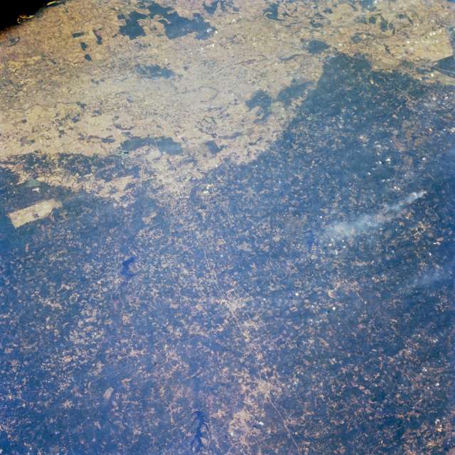 |
| STS068-232-043 Northern Louisiana, U.S.A. October 1994 Interstate Highway 20 appears as a thin line connecting Arcadia in the west to Tallulah in the east in this east-looking, synoptic photograph of northern Louisiana. Visible north of Interstate Highway 20 are dark, irregular-shaped Lake Claiborne and Bayou d'Arbonne Lake farther east. Only the general locations of Ruston and Monroe, two of the larger cities in northern Louisiana, can be discerned. The dark greens of the rolling hills, known locally as the Prairie Complex, contrast dramatically with the lighter colors of the flat, intensely cultivated western Mississippi River floodplain. A single smoke plume appears south of Interstate Highway 20. |
| Images: | All Available Images Low-Resolution 67k |
|
| Mission: | STS068 |
|
| Roll - Frame: | 232 - 43 |
|
| Geographical Name: | USA-MISSISSIPPI |
|
| Features: | MONROE,OUACHITA R, AGRICULTURE |
|
| Center Lat x Lon: | 32.5N x 92.5W |
|
| Film Exposure: | N | N=Normal exposure, U=Under exposed, O=Over exposed, F=out of Focus |
| Percentage of Cloud Cover-CLDP: | 5 |
|
| Camera:: | HB |
|
| Camera Tilt: | NV | LO=Low Oblique, HO=High Oblique, NV=Near Vertical |
| Camera Focal Length: | 100 |
|
| Nadir to Photo Center Direction: | SE | The direction from the nadir to the center point, N=North, S=South, E=East, W=West |
| Stereo?: | N | Y=Yes there is an adjacent picture of the same area, N=No there isn't |
| Orbit Number: | 103 |
|
| Date: | 19941006 | YYYYMMDD |
| Time: | 184513 | GMT HHMMSS |
| Nadir Lat: | 33.1N |
Latitude of suborbital point of spacecraft |
| Nadir Lon: | 93.7W |
Longitude of suborbital point of spacecraft |
| Sun Azimuth: | 197 | Clockwise angle in degrees from north to the sun measured at the nadir point |
| Space Craft Altitude: | 116 | nautical miles |
| Sun Elevation: | 51 | Angle in degrees between the horizon and the sun, measured at the nadir point |
| Land Views: | FLOOD PLAIN, FOREST |
|
| Water Views: | RESERVOIR |
|
| Atmosphere Views: | SMOKE |
|
| Man Made Views: | HIGHWAY |
|
| City Views: | |
|
Photo is not associated with any sequences | ||
| NASA Home Page |
JSC Home Page |
JSC Digital Image Collection |
Earth Science & Remote Sensing |
|
This service is provided by the International Space Station program and the JSC Earth Science & Remote Sensing Unit, ARES Division, Exploration Integration Science Directorate.

|