
Geographic Region: USA-OHIO
Feature: LAKE ERIE, CLEVELAND
|
Geographic Region: USA-OHIO Feature: LAKE ERIE, CLEVELAND |
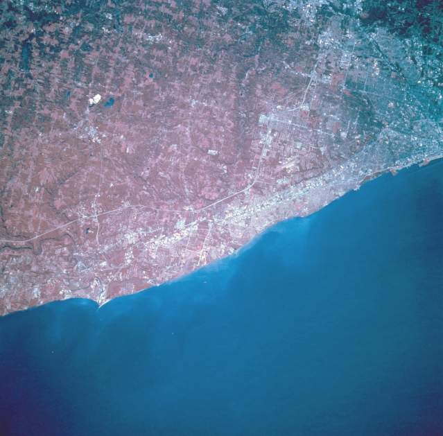 |
| STS068-209-070 Lake Erie, Ohio, U.S.A. October 1994 Lake Erie, the shallowest of the Great Lakes, is apparent in this south-looking, low-oblique, color infrared photograph. Discernible are eastern Cleveland (upper right); small communities with summer homes overlooking Lake Erie eastward from Cleveland to Painesville; and Interstate Highway 90 paralleling the lake. Much of the land south of Interstate Highway 90 resembles patterns in the deforested regions of Rondonia in the upper Amazon River Basin of Brazil (reference photograph STS046-078-026). Shoreline property values have improved during the last two decades as a result of the cleanup of Lake Erie. |
| Images: | All Available Images Low-Resolution 323k |
|
| Mission: | STS068 |
|
| Roll - Frame: | 209 - 70 |
|
| Geographical Name: | USA-OHIO |
|
| Features: | LAKE ERIE, CLEVELAND |
|
| Center Lat x Lon: | 41.5N x 81.5W |
|
| Film Exposure: | N | N=Normal exposure, U=Under exposed, O=Over exposed, F=out of Focus |
| Percentage of Cloud Cover-CLDP: | 0 |
|
| Camera:: | HB |
|
| Camera Tilt: | 23 | LO=Low Oblique, HO=High Oblique, NV=Near Vertical |
| Camera Focal Length: | 250 |
|
| Nadir to Photo Center Direction: | S | The direction from the nadir to the center point, N=North, S=South, E=East, W=West |
| Stereo?: | Y | Y=Yes there is an adjacent picture of the same area, N=No there isn't |
| Orbit Number: | 102 |
|
| Date: | 19941006 | YYYYMMDD |
| Time: | 171324 | GMT HHMMSS |
| Nadir Lat: | 42.3N |
Latitude of suborbital point of spacecraft |
| Nadir Lon: | 81.4W |
Longitude of suborbital point of spacecraft |
| Sun Azimuth: | 180 | Clockwise angle in degrees from north to the sun measured at the nadir point |
| Space Craft Altitude: | 116 | nautical miles |
| Sun Elevation: | 43 | Angle in degrees between the horizon and the sun, measured at the nadir point |
| Land Views: | PLAIN |
|
| Water Views: | LAKE |
|
| Atmosphere Views: | |
|
| Man Made Views: | URBAN AREA, AGRICULTURE |
|
| City Views: | |
|
Photo is not associated with any sequences | ||
| NASA Home Page |
JSC Home Page |
JSC Digital Image Collection |
Earth Science & Remote Sensing |
|
This service is provided by the International Space Station program and the JSC Earth Science & Remote Sensing Unit, ARES Division, Exploration Integration Science Directorate.

|