
Geographic Region: USA-TEXAS
Feature: L. TEXOMA TO N DALLAS
|
Geographic Region: USA-TEXAS Feature: L. TEXOMA TO N DALLAS |
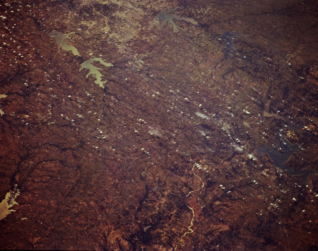 |
| STS068-174-169 Rolling Plains Northeast of Dallas, Texas, U.S.A. October 1994 Widely scattered cumulus clouds obscure some of the vast rolling plains of north Texas in this panoramic, southwest-looking photograph of the landscape north and northeast of Dallas. Concentrations of lighter features (top center) show northward development of the Dallas metropolitan area. The darker areas of mature vegetation within metropolitan Dallas show older, established neighborhoods. Four large reservoirs are discernible viewing counterclockwise from east of Dallas--Lake Ray Hubbard (top left), Lake Lavon, Garza Little Elm Reservoir, and Lake Ray Roberts. Visible are part of Cooper Lake, a recently completed reservoir on the South Sulphur River (lower left corner); part of Lake Texoma; and the meandering Red River (lower right quadrant). |
| Images: | All Available Images Low-Resolution 307k |
|
| Mission: | STS068 |
|
| Roll - Frame: | 174 - 169 |
|
| Geographical Name: | USA-TEXAS |
|
| Features: | L. TEXOMA TO N DALLAS |
|
| Center Lat x Lon: | 33.5N x 96.5W |
|
| Film Exposure: | N | N=Normal exposure, U=Under exposed, O=Over exposed, F=out of Focus |
| Percentage of Cloud Cover-CLDP: | 5 |
|
| Camera:: | LH |
|
| Camera Tilt: | 44 | LO=Low Oblique, HO=High Oblique, NV=Near Vertical |
| Camera Focal Length: | 250 |
|
| Nadir to Photo Center Direction: | W | The direction from the nadir to the center point, N=North, S=South, E=East, W=West |
| Stereo?: | Y | Y=Yes there is an adjacent picture of the same area, N=No there isn't |
| Orbit Number: | 103 |
|
| Date: | 19941006 | YYYYMMDD |
| Time: | 184452 | GMT HHMMSS |
| Nadir Lat: | 34.2N |
Latitude of suborbital point of spacecraft |
| Nadir Lon: | 94.8W |
Longitude of suborbital point of spacecraft |
| Sun Azimuth: | 195 | Clockwise angle in degrees from north to the sun measured at the nadir point |
| Space Craft Altitude: | 116 | nautical miles |
| Sun Elevation: | 50 | Angle in degrees between the horizon and the sun, measured at the nadir point |
| Land Views: | PLAIN, RANGE |
|
| Water Views: | RESERVOIR, RIVER |
|
| Atmosphere Views: | |
|
| Man Made Views: | |
|
| City Views: | |
|
Photo is not associated with any sequences | ||
| NASA Home Page |
JSC Home Page |
JSC Digital Image Collection |
Earth Science & Remote Sensing |
|
This service is provided by the International Space Station program and the JSC Earth Science & Remote Sensing Unit, ARES Division, Exploration Integration Science Directorate.

|