
Geographic Region: USA-OKLAHOMA
Feature: CANADIAN, CIMARRON R.
|
Geographic Region: USA-OKLAHOMA Feature: CANADIAN, CIMARRON R. |
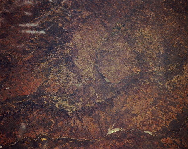 |
| STS068-174-163 Cimarron River and South Canadian River, Oklahoma, U.S.A. October 1994 This panoramic, low-oblique, southwest-looking photograph shows the high plains of northwestern Oklahoma with the Cimarron River (bottom of photograph); the agricultural field patterns in the North Canadian River Valley; and the curved loops of the South Canadian River (upper left). Visible are Fort Supply Lake (center) in the valley of the Wolf River, which joins the North Canadian River north of the lake, and the small city of Woodward (barely discernible) to the southeast, which is a market center for the surrounding livestock, farm, and dairy region. Woodward also serves as the headquarters for many gas and oil companies. Of the numerous pivot irrigation field patterns (right center to upper center), many appear in the Wolf River Valley near the Oklahoma-Texas border. |
| Images: | All Available Images Low-Resolution 311k |
|
| Mission: | STS068 |
|
| Roll - Frame: | 174 - 163 |
|
| Geographical Name: | USA-OKLAHOMA |
|
| Features: | CANADIAN, CIMARRON R. |
|
| Center Lat x Lon: | 36.5N x 99.5W |
|
| Film Exposure: | N | N=Normal exposure, U=Under exposed, O=Over exposed, F=out of Focus |
| Percentage of Cloud Cover-CLDP: | 5 |
|
| Camera:: | LH |
|
| Camera Tilt: | 42 | LO=Low Oblique, HO=High Oblique, NV=Near Vertical |
| Camera Focal Length: | 250 |
|
| Nadir to Photo Center Direction: | W | The direction from the nadir to the center point, N=North, S=South, E=East, W=West |
| Stereo?: | Y | Y=Yes there is an adjacent picture of the same area, N=No there isn't |
| Orbit Number: | 103 |
|
| Date: | 19941006 | YYYYMMDD |
| Time: | 184352 | GMT HHMMSS |
| Nadir Lat: | 37.2N |
Latitude of suborbital point of spacecraft |
| Nadir Lon: | 97.9W |
Longitude of suborbital point of spacecraft |
| Sun Azimuth: | 189 | Clockwise angle in degrees from north to the sun measured at the nadir point |
| Space Craft Altitude: | 116 | nautical miles |
| Sun Elevation: | 47 | Angle in degrees between the horizon and the sun, measured at the nadir point |
| Land Views: | PLAIN |
|
| Water Views: | RIVER |
|
| Atmosphere Views: | |
|
| Man Made Views: | AGRICULTURE |
|
| City Views: | |
|
Photo is not associated with any sequences | ||
| NASA Home Page |
JSC Home Page |
JSC Digital Image Collection |
Earth Science & Remote Sensing |
|
This service is provided by the International Space Station program and the JSC Earth Science & Remote Sensing Unit, ARES Division, Exploration Integration Science Directorate.

|