
Geographic Region: USA-OREGON
Feature: COOS BAY,CAPE BLANCO,MTS
|
Geographic Region: USA-OREGON Feature: COOS BAY,CAPE BLANCO,MTS |
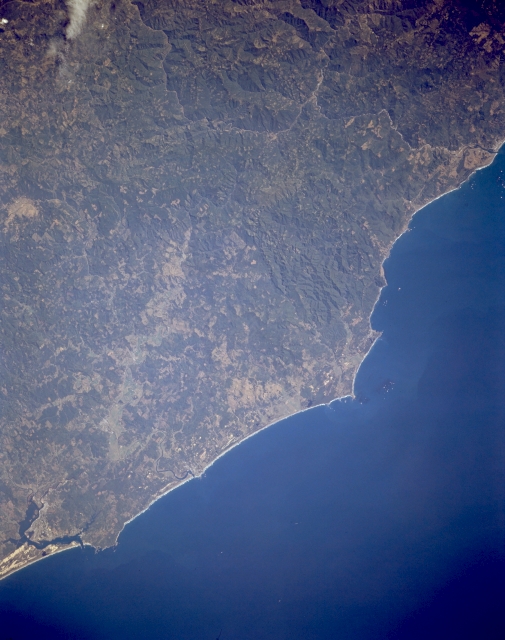 |
| STS068-170-107A Cape Blanco and Coos Bay, Oregon, U.S.A. October 1994 The forest-covered Coast Range and the central Oregon coast are visible in this south-southeast-looking, low-oblique photograph. Small rectangles designate timber-cutting operations scattered throughout the Coast Range. The Rogue River is apparent entering the Pacific Ocean at the upper right of the photograph, and Cape Blanco is visible to the right of the center. Coos Bay, a small port city on the central Oregon coast with a population of more than 16 500, is visible at the bottom left of the photograph. Coos Bay, a popular tourist resort, also has lumber, shipping, fishing, and canning industries. North of Coos Bay is the Oregon Dunes National Recreation Area. |
| Images: | All Available Images Low-Resolution 256k |
|
| Mission: | STS068 |
|
| Roll - Frame: | 170 - 107 A |
|
| Geographical Name: | USA-OREGON |
|
| Features: | COOS BAY,CAPE BLANCO,MTS |
|
| Center Lat x Lon: | 43.0N x 124.5W |
|
| Film Exposure: | N | N=Normal exposure, U=Under exposed, O=Over exposed, F=out of Focus |
| Percentage of Cloud Cover-CLDP: | 0 |
|
| Camera:: | LH |
|
| Camera Tilt: | 27 | LO=Low Oblique, HO=High Oblique, NV=Near Vertical |
| Camera Focal Length: | 250 |
|
| Nadir to Photo Center Direction: | N | The direction from the nadir to the center point, N=North, S=South, E=East, W=West |
| Stereo?: | Y | Y=Yes there is an adjacent picture of the same area, N=No there isn't |
| Orbit Number: | 72 |
|
| Date: | 19941004 | YYYYMMDD |
| Time: | 205043 | GMT HHMMSS |
| Nadir Lat: | 42.0N |
Latitude of suborbital point of spacecraft |
| Nadir Lon: | 124.6W |
Longitude of suborbital point of spacecraft |
| Sun Azimuth: | 195 | Clockwise angle in degrees from north to the sun measured at the nadir point |
| Space Craft Altitude: | 116 | nautical miles |
| Sun Elevation: | 43 | Angle in degrees between the horizon and the sun, measured at the nadir point |
| Land Views: | COAST, MOUNTAIN, CAPE |
|
| Water Views: | |
|
| Atmosphere Views: | |
|
| Man Made Views: | |
|
| City Views: | |
|
Photo is not associated with any sequences | ||
| NASA Home Page |
JSC Home Page |
JSC Digital Image Collection |
Earth Science & Remote Sensing |
|
This service is provided by the International Space Station program and the JSC Earth Science & Remote Sensing Unit, ARES Division, Exploration Integration Science Directorate.

|