
Geographic Region: USA-IOWA
Feature: CEDAR RAPIDS, IOWA CITY
|
Geographic Region: USA-IOWA Feature: CEDAR RAPIDS, IOWA CITY |
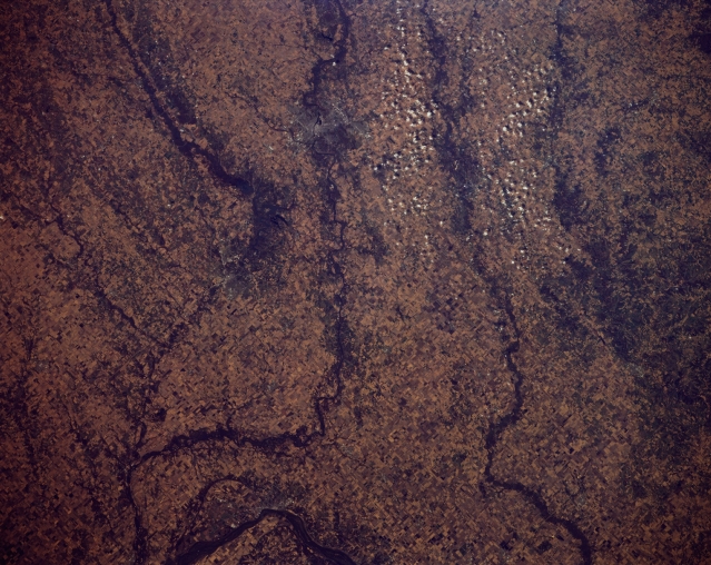 |
| STS066-152-129 East-Central Iowa, U.S.A. November 1994 Gently rolling terrain, agricultural field patterns, and several rivers are apparent in this near-vertical photograph. Discernible are the Mississippi River near Muscatine (left of bottom center), just southwest of which the more southerly Iowa River joins the Cedar River. North of the Cedar River is the Wapsipinicon River. |
| Images: | All Available Images Low-Resolution 320k |
|
| Mission: | STS066 |
|
| Roll - Frame: | 152 - 129 |
|
| Geographical Name: | USA-IOWA |
|
| Features: | CEDAR RAPIDS, IOWA CITY |
|
| Center Lat x Lon: | 41.5N x 91.5W |
|
| Film Exposure: | N | N=Normal exposure, U=Under exposed, O=Over exposed, F=out of Focus |
| Percentage of Cloud Cover-CLDP: | 5 |
|
| Camera:: | LH |
|
| Camera Tilt: | 35 | LO=Low Oblique, HO=High Oblique, NV=Near Vertical |
| Camera Focal Length: | 90 |
|
| Nadir to Photo Center Direction: | W | The direction from the nadir to the center point, N=North, S=South, E=East, W=West |
| Stereo?: | N | Y=Yes there is an adjacent picture of the same area, N=No there isn't |
| Orbit Number: | 49 |
|
| Date: | 19941106 | YYYYMMDD |
| Time: | 173442 | GMT HHMMSS |
| Nadir Lat: | 42.1N |
Latitude of suborbital point of spacecraft |
| Nadir Lon: | 89.7W |
Longitude of suborbital point of spacecraft |
| Sun Azimuth: | 178 | Clockwise angle in degrees from north to the sun measured at the nadir point |
| Space Craft Altitude: | 162 | nautical miles |
| Sun Elevation: | 32 | Angle in degrees between the horizon and the sun, measured at the nadir point |
| Land Views: | PLAIN |
|
| Water Views: | RIVER |
|
| Atmosphere Views: | |
|
| Man Made Views: | AGRICULTURE |
|
| City Views: | |
|
Photo is not associated with any sequences | ||
| NASA Home Page |
JSC Home Page |
JSC Digital Image Collection |
Earth Science & Remote Sensing |
|
This service is provided by the International Space Station program and the JSC Earth Science & Remote Sensing Unit, ARES Division, Exploration Integration Science Directorate.

|