
Geographic Region: USA-COLORADO
Feature: SANGRE DE CRISTO MTS,VOL
|
Geographic Region: USA-COLORADO Feature: SANGRE DE CRISTO MTS,VOL |
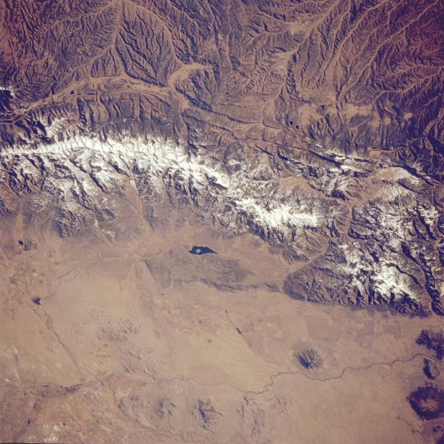 |
| STS066-124-035 San Luis Valley and Sangre De Cristo Mountains, New Mexico and Colorado, U.S.A. November 1994 Mountainous terrain and the relatively flat surface of the Rio Grande Rift Valley are featured in this photograph of south-central Colorado and north-central New Mexico. On the eastern side of the snow-covered Sangre de Cristo Mountains, two distinct drainage patterns show the Canadian River tributaries that drain southeast from the mountains and the headwater area for the Purgatoire River, which flows northeast and eventually merges with the Arkansas River. Meandering across the plains of the San Luis Valley is the narrow, dark Rio Grande, on either side of which appear several volcanic domes in various stages of erosion as identified by their radial drainage patterns. Dark Sanchez Reservoir appears north of the Colorado-New Mexico border (middle of the photograph). |
| Images: | All Available Images Low-Resolution 380k |
|
| Mission: | STS066 |
|
| Roll - Frame: | 124 - 35 |
|
| Geographical Name: | USA-COLORADO |
|
| Features: | SANGRE DE CRISTO MTS,VOL |
|
| Center Lat x Lon: | 37.0N x 105.5W |
|
| Film Exposure: | N | N=Normal exposure, U=Under exposed, O=Over exposed, F=out of Focus |
| Percentage of Cloud Cover-CLDP: | 0 |
|
| Camera:: | HB |
|
| Camera Tilt: | 41 | LO=Low Oblique, HO=High Oblique, NV=Near Vertical |
| Camera Focal Length: | 100 |
|
| Nadir to Photo Center Direction: | W | The direction from the nadir to the center point, N=North, S=South, E=East, W=West |
| Stereo?: | Y | Y=Yes there is an adjacent picture of the same area, N=No there isn't |
| Orbit Number: | 112 |
|
| Date: | 19941110 | YYYYMMDD |
| Time: | 163015 | GMT HHMMSS |
| Nadir Lat: | 36.2N |
Latitude of suborbital point of spacecraft |
| Nadir Lon: | 103.4W |
Longitude of suborbital point of spacecraft |
| Sun Azimuth: | 145 | Clockwise angle in degrees from north to the sun measured at the nadir point |
| Space Craft Altitude: | 158 | nautical miles |
| Sun Elevation: | 29 | Angle in degrees between the horizon and the sun, measured at the nadir point |
| Land Views: | MOUNTAIN, VALLEY |
|
| Water Views: | RIVER |
|
| Atmosphere Views: | |
|
| Man Made Views: | |
|
| City Views: | |
|
Photo is not associated with any sequences | ||
| NASA Home Page |
JSC Home Page |
JSC Digital Image Collection |
Earth Science & Remote Sensing |
|
This service is provided by the International Space Station program and the JSC Earth Science & Remote Sensing Unit, ARES Division, Exploration Integration Science Directorate.

|