Geographic Region: CANADA-O
Feature: AKIMISKI I., JAMES BAY
|
Geographic Region: CANADA-O Feature: AKIMISKI I., JAMES BAY |
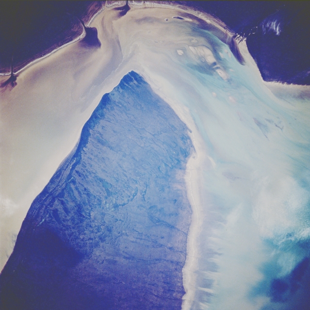 |
| STS066-121-027 James Bay, Canada November 1994 The light parts of the picture show muddy sediment which is being fed into James Bay by local rivers. The sediment pattern and current flow around the western end of Akimiski Island (center of image) are very pronounced in this westward view along the west side of shallow James Bay. Akimiski Island is only separated from the mainland and the mouth of the Attawapiskat River by 10 miles (16 kilometers). The dark water plumes along the top of the picture show drainage into James Bay from several small rivers as well as the Attawapiskat River. The overall quality of the image is too dark to allow many landforms or topography to be discerned, except to note that the drainage off of Akimiski Island is towards the north (right side of image). Patterns in the water immediately right (north) of the island show that winds on the day this photo was taken were blowing from the south (left). |
| Images: | All Available Images Low-Resolution 286k |
|
| Mission: | STS066 |
|
| Roll - Frame: | 121 - 27 |
|
| Geographical Name: | CANADA-O |
|
| Features: | AKIMISKI I., JAMES BAY |
|
| Center Lat x Lon: | 53.0N x 82W |
|
| Film Exposure: | N | N=Normal exposure, U=Under exposed, O=Over exposed, F=out of Focus |
| Percentage of Cloud Cover-CLDP: | 5 |
|
| Camera:: | HB |
|
| Camera Tilt: | 7 | LO=Low Oblique, HO=High Oblique, NV=Near Vertical |
| Camera Focal Length: | 100 |
|
| Nadir to Photo Center Direction: | S | The direction from the nadir to the center point, N=North, S=South, E=East, W=West |
| Stereo?: | N | Y=Yes there is an adjacent picture of the same area, N=No there isn't |
| Orbit Number: | 34 |
|
| Date: | 19941105 | YYYYMMDD |
| Time: | 190158 | GMT HHMMSS |
| Nadir Lat: | 53.3N |
Latitude of suborbital point of spacecraft |
| Nadir Lon: | 81.9W |
Longitude of suborbital point of spacecraft |
| Sun Azimuth: | 208 | Clockwise angle in degrees from north to the sun measured at the nadir point |
| Space Craft Altitude: | 163 | nautical miles |
| Sun Elevation: | 17 | Angle in degrees between the horizon and the sun, measured at the nadir point |
| Land Views: | ISLAND |
|
| Water Views: | BAY, SEDIMENT |
|
| Atmosphere Views: | |
|
| Man Made Views: | |
|
| City Views: | |
|
Photo is not associated with any sequences | ||
| NASA Home Page |
JSC Home Page |
JSC Digital Image Collection |
Earth Science & Remote Sensing |
|
This service is provided by the International Space Station program and the JSC Earth Science & Remote Sensing Unit, ARES Division, Exploration Integration Science Directorate.

|