
Geographic Region: USA-CALIFORNIA
Feature: TONOAPAH TEST RANGE
|
Geographic Region: USA-CALIFORNIA Feature: TONOAPAH TEST RANGE |
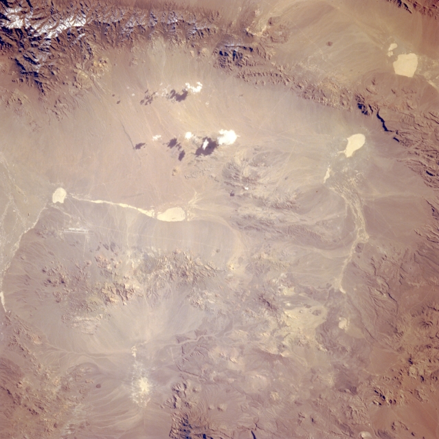 |
| STS062-098-163 Tonopah Test Range, Nevada, U.S.A. March 1994 The only recognizable manmade feature in this desert landscape is the highly reflective, narrow runway of the Tonopah Test Range, visible on the left side of the photograph. Apparent also are five highly reflective, dry lakebeds. A few isolated patches of cumulus clouds and their shadows are visible along the eastern side of the valley, and the snow-covered, higher elevations of the Cactus Range appear at the top of the photograph. The remainder of the landscape consists of eroded, low mountains and hills. |
| Images: | All Available Images Low-Resolution 308k |
|
| Mission: | STS062 |
|
| Roll - Frame: | 98 - 163 |
|
| Geographical Name: | USA-CALIFORNIA |
|
| Features: | TONOAPAH TEST RANGE |
|
| Center Lat x Lon: | 37.5N x 117.5W |
|
| Film Exposure: | N | N=Normal exposure, U=Under exposed, O=Over exposed, F=out of Focus |
| Percentage of Cloud Cover-CLDP: | 5 |
|
| Camera:: | HB |
|
| Camera Tilt: | 37 | LO=Low Oblique, HO=High Oblique, NV=Near Vertical |
| Camera Focal Length: | 250 |
|
| Nadir to Photo Center Direction: | W | The direction from the nadir to the center point, N=North, S=South, E=East, W=West |
| Stereo?: | Y | Y=Yes there is an adjacent picture of the same area, N=No there isn't |
| Orbit Number: | 130 |
|
| Date: | 19940312 | YYYYMMDD |
| Time: | 163342 | GMT HHMMSS |
| Nadir Lat: | 37.8N |
Latitude of suborbital point of spacecraft |
| Nadir Lon: | 115.5W |
Longitude of suborbital point of spacecraft |
| Sun Azimuth: | 120 | Clockwise angle in degrees from north to the sun measured at the nadir point |
| Space Craft Altitude: | 160 | nautical miles |
| Sun Elevation: | 29 | Angle in degrees between the horizon and the sun, measured at the nadir point |
| Land Views: | DESERT, MOUNTAIN |
|
| Water Views: | PLAYA |
|
| Atmosphere Views: | |
|
| Man Made Views: | AIRPORT |
|
| City Views: | |
|
Photo is not associated with any sequences | ||
| NASA Home Page |
JSC Home Page |
JSC Digital Image Collection |
Earth Science & Remote Sensing |
|
This service is provided by the International Space Station program and the JSC Earth Science & Remote Sensing Unit, ARES Division, Exploration Integration Science Directorate.

|