
Geographic Region: USA-TENNESSEE
Feature: CUMBERLAND MTS., RES,AGR
|
Geographic Region: USA-TENNESSEE Feature: CUMBERLAND MTS., RES,AGR |
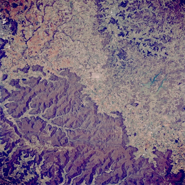 |
| STS062-083-060 Tims Ford Lake, Tennessee, U.S.A. March 1994 U-shaped, light sediment-laden Tims Ford Lake (right center) lies east of Fayetteville in the vegetated, rolling hills and broad cultivated valleys that characterize south-central Tennessee. In dramatic contrast are the dark, vegetated mountains of the larger northeast-southwest-trending Cumberland Plateau. Discernible are northern Huntsville, Alabama (upper left corner), and U. S. Highway 231/431 (top of photograph) that connects Huntsville and Fayetteville. |
| Images: | All Available Images Low-Resolution 430k |
|
| Mission: | STS062 |
|
| Roll - Frame: | 83 - 60 |
|
| Geographical Name: | USA-TENNESSEE |
|
| Features: | CUMBERLAND MTS., RES,AGR |
|
| Center Lat x Lon: | 35.0N x 86W |
|
| Film Exposure: | N | N=Normal exposure, U=Under exposed, O=Over exposed, F=out of Focus |
| Percentage of Cloud Cover-CLDP: | 0 |
|
| Camera:: | HB |
|
| Camera Tilt: | 16 | LO=Low Oblique, HO=High Oblique, NV=Near Vertical |
| Camera Focal Length: | 250 |
|
| Nadir to Photo Center Direction: | SE | The direction from the nadir to the center point, N=North, S=South, E=East, W=West |
| Stereo?: | Y | Y=Yes there is an adjacent picture of the same area, N=No there isn't |
| Orbit Number: | 20 |
|
| Date: | 19940305 | YYYYMMDD |
| Time: | 185127 | GMT HHMMSS |
| Nadir Lat: | 35.6N |
Latitude of suborbital point of spacecraft |
| Nadir Lon: | 86.5W |
Longitude of suborbital point of spacecraft |
| Sun Azimuth: | 200 | Clockwise angle in degrees from north to the sun measured at the nadir point |
| Space Craft Altitude: | 162 | nautical miles |
| Sun Elevation: | 47 | Angle in degrees between the horizon and the sun, measured at the nadir point |
| Land Views: | MOUNTAIN, HILL, PLATEAU |
|
| Water Views: | RESERVOIR |
|
| Atmosphere Views: | |
|
| Man Made Views: | |
|
| City Views: | |
|
Photo is not associated with any sequences | ||
| NASA Home Page |
JSC Home Page |
JSC Digital Image Collection |
Earth Science & Remote Sensing |
|
This service is provided by the International Space Station program and the JSC Earth Science & Remote Sensing Unit, ARES Division, Exploration Integration Science Directorate.

|